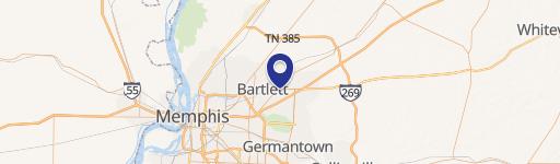
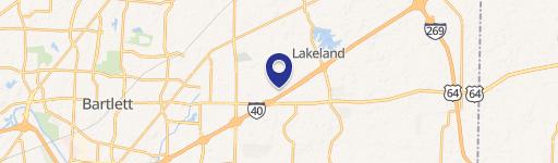
2500 Kate Bond Rd Memphis, TN 38133
1. On-site sales at neighborhood gardens are prohibited in residential zoning districts (R -MP, R-E, R-15, R-10, R-8, R-6, R-3, RU-1, RU-2, RU-3, RU-4, RU-5 and RW), with the exception of Community Supported Agriculture. 2. Neighborhood gardens shall: a. be managed to prevent the harborage of rodents and pests; b. be maintained to prevent odors; and c. be ma…
Cap rate
Implied · in-place · derived from last sale + estimated NOIValue
AI, CAP & Alternative Use estimations · Realmo proprietary blendProperty tax & assessments
Tax year 2022Comparables
6 recent transactions · within 1.5 miComparable in this City


Similar Nearby for Sale


Similar Nearby for Lease


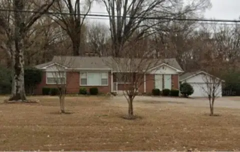
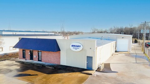
Property description
Physical attributes from public recordsZoning & alternative use
R-8 · Memphis, TN1. On-site sales at neighborhood gardens are prohibited in residential zoning districts (R -MP, R-E, R-15, R-10, R-8, R-6, R-3, RU-1, RU-2, RU-3, RU-4, RU-5 and RW), with the exception of Community Supported Agriculture. 2. Neighborhood gardens shall: a. be managed to prevent the harborage of rodents and pests; b. be maintained to prevent odors; and c. be managed to (to the extent that is possible), to prevent the runoff of top soil and composting materials from flowing onto adjacent properties or into natural or human made storm channels. 3. If security fencing is provided within the required front yard, such fencing shall not include bare chain link or sight - proof w ood fencing. Ornamental, wrought iron or decorative wood f encing are preferred materials. Vinyl-coated chain link fencing and a row of evergreen shrubs may be considered an acceptable alternative subject to the discretion of the Zoning Administrator. 4. If lighting is provided , only security lighting that is shielded to direct the light onto the subject property shall be permitted. 5. The following accessory structures and uses are permitted on neighborhood garden sites: a. Greenhouses; b. Pole barns; c. Aquaria and other related hydroponic infrastructure; d. Sheds; e. And other similar structures incidental to the operation of a neighborhood garden. 6. Greenhouses and pole b arns shall meet the same setback requirements and height restrictions as any principal use in the zoning district. These structures are subject to review under Administrative Site Plan Review process. 7. Where an accessory structure such as a tool shed is the only building on the lot, said accessory structure shall not be located any closer to the front of the lot than the rear building elevation of abutting structures, and no less than 5 feet from any side or rear property line. Said structure shall not exceed 25 feet in height. 8. Lots and tracts used for neighborhood gardens with no structures that require a building permit are exempt from the minimum lot requirements of Article 3. F. Apiaries (Beekeeping) 2.6 Use Standards Article 2 Districts and Uses 2.6.5 Open Use Standards Memphis/Shelby County Unified Development Code 53 ZTA 24-2 1. All colonies shall be duly registered with the Tennessee Department of Agriculture as required by Tennessee Code Title 44, Chapter 15, (T.C.A. 44 -15-101, et. seq.) the Tennessee Apiary Act of 1995, and shall adhere to all standards set forth in that Act. 2.
Costs & Benchmarks
Operating expenses, capex projections, utility benchmarks, and submarket comparables — all in one view.
Risks
Flood, climate, environmental, title, and tenant-concentration risk — surfaced with mitigations and source citations.


