Back to Search
Property profile & analytics
FOR LEASE
Industrial properties
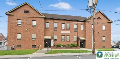
250 Radar Dr Northampton, PA 18067
Entity Owned
5-yr Hold
Free & Clear
Property ID
US73-4849074
 For Lease
1 / 2
For Lease
1 / 2
Contact for pricing
250 Radar Dr, Northampton, PA 18067
View Listing →
Property profile
Verified
Property type
Industrial properties
Use group
INDUSTRIAL PARK
Year built
2020
Total area
292,700 SF
Lot
21.68 ac (944,381 SF)
Zoning code
RS
APN
M5 2 16D 0501
UPID
US73-4849074
Cap rate & NOI
Priority signal for investors
Implied cap rate, NOI & suggested price
Cap rate vs submarket · NOI estimate · 3 price anchors
Implied cap rate, NOI & suggested price
Cap vs submarket · NOI estimate · 3 price anchors
Value estimations
Realmo proprietary · 4 methods
AI Approach
AI
by Request
CAP Approach
CAP
by Request
Comparable Approach
Comparable
by Request
Blend (final)
Blend
by Request
Owner & transaction history
Bcdpf Radar Distribution Center LLC · 5 yrs held
Bcdpf Radar Distribution Center LLC
since 2021
Last sale
$48.3M
3 recorded transactions
Zoning & alternative use
RS · Northampton, PA
Permitted uses
Permitted uses
Allowed · conditional · prohibited
Cap rate
Implied · in-place · derived from last sale + estimated NOI
Implied Cap rate
#1
Implied · in-place · NOI ÷ last sale
In-place · derived from last sale + estimated NOI
Cap rate, NOI & submarket benchmark
Implied cap rate vs Northampton submarket · NOI estimate · Typical band, median & reading
Implied cap rate, NOI & submarket benchmark
Cap vs Northampton submarket · NOI estimate · typical band, median & reading
Refine your cap rate
8-question underwriting flow
1.
Property current status — Going-In vs Stabilized
2.
Price for denominator — asking / offer / market
3.
Leasing status & lease structure (NNN / Gross)
4.
Tenant risk profile & vacancy assumption
5.
Upload T12 / rent roll / OM (optional)
Refine in 60 seconds, get exact suggested price
T12 upload · Submarket benchmarks · Sensitivity grid
Suggested price · 3 cap rate anchors
Income approach @ 5% / 7% / 9% — aggressive / typical / conservative
Suggested price at 5% / 7% / 9% cap
Aggressive / typical / conservative · Implied $/SF per anchor · Sensitivity grid
Suggested price at 5% / 7% / 9% cap
Aggressive / typical / conservative · implied $/SF · sensitivity
Value
AI, CAP & Alternative Use estimations · Realmo proprietary blendValue Estimations
Based on Realmo’s proprietary methodology
AI Approach
CAP Approach
Comparable Approach
Alternative Use
Get a detailed, property-specific estimation — fast and free
Price per SF
Sale + rent benchmarks
Subject property
—
Submarket sale & rent benchmarks
Median sale $/SF · Asking & closed rent · Submarket vacancy
Submarket sale & rent benchmarks
Median sale $/SF · asking & closed rent · submarket vacancy
Property tax & assessments
Tax year 2024Property tax & assessments
Tax year 2024
Tax billed
$368,148
Tax year 2024
Assessed value
$5,148,200
Assessed 2024
Previous assessed
$5,148,200
+0.0% YoY
Effective rate
7.15%
On assessed value
Assessed land
$1,424,500
Assessed improvement
$3,723,700
Land market value
$2,849,000
Improvement market value
$7,447,400
Total market value
$10,296,400
Comparables
6 recent transactions · within 1.5 miComparable in this city
6 recent transactions
Comparable in this City


Similar Nearby for Sale


Similar Nearby for Lease


Recent comparable sales
Sale price & price/SF · Sale date & distance · Adjustments & confidence
Recent comparable sales
Sale price & $/SF · sale date & distance · adjustments
Property description
Physical attributes from public recordsBuilding & lot
Public records
Property type
Industrial properties
Use group
INDUSTRIAL PARK
Status
For Lease
Year built
2020
Heating
YES
Cooling
CENTRAL
Units
1
Total area
292,700 SF
Lot
21.68 ac (944,381 SF)
Zoning code
RS
APN
M5 2 16D 0501
UPID
US73-4849074
Jurisdiction
NORTHAMPTON
Zoning & alternative use
RS · Northampton, PA
Zoning RS · permitted uses
RS · Northampton, PA
Permitted & conditional uses
Allowed uses · Special-permit conditions · Prohibited uses
Permitted & conditional uses
Allowed · special-permit conditions · prohibited
Northampton. Always verify with local authorities before improvements.
Building & site characteristics
From public records
Year built
2020
Heating
YES
Cooling
Yes
Units
1
Lot
21.68 ac
Current owner
From public records · entity-resolved
Bcdpf Radar Distribution Center LLC
Entity
Free & Clear · 5 yrs held
Mailing address
3520 PIEDMONT RD NE STE #410, ATLANTA, GA 30305-1512
Ownership since
2021
Owner contacts — direct phone, email, and related entities
Decision-maker phone · Verified email · Related entities & filings
Owner contacts
Email · phone · related entities
Sales History
3 recorded events · public records
Date
Price
Buyer
Seller
Deed Type
Mortgage
Aug 16, 2023
—
Bcdpf Radar Distribution Center LLC
—
Deed
related
$26,000,000 · Transamerica Life Insurance Company
Apr 9, 2021
$48,300,000
Bcdpf Radar Distribution Center LLC
Lehigh Valley Industrial Park Lot 4
Special Warranty Deed
—
Feb 12, 2019
—
Lehigh Vly Indl Pk Lot 4 Owne
—
Grant Deed
related
$40,880,024 · Td Bk NA
Coming soon
Costs & Benchmarks
Operating expenses, capex projections, utility benchmarks, and submarket comparables — all in one view.
Coming soon
Risks
Flood, climate, environmental, title, and tenant-concentration risk — surfaced with mitigations and source citations.
Try Rey
Ask anything about this address in plain English.
“Is 15.6% cap rate sustainable?” · “Best tenant mix for BU1?” · “What’s the redev upside?”
Full reports are paid
Unlock the full Property Analytics report
Start free for 7 days — no card required. Full owner contacts, all 4 valuations with methodology, refine flow, comparable adjustments, foot-traffic deep dive, export to PDF / CSV.


