2485 West Point Rd Lagrange, GA 30240
 For Sale
1 / 13
For Sale
1 / 13
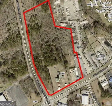
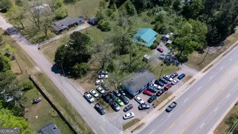
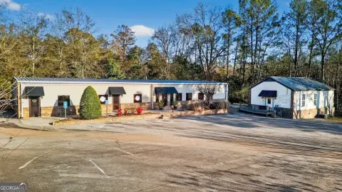
This exceptional commercial property, located at 2485 West Point Road in LaGrange, Georgia, presents a unique investment opportunity. The 6.08-acre lot boasts three separate buildings, offering significant flexibility for a variety of commercial uses. Its prime location on Highway 29, situated between Pegasus Parkway and Lukken Industrial, ensures high visibility and convenient access to major transportation routes. The property's proximity to the LaGrange Callaway Airport and the Industrial Park further enhances its appeal. Building 1, constructed in 1958, offers 3,744 square feet of space. Building 2, a more modern structure built in 2003, provides 4,000 square feet. Finally, Building 3, built in 1985, comprises 5,200 square feet. This combination of building sizes and ages allows for diverse operational configurations, catering to a wide range of business needs. The property's substantial acreage and strategic location make it an ideal choice for businesses seeking a prominent presence in a thriving commercial area. The property is priced at $895,000. This represents a compelling investment opportunity in a rapidly developing region.
Cap rate
Implied · in-place · derived from last sale + estimated NOIValue
AI, CAP & Alternative Use estimations · Realmo proprietary blendProperty tax & assessments
Tax year 2023Comparables
6 recent transactions · within 1.5 miComparable in this City


Similar Nearby for Sale

Similar Nearby for Lease


Property description
Physical attributes from public recordsZoning & alternative use
01-GI · Lagrange, GALagrange. Always verify with local authorities before improvements.
Costs & Benchmarks
Operating expenses, capex projections, utility benchmarks, and submarket comparables — all in one view.
Risks
Flood, climate, environmental, title, and tenant-concentration risk — surfaced with mitigations and source citations.


