227 6th St Council Bluffs, IA 51501-4269
-
Pottawattamie County Courthouse County Government Office
-
First Security Bank Bank Loan Service
-
Pottawattamie County Clerk-Court State Government Office Court Executive Officer
-
Pottawattamie County Elections County Government Office
-
Pottawattamie County Conservation Sustainability Organization
Chapter 15.13 - A-P/ADMINISTRATIVE-PROFESSIONAL DISTRICT 15.13.010 Statement Of Intent 15.13.020 Principal Uses 15.13.030 Conditional Uses 15.13.040 Accessory Uses 15.13.050 Site Development Regulations 15.13.060 Additional Regulations 15.13.070 Signs 15.13.010 Statement Of Intent This district is intended and designed to provide, in certain areas in the cit…
Cap rate
Implied · in-place · derived from last sale + estimated NOIValue
AI, CAP & Alternative Use estimations · Realmo proprietary blendProperty tax & assessments
Tax year 2021Comparables
6 recent transactions · within 1.5 miComparable in this City


Similar Nearby for Sale


Similar Nearby for Lease
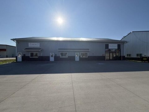


Property description
Physical attributes from public recordsZoning & alternative use
A-P · Council Bluffs, IAChapter 15.13 - A-P/ADMINISTRATIVE-PROFESSIONAL DISTRICT 15.13.010 Statement Of Intent 15.13.020 Principal Uses 15.13.030 Conditional Uses 15.13.040 Accessory Uses 15.13.050 Site Development Regulations 15.13.060 Additional Regulations 15.13.070 Signs 15.13.010 Statement Of Intent This district is intended and designed to provide, in certain areas in the city, for the development of professional and low-intensity business offices and uses in areas where residential dwellings predominate. (Ord. 5406 § 2 (part), 1998) 15.13.020 Principal Uses The following principal uses shall be permitted in an A-P district: Boarding, lodging, rooming house, or bed and breakfast; Business, professional office; Community recreation services; College or university; Consumer fireworks sales; Cultural service; Dwelling, multifamily; Dwelling, single-family attached; Dwelling, single-family detached; Dwelling, townhouse; Dwelling, two-family; Family home; Funeral service; General government use; Group care home; Hospital; Local utility services; Congregate housing, life care facility or nursing home; Park and recreation services; Private parking lot; Public parking lot; Public safety services; Religious assembly; School. (Ord. 5919 § 1, 2007) HISTORY Amended by Ord. 6506 on 7/11/2022 15.13.030 Conditional Uses The following conditional uses shall be permitted in an A-P district, in accordance with the requirements set forth in CBMC 15.27: Commercial recreation (indoor and outdoor); Day care services; Governmental maintenance facility. (Ord. 5406 § 2 (part), 1998) 15.13.040 Accessory Uses The following accessory uses shall be permitted in an A-P district: Uses of land or structure customarily incidental and subordinate to one of the principal uses, unless otherwise excluded. (Ord. 5406 § 2 (part), 1998) 15.13.050 Site Development Regulations Minimum Lot Size Any property, or combination of contiguous properties owned by the same person or entity, that are zoned A-P District and contain a minimum of one and one-half acres of total land area, shall be allowed to adopt a site specific development plan in accordance with the procedures stated in Section 15.28.060 of this Title. Lot area 5,000 square feet Lot width 50 feet Lot depth 100 feet Minimum Setbacks Principal Structure Accessory Structure Front yard 20 feet Greater of 20 feet or existing front setback line of principal structure Interior side yard 5 feet 3 feet Street side yard 15 feet 15 feet Rear yard 20 feet 3 feet Maximum height 50 feet 18 feet Lot coverage: all structures: 50% maximum (Ord.
Costs & Benchmarks
Operating expenses, capex projections, utility benchmarks, and submarket comparables — all in one view.
Risks
Flood, climate, environmental, title, and tenant-concentration risk — surfaced with mitigations and source citations.


