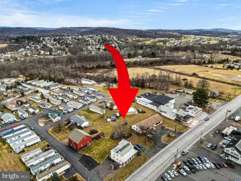
225 Keim St Pottstown, PA 19464-6029
Property profile & analytics
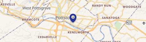
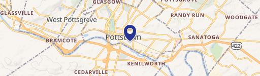
225 Keim St, Pottstown, PA 19464-6029
- Manufacturing properties
- 213,206 SF
- 6.38 lot acres
Property ID
US73-4057166
The Realmo ID is a unique identifier assigned to every property, incorporating country codes and precise geo-coordinates for 300x300-foot land blocks. It enables standardized data collection and seamless integration of disparate sources such as ownership, tax, title data and physical specifications. By aggregating current and historical records, the Realmo ID powers advanced analytics and delivers deep, verifiable insights for real estate professionals.
Location Intelligence
Current Use by Public Records
- Mc Farland C Ross PhD / Physician
Property Details for 225 Keim St
- Year built
- 1928
- Lot size
- 6.38 lot acres
- Zone code
- HM
- Property type
- Manufacturing properties
- APN
- 16-00-17069-20-4
- APU
- 160017069204
Sales History
| Date | Price | Buyer | Seller | Deed Type | Mortgage |
|---|---|---|---|---|---|
| Dec 20, 2002 | — | Pottstown Industrial Co | Pottstown Industrial Co | Quit Claim Deed · related | — |
| Apr 5, 1999 | — | Pottstown Industrial Complex | — | Deed Of Trust · related | $4.4M · Pennsauken Warehouse Assocs LP |
Value Estimations
based on Realmo’s proprietary methodology
-
Comparable approach
- Method
- Estimation
- Statistic Estimate
- $14,310,000
- AI Estimate
- $9,758,000
Market price range: $14.3M - $32.7MMarket price range: $9.76M - $28.4M
Get a detailed, property-specific estimation — fast and free
Location Insight
- Map
- Local Demand
- City
- Pottstown
- County
- Montgomery
- State
- Pennsylvania
- Longitude
- -75.6345
- Latitude
- 40.2397
- CBSA code
- 37980
- CBSA name
- PHILADELPHIA-CAMDEN-WILMINGTON, PA-NJ-DE-MD METROPOLITAN STATISTICAL AREA
Property Tax & Assessments
Tax date
Tax Amount
Assessed Land Value
Assessed Improvement Value
Total Assessed Value
Applied Tax Rate
Land Market Value
Improvement Market Value
Total Market Value
2023
$42,684
$0.00
$0.00
$695,490
-
$0.00
$0.00
$695,490