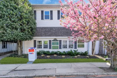
2163 Hwy 35 Sea Girt, NJ 08750-1003
Property profile & analytics
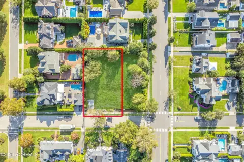
2163 Hwy 35, Sea Girt, NJ 08750-1003
- Commercial real estate
- 5,448 SF
- 0.75 lot acres
Property ID
US59-3072434
The Realmo ID is a unique identifier assigned to every property, incorporating country codes and precise geo-coordinates for 300x300-foot land blocks. It enables standardized data collection and seamless integration of disparate sources such as ownership, tax, title data and physical specifications. By aggregating current and historical records, the Realmo ID powers advanced analytics and delivers deep, verifiable insights for real estate professionals.
Location Intelligence
Current Use by Public Records
- Commercial real estate
Property Details for 2163 Hwy 35
- Year built
- 1991
- Lot size
- 0.75 lot acres
- Zone code
- HB80
- Property type
- Commercial real estate
- APN
- 52 00263-0000-00012
- APU
- 5200263000000012
Sales History
| Date | Price | Buyer | Seller | Deed Type | Mortgage |
|---|---|---|---|---|---|
| Dec 4, 2019 | $1,650,000 | Meadowbrook Realty LLC | Sejin Prop Mgmt LLC | Grant Deed | $1.4M · People's United Bk |
| Jun 18, 2007 | $1,150,000 | Sejin Properties Management Ll | Premier Dev Group Of Sea Girt LLC | Grant Deed | $700k · Wilmington Savings Fund Societ |
| — | — | Premier Dev Group Of Sea Girt LLC | — | Deed Of Trust · related | $385k · Wall Estates LLC |
Value Estimations
based on Realmo’s proprietary methodology
-
Comparable approach
- Method
- Estimation
- Statistic Estimate
- $947,000
Market price range: $948k - $2.26M
Get a detailed, property-specific estimation — fast and free
Location Insight
- Map
- Local Demand
- City
- Sea Girt
- County
- Monmouth
- State
- New Jersey
- Longitude
- -74.0635
- Latitude
- 40.1377
- CBSA code
- 35620
- CBSA name
- NEW YORK-NORTHERN NEW JERSEY-LONG ISLAND, NY-NJ-PA METROPOLITAN STATISTICAL AREA
Property Tax & Assessments
Tax date
Tax Amount
Assessed Land Value
Assessed Improvement Value
Total Assessed Value
Applied Tax Rate
Land Market Value
Improvement Market Value
Total Market Value
2022
$19,357
$382,500
$579,600
$962,100
-
$382,500
$579,600
$962,100