200 Palmer Ave Falmouth, MA 02540-2893
-
M Duffany Builders Construction Company General Contractor
-
Galasso Michael Construction Company General Contractor
In the GR District, the Zoning Board of Appeals finds that: a) The dwelling has been in existence as of January 1, 2000; b) There is no material change to the exterior of the existing dwelling, including architectural features; c) The size of the dwelling and the lot are suitable for the conversion; and d) All resulting rental dwelling units shall have a min…
Cap rate
Implied · in-place · derived from last sale + estimated NOIValue
AI, CAP & Alternative Use estimations · Realmo proprietary blendProperty tax & assessments
Tax year 2024Comparables
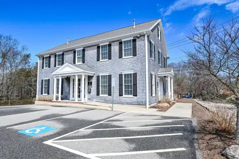
6 recent transactions · within 1.5 miComparable in this City


Similar Nearby for Sale


Similar Nearby for Lease
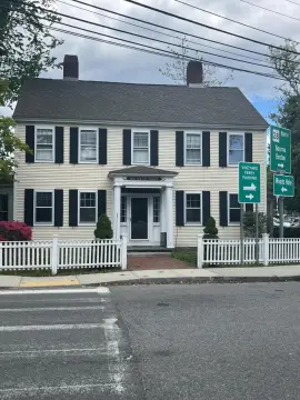


Property description
Physical attributes from public recordsZoning & alternative use
GR · Falmouth, MAIn the GR District, the Zoning Board of Appeals finds that: a) The dwelling has been in existence as of January 1, 2000; b) There is no material change to the exterior of the existing dwelling, including architectural features; c) The size of the dwelling and the lot are suitable for the conversion; and d) All resulting rental dwelling units shall have a minimum one-year rental period 2. In the SR-AA, SR-A, SR-B and SR-C Districts, the Zoning Board of Appeals finds that: a) The dwelling has been in existence as of January 1, 2000; b) There is no material change to the exterior of the existing dwelling, including architectural features; c) The conversion will not increase the gross floor area of the dwelling as it existed on January 1, 2000; d) There are no additional bedrooms above the number in existence in the dwelling as of January 1, 2000; e) There are no home occupations or taking of boarders; f) All resulting rental dwelling units shall have a minimum one-year rental period; and g) If the dwelling to be converted is located within the Water Resources Protection Overlay District or within a Coastal Pond Overlay District, the minimum lot size is 15,000 square feet for one additional dwelling unit; 20,000 square feet for 2 additional dwelling units; and 25,000 square feet for 3 additional dwelling units. 3. The Zoning Board of Appeals may grant the following exceptions in approving a special permit: a) Affordable units, as defined in Article 3 , need not comply with the additional square footage requirements in subsection (2)g above as long as the minimum lot size is 15,000 square feet. b) Preexisting conversions performed without the benefit of a special permit under this section shall be exempt from the requirements of subsection (2)g above if an application to obtain a special permit under this section is received by the Board of Appeals within one year of the effective date of the bylaw and the special permit is subsequently approved. Conversion of a single-family dwelling into office space A single-family dwelling in existence on the lot as of January 1, 1980 or portion thereof, may be converted into office space associated with the uses specified in subsections (4)a) through (4)f) below. Conversion into medical clinics or retail sales shall not be permitted. Conversions shall meet the following criteria: N N N N SP-Z 1. The dwelling shall be located within 500 feet of a business or industrial district. 2.
Costs & Benchmarks
Operating expenses, capex projections, utility benchmarks, and submarket comparables — all in one view.
Risks
Flood, climate, environmental, title, and tenant-concentration risk — surfaced with mitigations and source citations.


