200 Mislick Dr Deep River, CT 06417-1584
Property profile & analytics
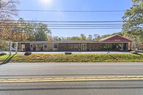
200 Mislick Dr, Deep River, CT 06417-1584
- Manufacturing properties
- 6,240 SF
- 0.47 lot acres
Property ID
US15-1172055
The Realmo ID is a unique identifier assigned to every property, incorporating country codes and precise geo-coordinates for 300x300-foot land blocks. It enables standardized data collection and seamless integration of disparate sources such as ownership, tax, title data and physical specifications. By aggregating current and historical records, the Realmo ID powers advanced analytics and delivers deep, verifiable insights for real estate professionals.
Location Intelligence
Current Use by Public Records
- Manufacturing properties
Property Details for 200 Mislick Dr
- Year built
- 2015
- Construction
- STEEL FRAME
- Lot size
- 0.47 lot acres
- Zone code
- CIP
- Property type
- Manufacturing properties
- APN
- DEEP M:38 L:6B-2
- APU
- DEEPM38L6B2
Sales History
| Date | Price | Buyer | Seller | Deed Type | Mortgage |
|---|---|---|---|---|---|
| — | — | Lee Property Holdings LLC | — | Deed Of Trust · related | $293k · Essex Svgs Bk Fsb |
Value Estimations
based on Realmo’s proprietary methodology
-
Comparable approach
- Method
- Estimation
- AI Estimate
- $524,000
Market price range: $164k - $603k -
Alternative Use
- Use
- Estimation
- INDUSTRIAL (GENERAL)
- $520,000 Current use
- APARTMENT HOUSE (5+ UNITS)
- $665,000 Change: +28% Conversion: Difficult
Get a detailed, property-specific estimation — fast and free
Location Insight
- Map
- Local Demand
- City
- Deep River
- County
- Middlesex
- State
- Connecticut
- Longitude
- -72.4429
- Latitude
- 41.3821
- CBSA code
- 25540
- CBSA name
- HARTFORD-WEST HARTFORD-EAST HARTFORD, CT METROPOLITAN STATISTICAL AREA
Property Tax & Assessments
Tax date
Tax Amount
Assessed Land Value
Assessed Improvement Value
Total Assessed Value
Applied Tax Rate
Land Market Value
Improvement Market Value
Total Market Value
2024
$12,400
$55,230
$339,920
$395,150
-
$0.00
$0.00
$0.00