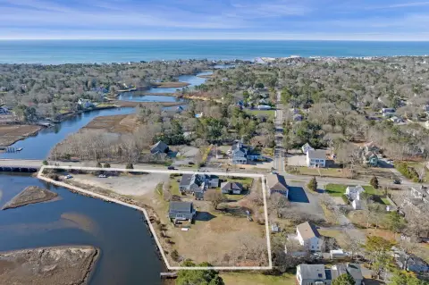
195 Rte 28 West Harwich, MA 02671-1224
Property profile & analytics
195 Rte 28, West Harwich, MA 02671-1224
- Office buildings
- 1,584 SF
- 0.61 lot acres
Property ID
US38-1208276
The Realmo ID is a unique identifier assigned to every property, incorporating country codes and precise geo-coordinates for 300x300-foot land blocks. It enables standardized data collection and seamless integration of disparate sources such as ownership, tax, title data and physical specifications. By aggregating current and historical records, the Realmo ID powers advanced analytics and delivers deep, verifiable insights for real estate professionals.
Location Intelligence
Current Use by Public Records
- Office buildings
Property Details for 195 Rte 28
- Year built
- 1981
- Construction
- FRAME
- Lot size
- 0.61 lot acres
- Zone code
- R
- Property type
- Office buildings
- APN
- HARW M:11 P:U3-A
- APU
- HARWM11PU3A
Sales History
| Date | Price | Buyer | Seller | Deed Type | Mortgage |
|---|---|---|---|---|---|
| Jul 24, 2013 | — | 195 Route 28 Realty LLC | — | Deed Of Trust · related | $205k · South Eastern Econ Dev Corp |
| Mar 22, 2013 | $429,600 | 195 Route 28 Realty LLC | Kuhn Nt | Grant Deed | $245k · Cape Cod Five Cent Bank |
| Mar 22, 2013 | — | 195 Route 28 Realty LLC | — | Deed Of Trust · related | $196k · Cape Cod Five Cent Bank |
| Dec 7, 2007 | $1 | Nt Kuhn | Kuhn,nancy M | Grant Deed | — |
| Jul 31, 2007 | $480,000 | Nancy M Kuhn | Casey Homes INC | Deed | $384k · Mortgage Electronic Registration Sy |
| Jan 15, 2003 | — | Casey Homes INC | — | Deed Of Trust · related | $50k · Cape Cod Five Cent Bank |
Value Estimations
based on Realmo’s proprietary methodology
-
AI approach
-
CAP approach
-
Comparable approach
-
Alternative Use
Get a detailed, property-specific estimation — fast and free
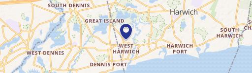
Location Insight
- Map
- Local Demand
- City
- West Harwich
- County
- Barnstable
- State
- Massachusetts
- Longitude
- -70.1048
- Latitude
- 41.6683
- CBSA code
- 12700
- CBSA name
- BARNSTABLE TOWN, MA METROPOLITAN STATISTICAL AREA
Property Tax & Assessments
Tax date
Tax Amount
Assessed Land Value
Assessed Improvement Value
Total Assessed Value
Applied Tax Rate
Land Market Value
Improvement Market Value
Total Market Value
2024
$4,065
$218,000
$456,100
$674,100
-
$0.00
$0.00
$0.00