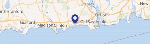
1749 Boston Post Rd Westbrook, CT 06498-2089
• NCD Neighborhood Commercial District • TIC Turnpike Interchange Commercial District • CB Commercial Boating District • RD Resort District • LI Light Industrial District • ID Industrial District A. PURPOSES 1. Commercial Town Center (CTC) District - The purpose of the Commercial Town Center (CTC) District is to maintain, enhance and promote a mixed-use, ped…
Cap rate
Implied · in-place · derived from last sale + estimated NOIValue
AI, CAP & Alternative Use estimations · Realmo proprietary blendProperty tax & assessments
Tax year 2023Comparables
6 recent transactions · within 1.5 miComparable in this City


Similar Nearby for Sale


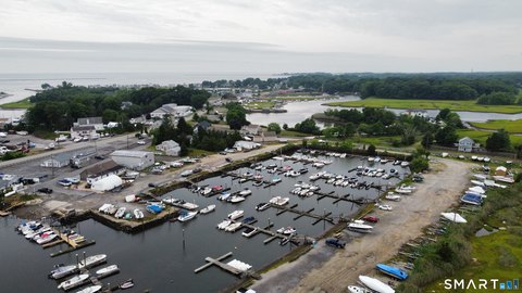


Similar Nearby for Lease


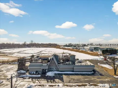
Property description
Physical attributes from public recordsZoning & alternative use
NCD · Westbrook, CT• NCD Neighborhood Commercial District • TIC Turnpike Interchange Commercial District • CB Commercial Boating District • RD Resort District • LI Light Industrial District • ID Industrial District A. PURPOSES 1. Commercial Town Center (CTC) District - The purpose of the Commercial Town Center (CTC) District is to maintain, enhance and promote a mixed-use, pedestrian-scale downtown area with a strong sense of place. The District provides for the central retail, office, cultural and governmental activities of the community as well as encouraging limited residential use. The Regulations encourage harmony and compatibility of design in an area of buildings built at different times and under no or various zoning regulations. The object is to permit the rehabilitation or rebuilding of existing buildings on or close to the street and property lines, thus preserving the historic look of the Town Center.
Costs & Benchmarks
Operating expenses, capex projections, utility benchmarks, and submarket comparables — all in one view.
Risks
Flood, climate, environmental, title, and tenant-concentration risk — surfaced with mitigations and source citations.


