Property profile & analytics
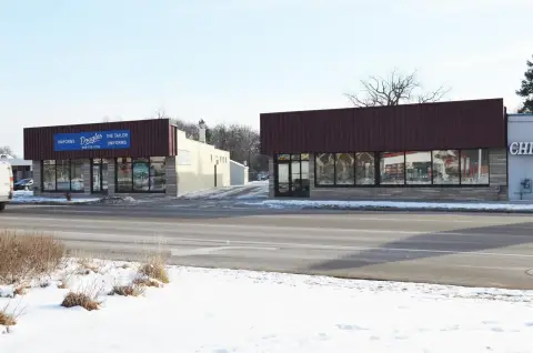
16590 13th Mile Rd Roseville, MI 48066-1507
- Flex space
- 35,666 SF
- 2.19 lot acres
OFF-MARKET
Value Estimations
$1,685,000
Show details
Cap Rate Potential
Location Intelligence
Property ID
US43-5175619
The Realmo ID is a unique identifier assigned to every property, incorporating country codes and precise geo-coordinates for 300x300-foot land blocks. It enables standardized data collection and seamless integration of disparate sources such as ownership, tax, title data and physical specifications. By aggregating current and historical records, the Realmo ID powers advanced analytics and delivers deep, verifiable insights for real estate professionals.
Current Use by Public Records
- Industrial Stamping & Manufacturing Co / Metal Fabrication Plant / Factory
Property Details for 16590 13th Mile Rd
- Year built
- 1972
- Lot size
- 2.19 lot acres
- Property size
- 35,666 SF
- Zone code
- I-2
- Property type
- Flex space
- APN
- 08-14-07-226-013
- APU
- 81407226013
Value Estimations
based on Realmo’s proprietary methodology
-
Comparable approach
- Method
- Estimation
- Statistic Estimate
- $1,683,000
- AI Estimate
- $1,683,000
Market price range: $1.47M - $2.62MMarket price range: $1.47M - $2.62M -
Alternative Use
- Use
- Estimation
- INDUSTRIAL (GENERAL)
- $2,110,000 Current use
- WAREHOUSE, STORAGE
- $2,405,000 Change: +14% Conversion: Easy
- RETAIL STORES
- $2,380,000 Change: +13% Conversion: Moderate
- OFFICE BUILDING
- $1,955,000 Change: -7% Conversion: Difficult
Get a detailed, property-specific valuation — fast and free
Location Insight
- Map
- Local Demand
- City
- Roseville
- County
- Macomb
- State
- Michigan
- Longitude
- -82.9515
- Latitude
- 42.5233
- CBSA code
- 19820
- CBSA name
- DETROIT-WARREN-LIVONIA, MI METROPOLITAN STATISTICAL AREA
Property Tax & Assessments
Tax date
Tax Amount
Assessed Land Value
Assessed Improvement Value
Total Assessed Value
Applied Tax Rate
Land Market Value
Improvement Market Value
Total Market Value
2022
$32,656
$0.00
$0.00
$586,100
-
$0.00
$0.00
$1,172,200