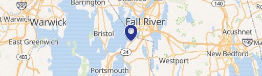
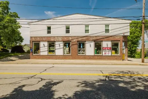
1540 Bulgarmarsh Rd Tiverton, RI 02878-2510
-
Crossroad Liquor (Bike/Boat/Book/etc) Store Bar & Pub
-
KG Fitness Gym & Fitness Center
-
Byte Federal Bitcoin ATM Atm
-
177 Variety Grocery & Convenience Store
-
ATM Atm
General Commercial GC. This district contains areas of the town which form the basic pattern of retail and service businesses serving the community, and the areas planned for expansion of such businesses. The GC District includes the major commercial area along Main Road in the northwest corner of Tiverton, and the smaller commercial area along Stafford Road…
Cap rate
Implied · in-place · derived from last sale + estimated NOIValue
AI, CAP & Alternative Use estimations · Realmo proprietary blendProperty tax & assessments
Tax year 2024Comparables
6 recent transactions · within 1.5 miComparable in this City

Similar Nearby for Sale



Similar Nearby for Lease


Property description
Physical attributes from public recordsZoning & alternative use
GC · Tiverton, RIGeneral Commercial GC. This district contains areas of the town which form the basic pattern of retail and service businesses serving the community, and the areas planned for expansion of such businesses. The GC District includes the major commercial area along Main Road in the northwest corner of Tiverton, and the smaller commercial area along Stafford Road, extending north from its intersection with Bulgarmarsh Road. g. Highway Commercial HC. This district contains areas of the town where businesses which serve regional needs rely on easy vehicular access and large land areas for parking and development. The HC District includes the commercial area bordering the City of Fall River and lying between Route 24 and Stafford Road, and the commercial area at the interchange of Route 24 and Fish Road and extending west along the south side of Souza Road. h. Waterfront W1. This district provides locations for moderate to high impact marine related commercial uses on and adjacent to the waterfront. i. Waterfront W2. This district provides locations for a mixture of residential and low impact service, retail, commercial, and marine related uses on and adjacent to the waterfront. j. Industrial I. This district contains that area of the town currently used for industrial and related uses, and which is considered suitable for future industrial development. The I District consists of a large land area east of Fish Road and on both sides of Route 24, and a smaller land area west of Fish Road and lying between the R-30 District and Souza Road. k. Open Space/Conservation OS. This district includes areas of coastal land and open space which are either owned publicly or by a private land conservation entity (e.g., land trust, Nature Conservancy, Audubon Society) and which are protected for one or more of the following purposes: keeping the land in a natural undeveloped condition, providing passive recreational opportunities to the public, and preserving specific habitat areas or agricultural uses. This district does not include undeveloped land which is privately owned but unprotected or protected by means of the purchase of development rights by the town or state, nor does it include land set aside as common open space as part of a rural residential development (see article IX). l. Neighborhood Business District NB. Transitional areas indicated by design as low density residential sections where homes have been converted to small-scale commercial and mixed uses.
Costs & Benchmarks
Operating expenses, capex projections, utility benchmarks, and submarket comparables — all in one view.
Risks
Flood, climate, environmental, title, and tenant-concentration risk — surfaced with mitigations and source citations.


