 Entity Owned
 Property profile
VerifiedCap rate & NOI
Current use
-
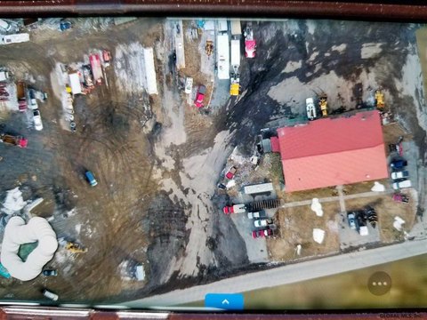
Waste Management Facility Hazardous Waste Disposal
Location
Value estimations
Owner & transaction history
Zoning & alternative use
e zoning districts established by this chapter, subject to future amendment, including an aggregate of all of the area of the Town, are and shall be as follows: A. Residential districts. (1) Land Conservation LC-42A and…
Comparables
6 recent transactions · within 1.5 miComparable in this City


Similar Nearby for Sale


Similar Nearby for Lease




Value estimation
Instant AI valuation built from comps, income signals, and proprietary benchmarks. A defensible range, not a single guess.
from $99/month
Cap rate
Cap rate calculated from real income and expense signals, benchmarked against sales of similar assets nearby.
from $99/month
Price sensitivity
The rate is the decision lever; valuation is the consequence.
Property tax & assessments
Tax year 2021Property description
Physical attributes from public recordsZoning & alternative use
LC-10A · Queensbury, NYe zoning districts established by this chapter, subject to future amendment, including an aggregate of all of the area of the Town, are and shall be as follows: A. Residential districts. (1) Land Conservation LC-42A and…
Zoning
The recorded zoning designation, what the district officially allows, and the municipal source it comes from.
Zoning designation
Official district profile
e zoning districts established by this chapter, subject to future amendment, including an aggregate of all of the area of the Town, are and shall be as follows: A. Residential districts. (1) Land Conservation LC-42A and…
What can be built and operated here — officially.
The district profile from the municipal source: what is on file for LC-10A in Queensbury, NY.
Registration is required before the official district profile is shown.
Find the owner behind the property.
Unlock the evidence behind ownership: portfolio, transactions, debt and signals that help you decide who to contact next.
Registration is required before any owner information is shown.


