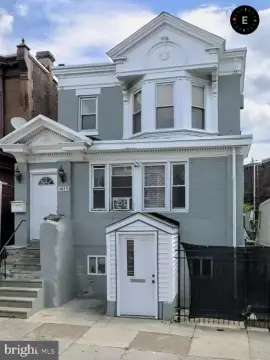
133 Tabor Rd Philadelphia, PA 19120-2937
CMX-2 Neighborhood Commercial Mixed-Use-2 C-2 RC-1 RC-2 OC CMX-2.5 Neighborhood Commercial Mixed-Use-2.5 Various special district controls CMX-3 Community Commercial Mixed-Use C-3 RC-3 CMX-4 Core Commercial Mixed-Use C-4 CMX-5 Center City Core Commercial Mixed-Use C-5 CA-1 Auto-Oriented Commercial-1 C-7 NSC CA-2 Auto-Oriented Commercial-2 ASC Eliminated >> C…
Cap rate
Implied · in-place · derived from last sale + estimated NOIValue
AI, CAP & Alternative Use estimations · Realmo proprietary blendProperty tax & assessments
Tax year 2023Comparables
6 recent transactions · within 1.5 miComparable in this City


Similar Nearby for Sale


Similar Nearby for Lease


Property description
Physical attributes from public recordsZoning & alternative use
CMX2 · Philadelphia, PACMX-2 Neighborhood Commercial Mixed-Use-2 C-2 RC-1 RC-2 OC CMX-2.5 Neighborhood Commercial Mixed-Use-2.5 Various special district controls CMX-3 Community Commercial Mixed-Use C-3 RC-3 CMX-4 Core Commercial Mixed-Use C-4 CMX-5 Center City Core Commercial Mixed-Use C-5 CA-1 Auto-Oriented Commercial-1 C-7 NSC CA-2 Auto-Oriented Commercial-2 ASC Eliminated >> C-6 (.2) Map Symbols. (.a) The alphanumeric map symbols are intended to provide a general, relative indication of the range of uses and activities allowed within the respective districts. "CMX" is used to indicate a mixed-use zoning district that is intended to accommodate both commercial and non-commercial development. "CA" is used to indicate zoning districts primarily intended to accommodate auto-oriented commercial development. 291 (.b) The numeral following the dash in the Commercial district map symbols is a relative indicator of the density/intensity or use, with a "1" indicating the lowest density/intensity/use option. (b) Purposes. Philadelphia's commercial zoning districts are primarily intended to accommodate and promote neighborhood-, community- and region-serving commercial uses, as well as mixed-use development consisting of commercial and residential uses in the same building or on the same site. This type of mixed-use development is encouraged in many areas of the City because it reflects the City's traditional urban, pedestrian-oriented character. Encouraging residential development in Commercial zoning districts also provides increased housing choice and reduces motorized transportation demands. The Commercial districts are distinguished primarily on the basis of allowed uses and commercial floor area limits. In the event of a conflict between any provision of this § 14-402 (Commercial and Commercial Mixed-Use Districts) and any other provision of this Zoning Code, the latter shall govern. (c) Descriptions. (.1)
No recorded transactions found for this property.
Costs & Benchmarks
Operating expenses, capex projections, utility benchmarks, and submarket comparables — all in one view.
Risks
Flood, climate, environmental, title, and tenant-concentration risk — surfaced with mitigations and source citations.


