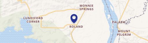
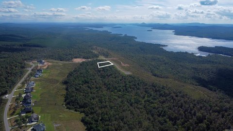
13201 Hwy 300th Rd Roland, AR 72135-8078
Property profile & analytics
13201 Hwy 300th Rd, Roland, AR 72135-8078
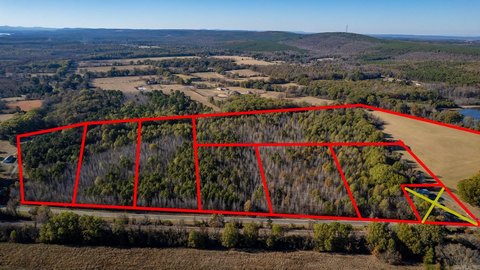
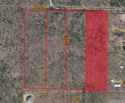
- Commercial land
- 3.04 lot acres
Property ID
US05-2199775
The Realmo ID is a unique identifier assigned to every property, incorporating country codes and precise geo-coordinates for 300x300-foot land blocks. It enables standardized data collection and seamless integration of disparate sources such as ownership, tax, title data and physical specifications. By aggregating current and historical records, the Realmo ID powers advanced analytics and delivers deep, verifiable insights for real estate professionals.
Location Intelligence
Current Use by Public Records
- Commercial land
Property Details for 13201 Hwy 300th Rd
- Lot size
- 3.04 lot acres
- Property type
- Commercial land
- APN
- 52R-027-04-002-00
- APU
- 52R0270400200
Sales History
| Date | Price | Buyer | Seller | Deed Type | Mortgage |
|---|---|---|---|---|---|
| Sep 10, 2024 | — | Foxden Enterprises LLC | — | Deed · related | $220k · Partners Bank |
| Feb 3, 2023 | — | Foxden Enterprises LLC | Foxden Capital LLC | Warranty Deed | — |
| Jan 13, 2023 | — | Foxden Enterprises LLC | — | Deed · related | $2.5M · The Malvern National Bank |
| Aug 5, 2021 | $60,000 | Foxden Capital LLC | Parkstone Properties LLC | Warranty Deed | — |
| Sep 14, 2018 | — | Parkstone Properties LLC | — | Deed · related | — |
| Jul 9, 2018 | — | Parkstone Properties LLC | — | Deed · related | — |
| — | — | Parkstone Properties LLC | — | Loan Modification · related | — |
| — | — | Parkstone Properties LLC | — | Loan Modification · related | — |
Value Estimations
based on Realmo’s proprietary methodology
-
AI approach
-
CAP approach
-
Comparable approach
-
Alternative Use
Get a detailed, property-specific estimation — fast and free
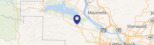
Location Insight
- Map
- Local Demand
- City
- Roland
- County
- Pulaski
- State
- Arkansas
- Longitude
- -92.4767
- Latitude
- 34.8676
- CBSA code
- 30780
- CBSA name
- LITTLE ROCK-NORTH LITTLE ROCK, AR METROPOLITAN STATISTICAL AREA
Property Tax & Assessments
Tax date
Tax Amount
Assessed Land Value
Assessed Improvement Value
Total Assessed Value
Applied Tax Rate
Land Market Value
Improvement Market Value
Total Market Value
2024
$618
$12,160
$0.00
$12,160
-
$60,800
$0.00
$60,800