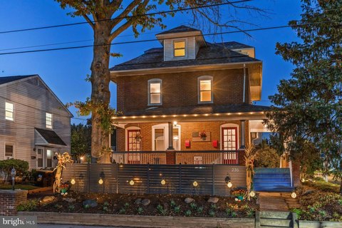
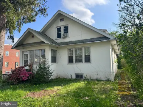
131 Crystal Rd Lansdale, PA 19446
Property profile & analytics
131 Crystal Rd, Lansdale, PA 19446
- Apartment buildings
- 6,742 SF
- 0.69 lot acres
Property ID
US73-2690418
The Realmo ID is a unique identifier assigned to every property, incorporating country codes and precise geo-coordinates for 300x300-foot land blocks. It enables standardized data collection and seamless integration of disparate sources such as ownership, tax, title data and physical specifications. By aggregating current and historical records, the Realmo ID powers advanced analytics and delivers deep, verifiable insights for real estate professionals.
Location Intelligence
Current Use by Public Records
- Apartment buildings
Property Details for 131 Crystal Rd
- Year built
- 1988
- Lot size
- 0.69 lot acres
- Zone code
- R2
- Property type
- Apartment buildings
- APN
- 46-00-00694-03-4
- APU
- 460000694034
Sales History
| Date | Price | Buyer | Seller | Deed Type | Mortgage |
|---|---|---|---|---|---|
| May 25, 2016 | $606,500 | Tomasz Witkowski | Felton Rebecca Trust | Grant Deed | — |
| Apr 28, 2016 | $606,500 | Tomasz Witkowski | Felton Rebecca Trust | Warranty Deed | $450k · Univest Bk & Tr Co |
| Nov 16, 2012 | — | Felton Rebecca Trust | Felton,rebecca B | Quit Claim Deed · related | — |
Value Estimations
based on Realmo’s proprietary methodology
-
Comparable approach
- Method
- Estimation
- Statistic Estimate
- $1,003,000
Market price range: $537k - $1.29M -
Alternative Use
- Use
- Estimation
- APARTMENT HOUSE (5+ UNITS)
- $935,000 Current use
- OFFICE BUILDING
- $1,105,000 Change: +18% Conversion: Moderate
- MEDICAL BUILDING
- $1,065,000 Change: +13% Conversion: Moderate
- RESTAURANT
- $945,000 Change: +1% Conversion: Difficult
- NEIGHBORHOOD: SHOPPING CENTER
- $880,000 Change: -6% Conversion: Difficult
- INDUSTRIAL (GENERAL)
- $755,000 Change: -20% Conversion: Difficult
Get a detailed, property-specific estimation — fast and free
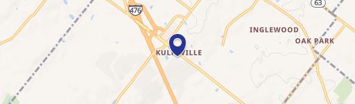
Location Insight
- Map
- Local Demand
- City
- Lansdale
- County
- Montgomery
- State
- Pennsylvania
- Longitude
- -75.2469
- Latitude
- 40.2657
- CBSA code
- 37980
- CBSA name
- PHILADELPHIA-CAMDEN-WILMINGTON, PA-NJ-DE-MD METROPOLITAN STATISTICAL AREA
Property Tax & Assessments
Tax date
Tax Amount
Assessed Land Value
Assessed Improvement Value
Total Assessed Value
Applied Tax Rate
Land Market Value
Improvement Market Value
Total Market Value
2023
$11,149
$60,680
$238,170
$298,850
-
$60,680
$238,170
$298,850