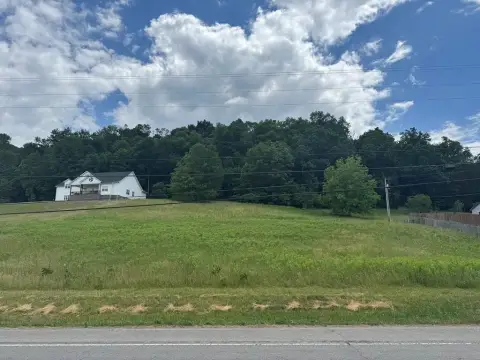
125 Gordonsville Hwy Carthage, TN 37030-1876
-
US Consolidated Farm Services Agency Sustainability Organization
-
Natural Resources Conservation Sustainability Organization
Within the C-2 General Commercial District, as shown on the Official Carthage Zoning Map, the following regulations shall apply: 11-505.2 PERMITIED USES ll-505.2A Business and personal services; all those permitted in the C-1 Central Commercial District and including the following types of establishments: Dry cleaning and laundry service, electrical repair,…
Cap rate
Implied · in-place · derived from last sale + estimated NOIValue
AI, CAP & Alternative Use estimations · Realmo proprietary blendProperty tax & assessments
Comparables
6 recent transactions · within 1.5 miComparable in this City


Similar Nearby for Sale

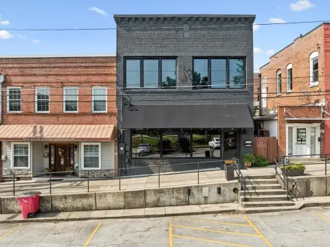

Property description
Physical attributes from public recordsZoning & alternative use
C-2 · Carthage, TNWithin the C-2 General Commercial District, as shown on the Official Carthage Zoning Map, the following regulations shall apply: 11-505.2 PERMITIED USES ll-505.2A Business and personal services; all those permitted in the C-1 Central Commercial District and including the following types of establishments: Dry cleaning and laundry service, electrical repair, equipment rental , exterminating service, gunsmith, hotel and motels, small engine and motor repair, upholstering service, veterinary service-indoor, and similar uses. 11-505.2B Retail and wholesale trade; all those permitted in the C-1 Central Commercial District and including the following types of establishments: Automotive parts store, building materials, cabinet sales, c;lepartment store, fertilizer sales-packaged, florist-wholesale, furniture sales, motorcycle sales, nursery and garden centers retail, pet shop, restaurant-drive-in, and similar uses. 11-505.2C Public and semi-public uses, including the following types of establishments: Cemetery (subject to the provisions of Section 11-604.2 of this Official Zoning Code), charitable, fraternal or social organization, church or similar place of worship, community center, daycare center, funeral home, general office buildings, group homes, hospital, medical clinic, nursing home, schools, retirement center, temporary care facility and similar uses. l l-5 05.2D Professional offices for doctors, dentists, lawyers, architects, artists, engineers and the like. l l-5 05.2E Federal, state, county and municipal uses. 11-505.2F Automotive and transportation services, limited to the following types of establishments: Automotive tire sales and tire repair, car wash, gasoline station (with no above ground storage of flammable material in excess of l 000 gallons and subject to the provisions of Section 11-604.1 and 11-604.6 of this Official Zoning Code), off-street parking lots (meeting the design requirements of Section 11- 301.5 of this Official Zoning Code), taxicab stand, and similar uses. 11-505.20 Amusement and recreational services; all those permitted in the C-1 Central Commercial District and including the following types of establishme nts: health and physical fitness clubs. 11-505.2H Light manufacturing; limited to the following types of establishments: Commercial printing, laboratories, optical instruments and lenses, and similar uses. 11-505.21 11-505.2J ll-505.2K 11-505 .2L 11-505 .3 43 Limited manufacturing for an on-premise business or service provided the following conditions are complied with: 1.
Costs & Benchmarks
Operating expenses, capex projections, utility benchmarks, and submarket comparables — all in one view.
Risks
Flood, climate, environmental, title, and tenant-concentration risk — surfaced with mitigations and source citations.


