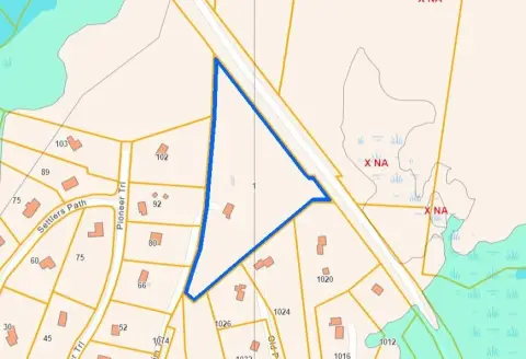
121 Clay Pit Rd Marshfield, MA 02050
by Art. 27 ] See table attached to this bylaw which is declared to be a part of this bylaw. In addition, uses are subject to Articles XI , XIII and XV where appropriate. [1] Uses Residential Business Industrial Overlay R-1 R-2 R-3 RB B-1 B-2 B-3 B-4 OP I-1 A PMUD WRPD BRVO KEY: S = Special Permit Required P = Use Permitted - = Prohibited Use Principal Uses R…
Cap rate
Implied · in-place · derived from last sale + estimated NOIValue
AI, CAP & Alternative Use estimations · Realmo proprietary blendProperty tax & assessments
Tax year 2024Comparables
6 recent transactions · within 1.5 miComparable in this City


Similar Nearby for Sale


Similar Nearby for Lease


Property description
Physical attributes from public recordsZoning & alternative use
R-1 · Marshfield, MAby Art. 27 ] See table attached to this bylaw which is declared to be a part of this bylaw. In addition, uses are subject to Articles XI , XIII and XV where appropriate. [1] Uses Residential Business Industrial Overlay R-1 R-2 R-3 RB B-1 B-2 B-3 B-4 OP I-1 A PMUD WRPD BRVO KEY: S = Special Permit Required P = Use Permitted - = Prohibited Use Principal Uses Residential 1. One-family detached dwelling P P P P - S P P - - - - P P 2. Open spa
No recorded transactions found for this property.
Costs & Benchmarks
Operating expenses, capex projections, utility benchmarks, and submarket comparables — all in one view.
Risks
Flood, climate, environmental, title, and tenant-concentration risk — surfaced with mitigations and source citations.


