11919 Ft St Omaha, NE 68164-2059
Property profile & analytics
11919 Ft St, Omaha, NE 68164-2059
- Grocery and convenience stores
- 3,111 SF
- 1.85 lot acres
Property ID
US57-0239509
The Realmo ID is a unique identifier assigned to every property, incorporating country codes and precise geo-coordinates for 300x300-foot land blocks. It enables standardized data collection and seamless integration of disparate sources such as ownership, tax, title data and physical specifications. By aggregating current and historical records, the Realmo ID powers advanced analytics and delivers deep, verifiable insights for real estate professionals.
Location Intelligence
Current Use by Public Records
- Fas Mart / Gas Station
- Phillips 66 / Gas Station
- Western Union / Bank / Credit Union
Property Details for 11919 Ft St
- Year built
- 1994
- Lot size
- 1.85 lot acres
- Property type
- Grocery and convenience stores
- APN
- 127590010
- APU
- 127590010
Sales History
| Date | Price | Buyer | Seller | Deed Type | Mortgage |
|---|---|---|---|---|---|
| Mar 1, 2016 | $175,000 | Gpm Midwest 18 LLC | Gas-mart USA INC | Grant Deed | — |
| Sep 4, 2008 | — | Gas-mart USA INC | — | Deed Of Trust · related | $42M · Sun Life Assurance Co |
Value Estimations
based on Realmo’s proprietary methodology
-
AI approach
- Method
- Estimation
- ML approach
- $405,000
-
CAP approach
- CAP Return
- Estimation
- 6%
- $695,000
- 6.5%
- $640,000
- 7%
- $595,000
-
Comparable approach
- Method
- Estimation
- AI Estimate
- $534,000
Market price range: $321k - $695k -
Alternative Use
- Use
- Estimation
- NEIGHBORHOOD: SHOPPING CENTER
- $580,000 Current use
- RETAIL STORES
- $485,000 Change: -16% Conversion: Easy
- MEDICAL BUILDING
- $470,000 Change: -19% Conversion: Difficult
Get a detailed, property-specific estimation — fast and free
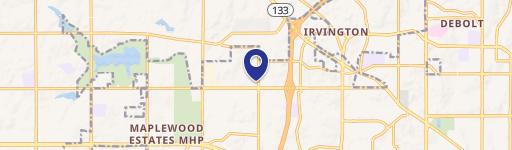
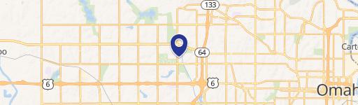
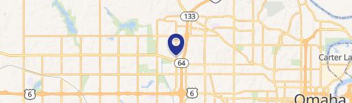
Location Insight
- Map
- Local Demand
- City
- Omaha
- County
- Douglas
- State
- Nebraska
- Longitude
- -96.0999
- Latitude
- 41.3061
- CBSA code
- 36540
- CBSA name
- OMAHA-COUNCIL BLUFFS, NE-IA METROPOLITAN STATISTICAL AREA
Property Tax & Assessments
Tax date
Tax Amount
Assessed Land Value
Assessed Improvement Value
Total Assessed Value
Applied Tax Rate
Land Market Value
Improvement Market Value
Total Market Value
2023
$19,868
$581,700
$360,000
$941,700
-
$581,700
$360,000
$941,700