Back to Search
Property profile & analytics
OFF-MARKET
Gas stations
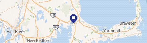
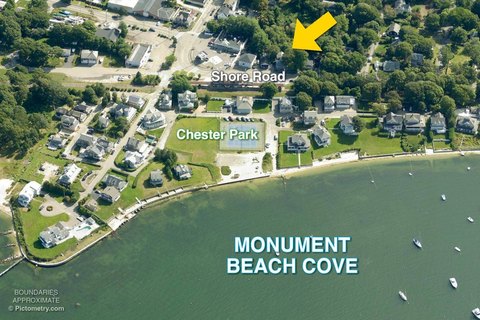
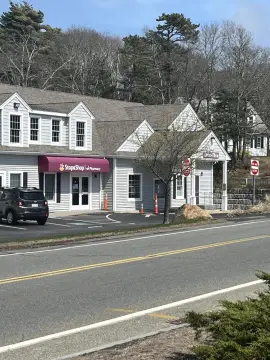
1030 Sandwich Rd Bourne, MA 02532
Entity Owned
7-yr Hold
Free & Clear
Property ID
US38-1112839
Property profile
Verified
Property type
Gas stations
Use group
SERVICE STATION (FULL SERVICE)
Year built
1978
Construction
STEEL FRAME
Total area
168 SF
Lot
0.25 ac (11,021 SF)
APN
BOUR M:12.3 P:122
UPID
US38-1112839
Cap rate & NOI
Priority signal for investors
Implied cap rate, NOI & suggested price
Cap rate vs submarket · NOI estimate · 3 price anchors
Implied cap rate, NOI & suggested price
Cap vs submarket · NOI estimate · 3 price anchors
Value estimations
Realmo proprietary · 4 methods
AI Approach
AI
by Request
CAP Approach
CAP
by Request
Comparable Approach
Comparable
by Request
Blend (final)
Blend
by Request
Owner & transaction history
Sadiq Corp · 7 yrs held
Sadiq Corp
since 2018
6 recorded transactions
Zoning & alternative use
Permitted uses
Permitted uses
Allowed · conditional · prohibited
Cap rate
Implied · in-place · derived from last sale + estimated NOI
Implied Cap rate
#1
Implied · in-place · NOI ÷ last sale
In-place · derived from last sale + estimated NOI
Cap rate, NOI & submarket benchmark
Implied cap rate vs Bourne submarket · NOI estimate · Typical band, median & reading
Implied cap rate, NOI & submarket benchmark
Cap vs Bourne submarket · NOI estimate · typical band, median & reading
Refine your cap rate
8-question underwriting flow
1.
Property current status — Going-In vs Stabilized
2.
Price for denominator — asking / offer / market
3.
Leasing status & lease structure (NNN / Gross)
4.
Tenant risk profile & vacancy assumption
5.
Upload T12 / rent roll / OM (optional)
Refine in 60 seconds, get exact suggested price
T12 upload · Submarket benchmarks · Sensitivity grid
Suggested price · 3 cap rate anchors
Income approach @ 5% / 7% / 9% — aggressive / typical / conservative
Suggested price at 5% / 7% / 9% cap
Aggressive / typical / conservative · Implied $/SF per anchor · Sensitivity grid
Suggested price at 5% / 7% / 9% cap
Aggressive / typical / conservative · implied $/SF · sensitivity
Value
AI, CAP & Alternative Use estimations · Realmo proprietary blendValue Estimations
Based on Realmo’s proprietary methodology
AI Approach
CAP Approach
Comparable Approach
Alternative Use
Get a detailed, property-specific estimation — fast and free
Price per SF
Sale + rent benchmarks
Subject property
—
Submarket sale & rent benchmarks
Median sale $/SF · Asking & closed rent · Submarket vacancy
Submarket sale & rent benchmarks
Median sale $/SF · asking & closed rent · submarket vacancy
Property tax & assessments
Tax year 2024Property tax & assessments
Tax year 2024
Tax billed
$4,277
Tax year 2024
Assessed value
$533,300
Assessed 2024
Previous assessed
$533,300
+0.0% YoY
Effective rate
0.80%
On assessed value
Assessed land
$233,700
Assessed improvement
$299,600
Comparables
6 recent transactions · within 1.5 miComparable in this city
6 recent transactions
Comparable in this City


Similar Nearby for Sale


Similar Nearby for Lease


Recent comparable sales
Sale price & price/SF · Sale date & distance · Adjustments & confidence
Recent comparable sales
Sale price & $/SF · sale date & distance · adjustments
Property description
Physical attributes from public recordsBuilding & lot
Public records
Property type
Gas stations
Use group
SERVICE STATION (FULL SERVICE)
Status
Off-Market
Year built
1978
Construction
STEEL FRAME
Heating
ELECTRIC
Buildings
1
Stories
1
Total area
168 SF
Lot
0.25 ac (11,021 SF)
APN
BOUR M:12.3 P:122
UPID
US38-1112839
Jurisdiction
BOURNE
Zoning & alternative use
Zoning · permitted uses
Permitted & conditional uses
Allowed uses · Special-permit conditions · Prohibited uses
Permitted & conditional uses
Allowed · special-permit conditions · prohibited
Building & site characteristics
From public records
Year built
1978
Construction
STEEL FRAME
Heating
ELECTRIC
Stories
1
Buildings
1
Lot
0.25 ac
Current owner
From public records · entity-resolved
Sadiq Corp
Entity
Free & Clear · 7 yrs held
Mailing address
22 FALMOUTH RD, MASHPEE, MA 02649-2743
Ownership since
2018
Owner contacts — direct phone, email, and related entities
Decision-maker phone · Verified email · Related entities & filings
Owner contacts
Email · phone · related entities
Sales History
6 recorded events · public records
Date
Price
Buyer
Seller
Deed Type
Mortgage
Mar 14, 2025
—
Sadiq Corp
—
Deed
related
$101,500 · Volta Oil Company INC
Sep 21, 2018
$165,000
Sadiq Corp
Sterling Kings INC
Quit Claim Deed
—
Aug 13, 2010
$200,000
Sterling Kings INC
Cks Sag RT
One Of Committee, Strict Foreclosure, Sheriff, Or Redemption Deeds
related
—
Jun 13, 2002
$850,000
Ck Smith&co INC
Sag RT
Grant Deed
$13,200,000 · Banknorth NA
Jan 15, 1998
—
Sag RT
—
Deed Of Trust
related
$408,000 · Peg Managers Acceptnc
Aug 11, 1994
$450,000
Condo Capital Corp
David J Adams Irt
Grant Deed
related
—
Coming soon
Costs & Benchmarks
Operating expenses, capex projections, utility benchmarks, and submarket comparables — all in one view.
Coming soon
Risks
Flood, climate, environmental, title, and tenant-concentration risk — surfaced with mitigations and source citations.
Try Rey
Ask anything about this address in plain English.
“Is 15.6% cap rate sustainable?” · “Best tenant mix for BU1?” · “What’s the redev upside?”
You own 1030 Sandwich Rd?
List it free. Reach 20,000 daily buyers.
We’ve already pulled the facts. Confirm photos + price and you’re live in 2 minutes.
List this address →
Full reports are paid
Unlock the full Property Analytics report
Start free for 7 days — no card required. Full owner contacts, all 4 valuations with methodology, refine flow, comparable adjustments, foot-traffic deep dive, export to PDF / CSV.


