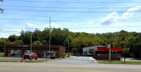
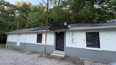
1026 Hwy 25th 70 Newport, TN 37821-8048
Property profile & analytics
1026 Hwy 25th 70, Newport, TN 37821-8048
- Retail space
- 4,250 SF
- 2.20 lot acres
Property ID
US80-1098109
The Realmo ID is a unique identifier assigned to every property, incorporating country codes and precise geo-coordinates for 300x300-foot land blocks. It enables standardized data collection and seamless integration of disparate sources such as ownership, tax, title data and physical specifications. By aggregating current and historical records, the Realmo ID powers advanced analytics and delivers deep, verifiable insights for real estate professionals.
Location Intelligence
Current Use by Public Records
- Retail space
Property Details for 1026 Hwy 25th 70
- Year built
- 2021
- Construction
- MASONRY/CONCRETE MASONRY UNITS (CMUS)
- Lot size
- 2.20 lot acres
- Property type
- Retail space
- APN
- 015046 09700
- APU
- 1504609700
Sales History
| Date | Price | Buyer | Seller | Deed Type | Mortgage |
|---|---|---|---|---|---|
| Jan 15, 2021 | $277,500 | Scott Thornton Bartley | Danny Ray Jenkins | Warranty Deed | — |
| Jan 2, 2020 | — | Marcus D Stinnett | Florine L Stinnett | Quit Claim Deed · related | — |
| Oct 7, 2008 | $160,000 | Cleo Stinnett | Sale,lowell & Lisa C | Warranty Deed | — |
Value Estimations
based on Realmo’s proprietary methodology
-
AI approach
-
CAP approach
-
Comparable approach
-
Alternative Use
Get a detailed, property-specific estimation — fast and free
Location Insight
- Map
- Local Demand
- City
- Newport
- County
- Cocke
- State
- Tennessee
- Longitude
- -83.2397
- Latitude
- 35.9735
- CBSA code
- 35460
- CBSA name
- NEWPORT, TN MICROPOLITAN STATISTICAL AREA
Property Tax & Assessments
Tax date
Tax Amount
Assessed Land Value
Assessed Improvement Value
Total Assessed Value
Applied Tax Rate
Land Market Value
Improvement Market Value
Total Market Value
2023
$9,641
$93,360
$100,560
$193,920
-
$233,400
$251,400
$484,800