Back to Search
Property profile & analytics
OFF-MARKET
Estimated value
$560,000
Office buildings
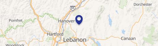
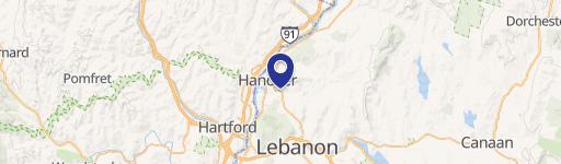
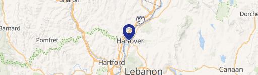
10 Buck Rd Hanover, NH 03755-2700
Entity Owned
8-yr Hold
~
Est. High Equity
Property ID
US58-0086290
Property profile
Verified
Property type
Office buildings
Use group
OFFICE BUILDING
Year built
1978
Construction
CONCRETE
Total area
4,775 SF
Lot
1.74 ac (75,794 SF)
Zoning code
OL
APN
HNOV M:024 B:038 L:001
UPID
US58-0086290
Cap rate & NOI
Priority signal for investors
Implied cap rate, NOI & suggested price
Cap rate vs submarket · NOI estimate · 3 price anchors
Implied cap rate, NOI & suggested price
Cap vs submarket · NOI estimate · 3 price anchors
Current use
Occupant on record · Public records
-
Clauson Atwood Law Firm
-
Resolve Medical Billing Service
-
King's Row Coffee Cafe & Coffee Shop Specialty Food Shop
-
Juliette Belmonte Art Art Gallery
-
CollegeLab Training Center
Value estimations
Realmo proprietary · 4 methods
AI Approach
AI
$525k
CAP Approach
CAP
by Request
Comparable Approach
Comparable
$612k
Blend (final)
Blend
$560k
Owner & transaction history
Ctr Buck Road LLC · 8 yrs held
Ctr Buck Road LLC
since 2018
7 recorded transactions
Zoning & alternative use
OL · Hanover, NH
Permitted uses
Permitted uses
Allowed · conditional · prohibited
Cap rate
Implied · in-place · derived from last sale + estimated NOI
Implied Cap rate
#1
Implied · in-place · NOI ÷ last sale
In-place · derived from last sale + estimated NOI
Cap rate, NOI & submarket benchmark
Implied cap rate vs Hanover submarket · NOI estimate · Typical band, median & reading
Implied cap rate, NOI & submarket benchmark
Cap vs Hanover submarket · NOI estimate · typical band, median & reading
Refine your cap rate
8-question underwriting flow
1.
Property current status — Going-In vs Stabilized
2.
Price for denominator — asking / offer / market
3.
Leasing status & lease structure (NNN / Gross)
4.
Tenant risk profile & vacancy assumption
5.
Upload T12 / rent roll / OM (optional)
Refine in 60 seconds, get exact suggested price
T12 upload · Submarket benchmarks · Sensitivity grid
Suggested price · 3 cap rate anchors
Income approach @ 5% / 7% / 9% — aggressive / typical / conservative
Suggested price at 5% / 7% / 9% cap
Aggressive / typical / conservative · Implied $/SF per anchor · Sensitivity grid
Suggested price at 5% / 7% / 9% cap
Aggressive / typical / conservative · implied $/SF · sensitivity
Value
AI, CAP & Alternative Use estimations · Realmo proprietary blendValue Estimations
Based on Realmo’s proprietary methodology
AI Approach
Method
Estimation
Statistic approach
by Request
ML approach
$525,000
CAP Approach
CAP Return
Estimation
6%
by Request
6.5%
by Request
7%
by Request
Alternative Use
Use
Estimation
RETAIL STORES
$790,000
Change: -19% · Conversion: Moderate
Blend value · Realmo final
$560k
Range $504k – $616k · ±10%
Realmo estimate · informational only.
These numbers are calculated by our models from public records and may not reflect actual market value.
Not an appraisal.
Verify with a licensed appraiser before transacting. Realmo accepts no liability for divergence from real-world outcomes.
View the full estimation — every method, every assumption
Confidence drivers & risk notes · Custom comparable set · Free for first 3 / day
Full estimation methodology
Every method · every assumption · confidence drivers
Price per SF
Sale + rent benchmarks
Subject property
$117 / SF
Submarket sale & rent benchmarks
Median sale $/SF · Asking & closed rent · Submarket vacancy
Submarket sale & rent benchmarks
Median sale $/SF · asking & closed rent · submarket vacancy
Property tax & assessments
Tax year 2022Property tax & assessments
Tax year 2022
Tax billed
$11,322
Tax year 2022
Assessed value
$636,400
Assessed 2022
Previous assessed
$636,400
+0.0% YoY
Effective rate
1.78%
On assessed value
Assessed land
$267,600
Assessed improvement
$368,800
Applied tax rate
33,860.0000
Comparables
6 recent transactions · within 1.5 miComparable in this city
6 recent transactions
Comparable in this City


Similar Nearby for Sale


Recent comparable sales
Sale price & price/SF · Sale date & distance · Adjustments & confidence
Recent comparable sales
Sale price & $/SF · sale date & distance · adjustments
Property description
Physical attributes from public recordsBuilding & lot
Public records
Property type
Office buildings
Use group
OFFICE BUILDING
Status
Off-Market
Year built
1978
Construction
CONCRETE
Heating
HOT WATER
Cooling
YES
Buildings
1
Stories
2
Units
1
Total area
4,775 SF
Lot
1.74 ac (75,794 SF)
Zoning code
OL
APN
HNOV M:024 B:038 L:001
UPID
US58-0086290
Jurisdiction
HANOVER TOWN
Zoning & alternative use
OL · Hanover, NH
Zoning OL · permitted uses
OL · Hanover, NH
Permitted & conditional uses
Allowed uses · Special-permit conditions · Prohibited uses
Permitted & conditional uses
Allowed · special-permit conditions · prohibited
Hanover. Always verify with local authorities before improvements.
Alternative use value scenarios
Repositioning upside vs current use
RETAIL STORES
Est. value
$790,000
RETAIL STORES
Alternative use deep dive — conversion cost, permits, timeline
Conversion cost estimate · Permit path & risks · Stabilized NOI per option
Alternative use deep dive
Conversion cost · permit path · stabilized NOI per option
Building & site characteristics
From public records
Year built
1978
Construction
CONCRETE
Heating
HOT WATER
Cooling
Yes
Stories
2
Buildings
1
Units
1
Lot
1.74 ac
Current owner
From public records · entity-resolved
Ctr Buck Road LLC
Entity
Mailing address
23 S MAIN ST STE #3, HANOVER, NH 03755-2075
Ownership since
2018
Owner contacts — direct phone, email, and related entities
Decision-maker phone · Verified email · Related entities & filings
Owner contacts
Email · phone · related entities
Sales History
10 recorded events · public records
Date
Price
Buyer
Seller
Deed Type
Mortgage
Jun 1, 2023
—
C T R Buck Road LLC
—
Deed
related
$380,000 · Bar Harbor Bank & Trust Co
May 9, 2018
$440,000
Ctr Buck Road LLC
Clauson,helen
Warranty Deed
$80,000 · Helen F Clauson
Jun 26, 2017
—
Helen F Clauson
—
Deed
related
$25,000 · Laura E Clauson
Jan 19, 2017
—
Helen Clauson
—
Deed
related
$140,000 · Mascoma Svgs
Sep 21, 2012
—
Helen Clauson
—
Deed Of Trust
related
$46,961 · Ledyard National Bank
May 16, 2006
—
K William Clauson T
—
Deed Of Trust
related
$100,000 · Ledyard National Bank
Jul 31, 2002
$17,300
Helen Clauson
Whelan,heide W
Grant Deed
—
—
—
Helen Clauson
—
Deed Of Trust
related
$140,000 · Mascoma Svgs
—
—
Helen F Clauson
—
Deed Of Trust
related
$24,000 · Karl R Clauson
—
—
Helen F Clauson
—
Deed Of Trust
related
$25,000 · Laura E Clauson
Coming soon
Costs & Benchmarks
Operating expenses, capex projections, utility benchmarks, and submarket comparables — all in one view.
Coming soon
Risks
Flood, climate, environmental, title, and tenant-concentration risk — surfaced with mitigations and source citations.
Try Rey
Ask anything about this address in plain English.
“Is 15.6% cap rate sustainable?” · “Best tenant mix for BU1?” · “What’s the redev upside?”
You own 10 Buck Rd?
List it free. Reach 20,000 daily buyers.
We’ve already pulled the facts. Confirm photos + price and you’re live in 2 minutes.
List this address →
Full reports are paid
Unlock the full Property Analytics report
Start free for 7 days — no card required. Full owner contacts, all 4 valuations with methodology, refine flow, comparable adjustments, foot-traffic deep dive, export to PDF / CSV.


