Property summary
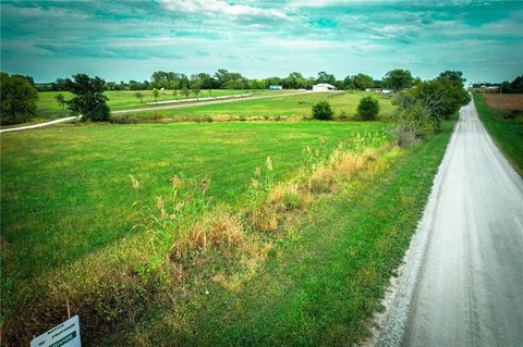
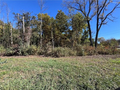
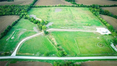
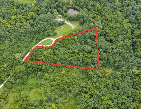
This 8.4-acre Missouri farmland presents a unique investment opportunity for agricultural pursuits. Located in Lathrop, Clinton County (zip code 64465), this property, identified as Lot 2 SW Brangus N/A, offers fertile land suitable for various farming operations, including cultivation and livestock. While a survey is currently underway (ordered July 1st, 2024, with results expected within six weeks), the property includes a well of unknown condition. Public water and electricity are… conveniently accessible on the adjacent Lot 3. This property is ideal for those seeking a productive agricultural investment. Note that final boundary lines are pending the completion of the aforementioned survey. Interested parties should be aware that this is one of several adjacent lots available for purchase.
Ownership intelligence
Resolved identity, portfolio, hold profile and investor signals. Included in the full report.
Owner contacts
Skip-traced phones and e-mails of the owner. Included with the full report.
Mortgages
Recorded lenders, amounts and estimated maturities of the owner's loan book — in the full report.
Property tax
No data for this sectionNo tax or assessment record is on file for this parcel in the county feed.
Value estimate
· Sep 2026No data for this sectionNo value estimate could be modeled: the record carries too little market input for this parcel.
Recently sold
No data for this sectionNo cleaned sale $/SF benchmark exists for this use type in this ZIP, submarket or county yet.
Cap rate analysis
No income signal is modeled for this parcel yet — the Cap Rates tab runs the workflow.
Zoning insight
No data for this sectionNo zoning code is on file for this parcel. Coverage grows with every catalog release.
Location intelligence
Location
Every figure names its source: public record, benchmark, or modeled. Coverage varies by property — thin data is stated as missing, never invented.
Comparables
6 recent transactions · within 1.5 miComparable in this City


Similar Nearby for Sale


Instant AI valuation built from comps, income signals, and proprietary benchmarks.A defensible range, not a single guess.
from $99/month
Cap rate calculated from real income and expense signals, benchmarked against sales of similar assets nearby.
from $99/month
The recorded zoning designation, what the district officially allows, and the municipal source it comes from.
No zoning code is on file for this parcel. Zoning coverage grows with every catalog release — check back, or open Location Intelligence for use analysis of this corner.
Phones and e-mails of the people behind this property's owner, traced from licensed contact data.
Owner phones and e-mails come with the full report for this property - traced from licensed contact data, with verification and Do-Not-Call flags on every number.
Unlock the evidence behind ownership: portfolio, transactions, debt and signals that help you decide who to contact next.
Registration is required before any owner information is shown.
The mortgage data is behind the paid report: recorded loans of the owner - lender, amount, rate and the estimated maturity - as part of the Ownership Intelligence workspace.
Registration is required before any owner information is shown.
- Ownership
- Owner Contacts
- Full Property Data
- Historical Records
- Value Estimation
- NOI Potential
- Cap Rate Calculation
- Location Insight
- Alternative use
- Local Zoning Insight
Cancel anytime.
- 30 reports a month
- Ownership
- Owner Contacts
- Full Property Data
- Historical Records
- Value Estimation
- NOI Potential
- Cap Rate Calculation
- Location Insight
- Alternative use
- Local Zoning Insight
- Location Analytics
Cancel anytime.
- 300 reports a month
- Ownership
- Owner Contacts
- Full Property Data
- Historical Records
- Value Estimation
- NOI Potential
- Cap Rate Calculation
- Location Insight
- Alternative use
- Local Zoning Insight
- Location Analytics
and get 1 Light Report
- Full Property Data
- Historical Records
- Value Estimation
- NOI Potential
- Cap Rate Calculation
- Location Insight
- Alternative use
- Local Zoning Insight


