978 Hwy South Flat, WY 82401
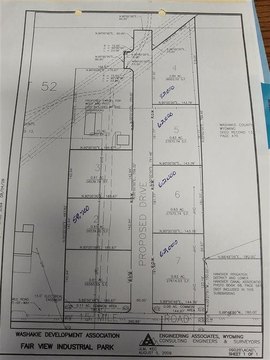
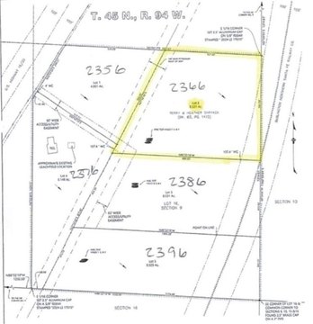
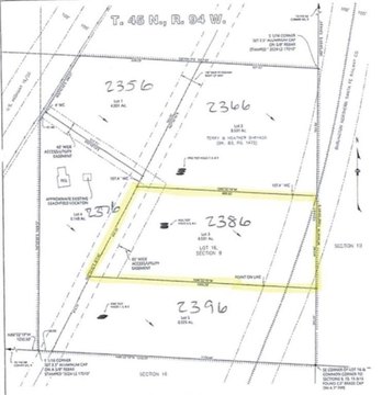
This exceptional 56.76-acre property in Washakie County, Wyoming, presents a unique investment opportunity. Located just under a mile from Worland's city limits, this land boasts 2,472,465.6 square feet of versatile space. A significant feature is Slick Creek, which flows the entire length of the property, attracting abundant wildlife. The land has a rich agricultural history, previously used for alfalfa and wheat farming. Water rights from the Upper Hanover Canal are included. The property's proximity to Worland (less than a mile), the Big Horn Mountains (30 minutes), Casper, WY (two hours), and Billings, MT (two hours) enhances its appeal. Potential uses are diverse, ranging from specialty crop farming (vegetables, flowers, nursery stock) to a small-scale subdivision, or even recreational ventures like a corn maze or pumpkin patch. The elevated area above the canal offers further income potential, perhaps for storage units or parking for recreational vehicles. Three existing billboards generate rental income: one pays $75 annually, another $400, and a third $150. A trailer house on the property may be purchased separately. This is an exceptional opportunity to embrace the Wyoming lifestyle.
Cap rate
Implied · in-place · derived from last sale + estimated NOIValue
AI, CAP & Alternative Use estimations · Realmo proprietary blendComparables
6 recent transactions · within 1.5 miComparable in this City


Similar Nearby for Sale


Property description
Physical attributes from public recordsZoning & alternative use
No recorded transactions found for this property.
Costs & Benchmarks
Operating expenses, capex projections, utility benchmarks, and submarket comparables — all in one view.
Risks
Flood, climate, environmental, title, and tenant-concentration risk — surfaced with mitigations and source citations.


