
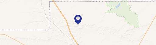
0 7Th Rd, Power, MT 59468
This exceptional 156-acre agricultural property in Power, Montana, presents a unique investment opportunity. Conveniently located near Interstate 15 and just 20 miles from Great Falls, this expansive land boasts stunning views and easy access to essential utilities. Power is readily available at the roadside. The property is currently leased for agricultural use until November 30, 2024, providing immediate income potential. A portion of the acreage is designated for cropland, while the remainder is utilized as pastureland, offering versatility for various agricultural pursuits. The property's size and location make it ideal for farming, cattle ranching, or establishing a private estate with ample land for personal use and potential rental income from the remaining acreage. The property is situated in Teton County, Montana, with a zip code of 59468. Its coordinates are 47.7122843 latitude and -111.6767786 longitude. This is a rare chance to acquire a substantial land holding with significant potential in a desirable Montana location. Don't miss this opportunity to own a piece of Montana's agricultural heartland.
Cap rate
Implied · in-place · derived from last sale + estimated NOIValue
AI, CAP & Alternative Use estimations · Realmo proprietary blendComparables
6 recent transactions · within 1.5 miComparable in this City


Property description
Physical attributes from public recordsZoning & alternative use
No recorded transactions found for this property.
Costs & Benchmarks
Operating expenses, capex projections, utility benchmarks, and submarket comparables — all in one view.
Risks
Flood, climate, environmental, title, and tenant-concentration risk — surfaced with mitigations and source citations.


