Property summary
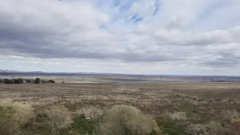
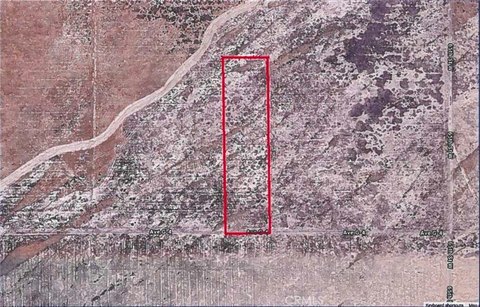
This exceptional 7.47-acre parcel, located at the southeast corner of 15th Street West and West Avenue K-8 in Lancaster, CA (APN 3125-010-071), presents a remarkable multi-family development opportunity. Zoned LRCPD (Regional Commercial Planned Development), this unencumbered site allows for diverse uses including multifamily residential (affordable, workforce, and build-to-rent options), hotel, retail, office, and entertainment. Its strategic location offers excellent frontage along 15th Street West with convenient access to the Antelope Valley Freeway (CA Hwy 14) via Avenue L ramps. The property is surrounded by existing multi-family, senior, and single-family housing, as well as retail centers, ensuring a strong existing infrastructure and market demand. The site's proximity to major aerospace employers like Northrop Grumman, Lockheed, Boeing, General Atomics, and NASA in nearby Palmdale, contributes to a robust and growing regional employment market, further enhancing the investment potential. The anticipated increase in employment opportunities, both directly and indirectly related to these aerospace companies, creates a significant demand for housing and supporting services. The property is also conveniently located near the Lancaster Commerce Center, a major retail hub featuring Costco, Target, and other prominent businesses. This prime location, coupled with the flexible zoning and substantial lot size, makes this an exceptional investment opportunity for developers seeking to capitalize on the thriving Lancaster market and the burgeoning aerospace industry. The asking price for this exceptional property is $3,000,000.
Property profile
VerifiedCap rate & NOI
Location
Value estimations
Owner & transaction history
Comparables
6 recent transactions · within 1.5 miComparable in this City


Similar Nearby for Sale


Similar Nearby for Lease


Value estimation
Instant AI valuation built from comps, income signals, and proprietary benchmarks. A defensible range, not a single guess.
from $99/month
Cap rate
Cap rate calculated from real income and expense signals, benchmarked against sales of similar assets nearby.
from $99/month
Property description
Physical attributes from public recordsZoning & alternative use
Zoning
The recorded zoning designation, what the district officially allows, and the municipal source it comes from.
No zoning code is on file for this parcel. Zoning coverage grows with every catalog release — check back, or open Location Intelligence for use analysis of this corner.
Find the owner behind the property.
Unlock the evidence behind ownership: portfolio, transactions, debt and signals that help you decide who to contact next.
Registration is required before any owner information is shown.
- Full Property Data
- Historical Records
- Value Estimation
- NOI Potential
- Cap Rate Calculation
- Ownership
- Location Insight
- Alternative use
- Local Zoning Insight
Cancel anytime.
- 30 reports a month
- Location Analytics
- Market Trends
- Full Property Data
- Historical Records
- Value Estimation
- NOI Potential
- Cap Rate Calculation
- Ownership
- Location Insight
- Alternative use
- Local Zoning Insight
Cancel anytime.
- 300 reports a month
- Location Analytics
- Market Trends
- Full Property Data
- Historical Records
- Value Estimation
- NOI Potential
- Cap Rate Calculation
- Ownership
- Location Insight
- Alternative use
- Local Zoning Insight
and get 1 Light Report
- Property Information
- Historical Records
- Value Estimation
- NOI Potential
- Cap Rate Potential
- Location Insight
- Alternative use
- Local Zoning Insight


