0 Imperial Ave Burns, OR 97720
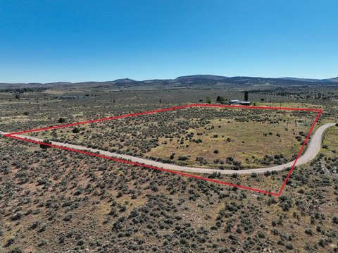
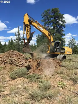
This exceptional 6.57-acre commercial lot presents a unique investment opportunity in Burns, Oregon, situated within Harney County. Conveniently located near Slater Elementary School and Harney District Hospital, this property offers both ample space and proximity to essential amenities. The lot boasts gravel access from a paved city road and features partial fencing with existing rock jacks, potentially reducing development costs. The parcel ID is 23s30e12-ac-00201. 2023 property taxes, prior to a boundary adjustment, were $468.28. This buildable lot provides significant potential for various commercial ventures. Buyers can explore financing options through cash purchases or bank financing. Further information regarding building permits, utility connections, and other development details can be obtained from the City of Burns. A video showcasing the property is available online. This is a rare opportunity to acquire a substantial commercial lot in a desirable location within Burns city limits. Don't miss out on this chance to establish your business in a thriving community.
Cap rate
Implied · in-place · derived from last sale + estimated NOIValue
AI, CAP & Alternative Use estimations · Realmo proprietary blendComparables
6 recent transactions · within 1.5 miComparable in this City


Similar Nearby for Sale


Property description
Physical attributes from public recordsZoning & alternative use
No recorded transactions found for this property.
Costs & Benchmarks
Operating expenses, capex projections, utility benchmarks, and submarket comparables — all in one view.
Risks
Flood, climate, environmental, title, and tenant-concentration risk — surfaced with mitigations and source citations.


