Property summary
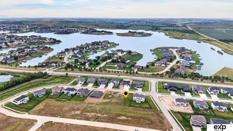
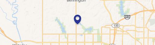
This exceptional 36-acre parcel in Bennington, Nebraska, presents a unique opportunity for mixed-use development. Located just south of Highway 36 near 145th Street, this vacant land is zoned AG and offers significant potential for residential, multi-family, or commercial projects. The property's prime location within Bennington's jurisdiction, a rapidly growing area of the Omaha metro, is adjacent to existing townhome and retirement communities, ensuring strong demand. The east property line could become the future 144th Street, connecting Bennington Road and Highway 36, enhancing accessibility and value. A natural buffer provided by the Papio Natural Resource District on the west side ensures privacy. Conveniently located 2.6 miles from Highway 133 (leading to Blair and Omaha), 1.4 miles from downtown Bennington, and within easy reach of Standing Bear and Cunningham Lakes, this property offers residents access to both work and recreational opportunities. Currently planted in soybeans and part of a crop-share program, the gently sloping land is ready for future development. The asking price is $1,995,000, representing a price per acre of $55,416.67. The total square footage is 1,742,400. Ownership is fee simple. This property is ideal for investors seeking long-term growth or immediate development potential in a thriving Nebraska community.
Property profile
VerifiedCap rate & NOI
Location
Value estimations
Owner & transaction history
Comparables
6 recent transactions · within 1.5 miComparable in this City


Similar Nearby for Sale

Similar Nearby for Lease


Value estimation
Instant AI valuation built from comps, income signals, and proprietary benchmarks. A defensible range, not a single guess.
from $99/month
Cap rate
Cap rate calculated from real income and expense signals, benchmarked against sales of similar assets nearby.
from $99/month
Property description
Physical attributes from public recordsZoning & alternative use
Zoning
The recorded zoning designation, what the district officially allows, and the municipal source it comes from.
No zoning code is on file for this parcel. Zoning coverage grows with every catalog release — check back, or open Location Intelligence for use analysis of this corner.
Find the owner behind the property.
Unlock the evidence behind ownership: portfolio, transactions, debt and signals that help you decide who to contact next.
Registration is required before any owner information is shown.
- Full Property Data
- Historical Records
- Value Estimation
- NOI Potential
- Cap Rate Calculation
- Ownership
- Location Insight
- Alternative use
- Local Zoning Insight
Cancel anytime.
- 30 reports a month
- Location Analytics
- Market Trends
- Full Property Data
- Historical Records
- Value Estimation
- NOI Potential
- Cap Rate Calculation
- Ownership
- Location Insight
- Alternative use
- Local Zoning Insight
Cancel anytime.
- 300 reports a month
- Location Analytics
- Market Trends
- Full Property Data
- Historical Records
- Value Estimation
- NOI Potential
- Cap Rate Calculation
- Ownership
- Location Insight
- Alternative use
- Local Zoning Insight
and get 1 Light Report
- Property Information
- Historical Records
- Value Estimation
- NOI Potential
- Cap Rate Potential
- Location Insight
- Alternative use
- Local Zoning Insight


