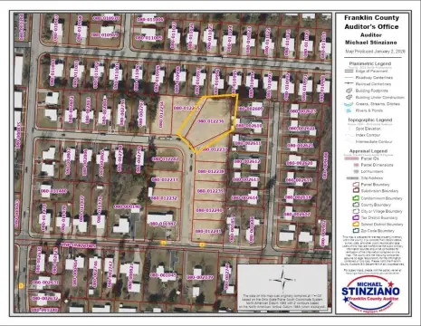
0 Cooper Rd Westerville, OH 43081
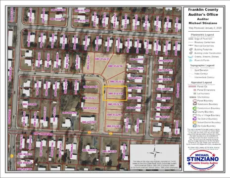
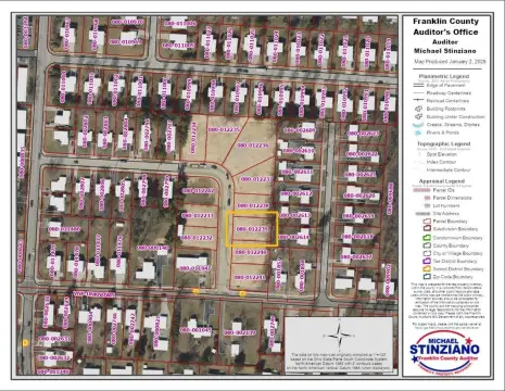
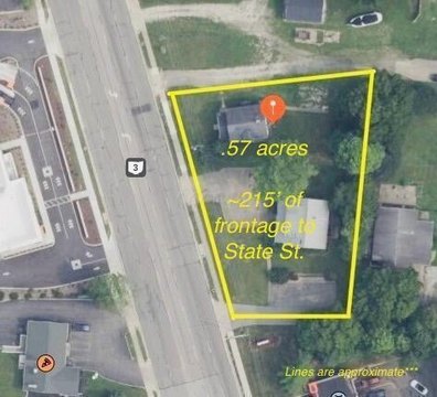
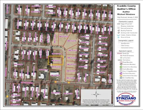
This exceptional 7.5-acre commercial land parcel presents a prime development opportunity in Westerville, Ohio. Located in Franklin County, with the address of Cooper Rd, zip code 43081, and APN 080-011862-00, this property boasts convenient access to utilities, making it ideal for a variety of commercial projects. Its strategic location offers significant advantages, being within walking distance of the Otterbein University campus. This proximity to a thriving educational institution provides potential for synergy and a strong local market. The substantial lot size allows for considerable flexibility in development plans, accommodating a range of building sizes and configurations. The property's latitude and longitude coordinates are 40.10372389910873 and -82.9399501265613 respectively. This presents a rare chance to acquire a well-situated, sizable tract of land in a desirable Westerville location, perfect for investors and developers seeking a high-potential project. The property is classified as commercial land. Serious inquiries are encouraged.
Cap rate
Implied · in-place · derived from last sale + estimated NOIValue
AI, CAP & Alternative Use estimations · Realmo proprietary blendComparables
6 recent transactions · within 1.5 miComparable in this City


Similar Nearby for Sale

Similar Nearby for Lease


Property description
Physical attributes from public recordsZoning & alternative use
No recorded transactions found for this property.
Costs & Benchmarks
Operating expenses, capex projections, utility benchmarks, and submarket comparables — all in one view.
Risks
Flood, climate, environmental, title, and tenant-concentration risk — surfaced with mitigations and source citations.


