700 700 McCordsville, IN 46055
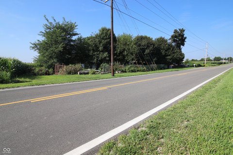
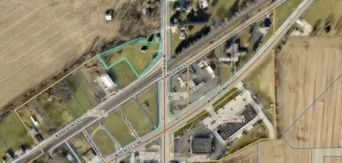
This exceptional 58-acre parcel presents a unique opportunity for developers seeking prime land in a rapidly growing area. Located in McCordsville, Indiana, with an address of W 500 N & N 700 W, Hancock County, zip code 46055 (latitude 39.856462, longitude -85.9348119), this property is zoned for both residential and commercial development. The land is ideally suited for residential or multifamily projects, with a 144-home Planned Unit Development (PUD) already approved. Utilities are conveniently located near the site, simplifying infrastructure development. All necessary due diligence materials are readily available, including a recent survey and a clean Phase I environmental report. This comprehensive package streamlines the development process, minimizing potential delays. The property's size allows for flexibility
Cap rate
Implied · in-place · derived from last sale + estimated NOIValue
AI, CAP & Alternative Use estimations · Realmo proprietary blendComparables
6 recent transactions · within 1.5 miComparable in this City


Similar Nearby for Sale


Similar Nearby for Lease


Property description
Physical attributes from public recordsZoning & alternative use
No recorded transactions found for this property.
Costs & Benchmarks
Operating expenses, capex projections, utility benchmarks, and submarket comparables — all in one view.
Risks
Flood, climate, environmental, title, and tenant-concentration risk — surfaced with mitigations and source citations.


