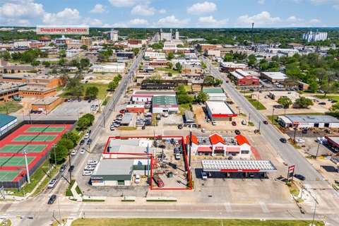
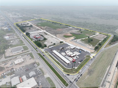
US 75, Sherman, TX 75090
LAND - Sherman, TX
- Added:
- Jun 10, 2026
- Days on Market:
- 2
- Last Refresh:
- Jun 11 at 11:06 am
Property Features for US 75
General Information
- Property type
- Land
- Property subtype
- Other
- Standard status
- Active
- APN
- 127649
- Lot size
- 53.40 Acres
Utilities
- Sewer type
- Public Sewer
- Water source
- Public
Listing agent Jordan Cortez License #0494942 (214) 556-1951
Listing office Vanguard Real Estsate Advisors Dallas, TX (214) 556-1951
Listing date Jun 10, 2026
Copyright © 2026 North Texas Real Estate Information Systems, Inc. All rights reserved. All information provided by the listing agent/broker is deemed reliable but is not guaranteed and should be independently verified.
HighLights
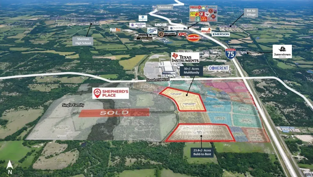
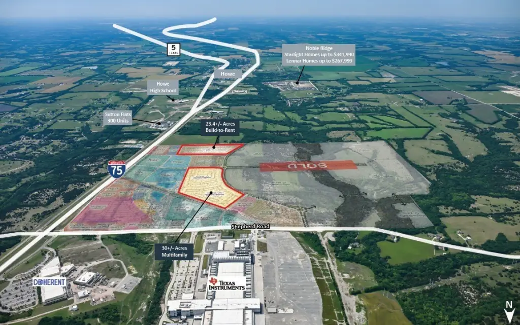
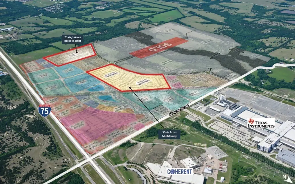
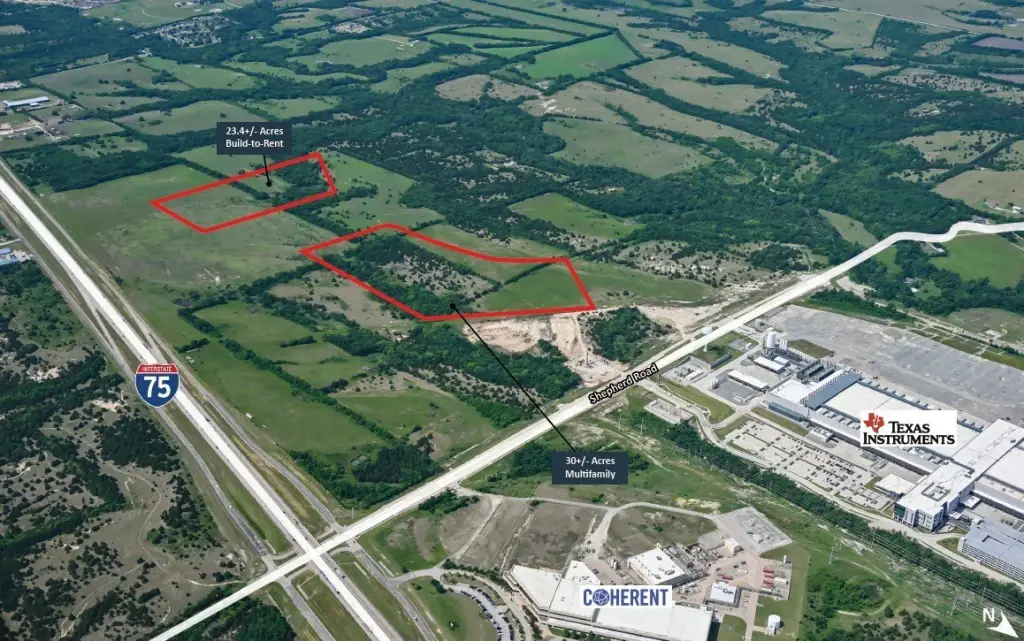
- 23.4‑acre build‑to‑rent site and 30‑acre multifamily site in Shepherd's Place master planned community
- Located at the southwest corner of US‑75 and Shepherd Road in Sherman, TX
- Sites are within the Shepherd's Place planned development zoning (531‑acre community)
- Planned community includes 60 acres of retail, 20 acres of office, 24 acres of townhomes, and 7 acres of hospitality
- Ownership would consider subdividing the 30‑acre multifamily site into two 15‑acre tracts
- All sites can be purchased individually; build‑to‑rent site can also be developed as multifamily
Overview
Shepherd’s Place is described as a 531-acre community located at the southwest corner of US-75 and Shepherd Road in Sherman, Texas. The master plan also contemplates 60 acres of retail, 20 acres of office, 941 single-family lots, 24 acres of townhomes, and 7 acres of hospitality, creating a broader mixed-use framework around these parcels.
For developers, these tracts offer flexibility to pursue either build-to-rent or multifamily product types under the same planned-development approval framework. The ability to purchase sites individually, along with the option to split the larger multifamily land into two smaller tracts, may help match different pro forma and entitlements strategies while keeping the development tied to the Shepherd’s Place master plan.
Current Use by Public Records
Map
- City
- Sherman
- County
- Grayson
- State
- Texas
- Longitude
- -96.6074592
- Latitude
- 33.550182