STACKHOUSE POINT, Edwards, MO 65326
LAND - Edwards, MO
- Added:
- Jun 10, 2026
- Days on Market:
- 2
- Last Refresh:
- Jun 11 at 11:06 am
Property Features for STACKHOUSE POINT
General Information
- Property type
- Land
- Property subtype
- Other
- Zoning
- RES
- Standard status
- Active
- APN
- 04-8.0-34.0-002.0-005-054.000
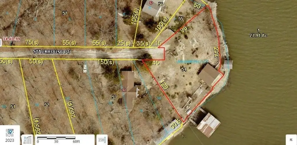
- Lot size
- 0.32 Acres
Taxes and HOA fees
- Tax Description
- UNNUMBERED LOT PINE COVE 8TH ADD AMD PLAT OF LOTS 8 & 9 & PT OF LOTS 7 & 10 BLK 3
- Tax Annual Amount
- 196
Utilities
- Water source
- Well
- Water front
- 1

Listing agent Chet Meierarend License #1999031195 (816) 365-3012
Listing office RE/MAX Premier Properties 17000 E 40 Highway Ste 1, Independence, MO (816) 416-7090
Listing date Jun 10, 2026
Copyright © 2026 Heartland Multiple Listing Service. All rights reserved. All information provided by the listing agent/broker is deemed reliable but is not guaranteed and should be independently verified.
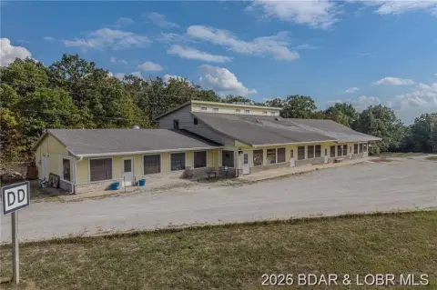
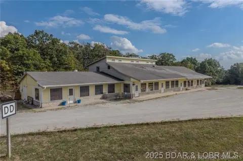
HighLights
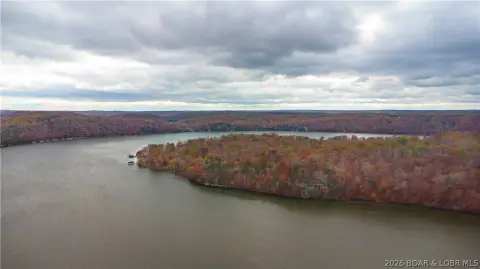
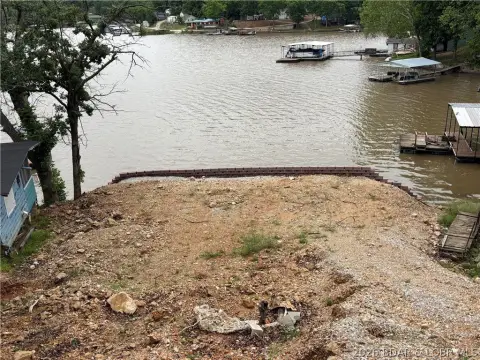
- Full lakefront point lot with panoramic views of the Lake of the Ozarks
- Expansive shoreline providing direct waterfront access
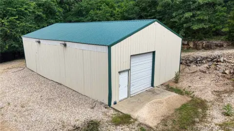
- Large dock for lake use
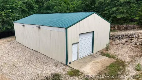
- Boathouse for convenient off‑season boat storage
- Martini deck perched above the water for entertaining and sunset viewing
- Water source: well
Overview
The site is located in Edwards, Missouri, in Camden County. The address is listed as Stackhouse Point, Edwards, MO 65326, and the property is offered under residential zoning (RES). With the point-lot configuration and extensive shoreline as highlighted in the remarks, the waterfront location is central to the property’s overall character.
For buyers looking to create a custom lake retreat, this parcel offers a straightforward path from land purchase to site planning, with key waterfront infrastructure already present. Tenants are not the focus of this offering, but the property may appeal to owner-builders and prospective second-home buyers who want a lakefront setting with a dock, boathouse storage, and an elevated deck as part of the starting point.
Current Use by Public Records
Map
- City
- Edwards
- County
- Benton
- State
- Missouri
- Longitude
- -93.01915322
- Latitude
- 38.19238031