Elevated Mountain Homesite with
NKA Blessing Hill Rd Post Falls, ID 83854
For Sale
$550,000
LAND - Post Falls, ID
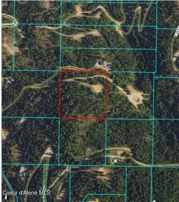
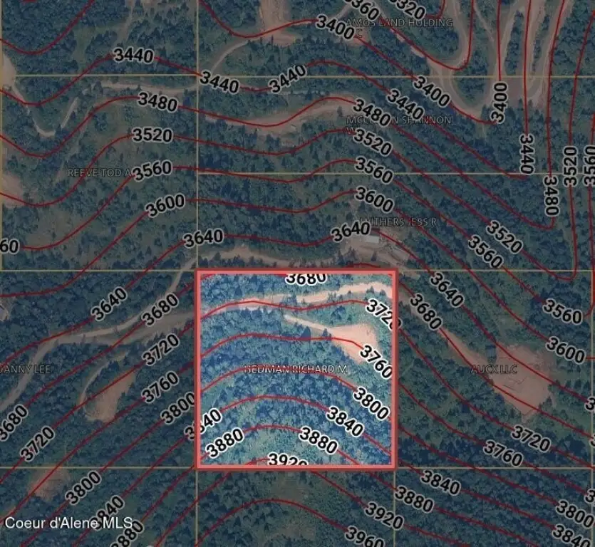
Lot Size10.00 Acres
Days on Market90
Property Features for NKA Blessing Hill Rd
General Information
- Property type
- Land
- Property subtype
- Other
- Zoning
- County- RUR-RES
- Parking features
- Open
- Exterior features
- Timber - Part
- Standard status
- Active
- APN
- 0272900B005A
- Lot size
- 10.00 Acres
Taxes and HOA fees
- Tax Year
- 2025
- Tax Description
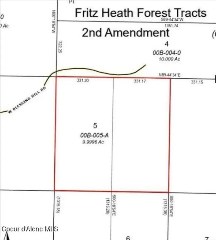
- Fritz Heath Forest Tracts 2nd Amendment, N2-Lts 5 & 6 Block B 2250N05w
- Tax Annual Amount
- 44
Listing Agency:
EXP Realty
(208) 890-7776
Listed By:
Richard Abbey · License #SP44408
(208) 755-0488
Added: Apr 27
Changed: Jul 24
Last Checked: Jul 25 at 6:06AM
MLS# 26-4051
Copyright © 2026 Coeur d'Alene Multiple Listing Service. All rights reserved. All information provided by the listing agent/broker is deemed reliable but is not guaranteed and should be independently verified.
Investment Insights
Based on property information with market context.
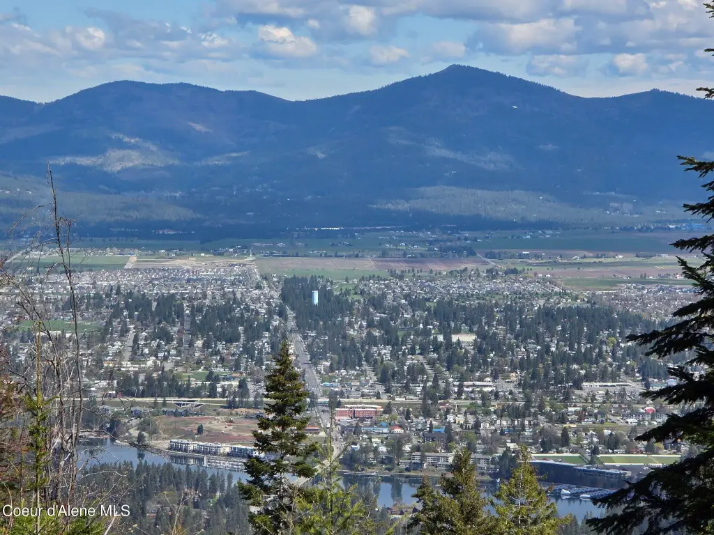
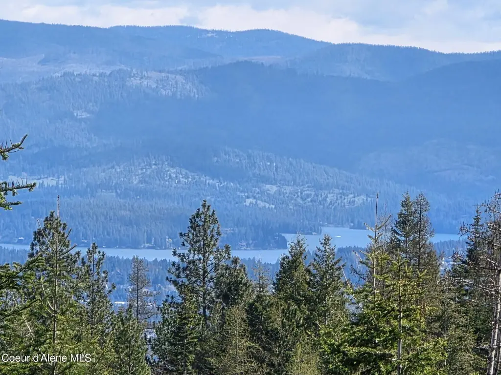
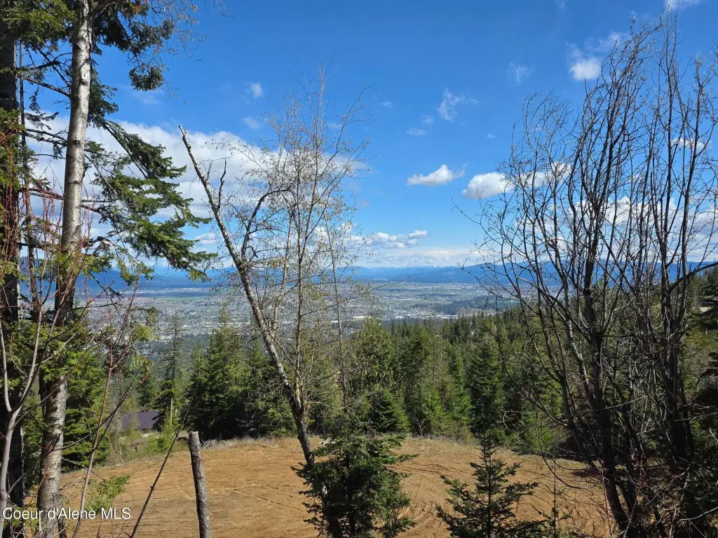
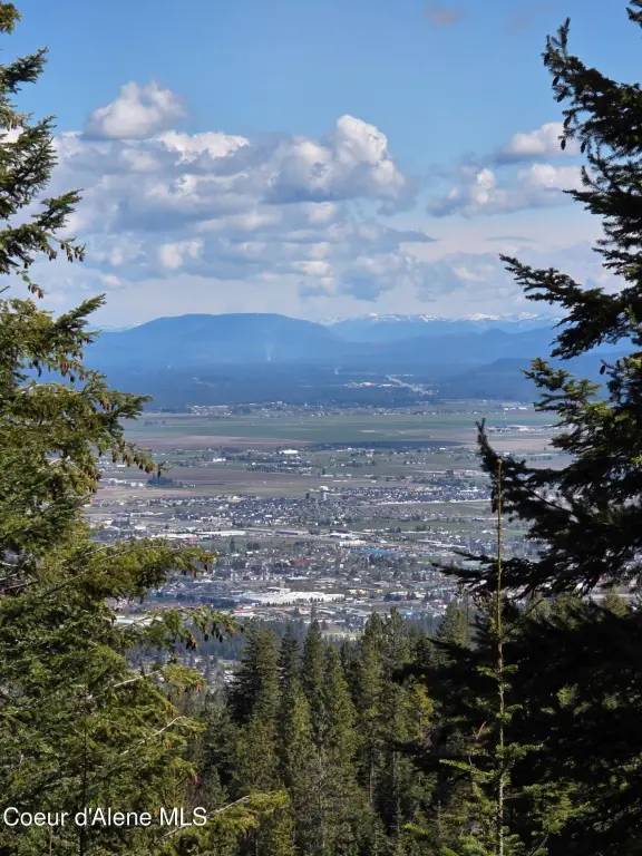
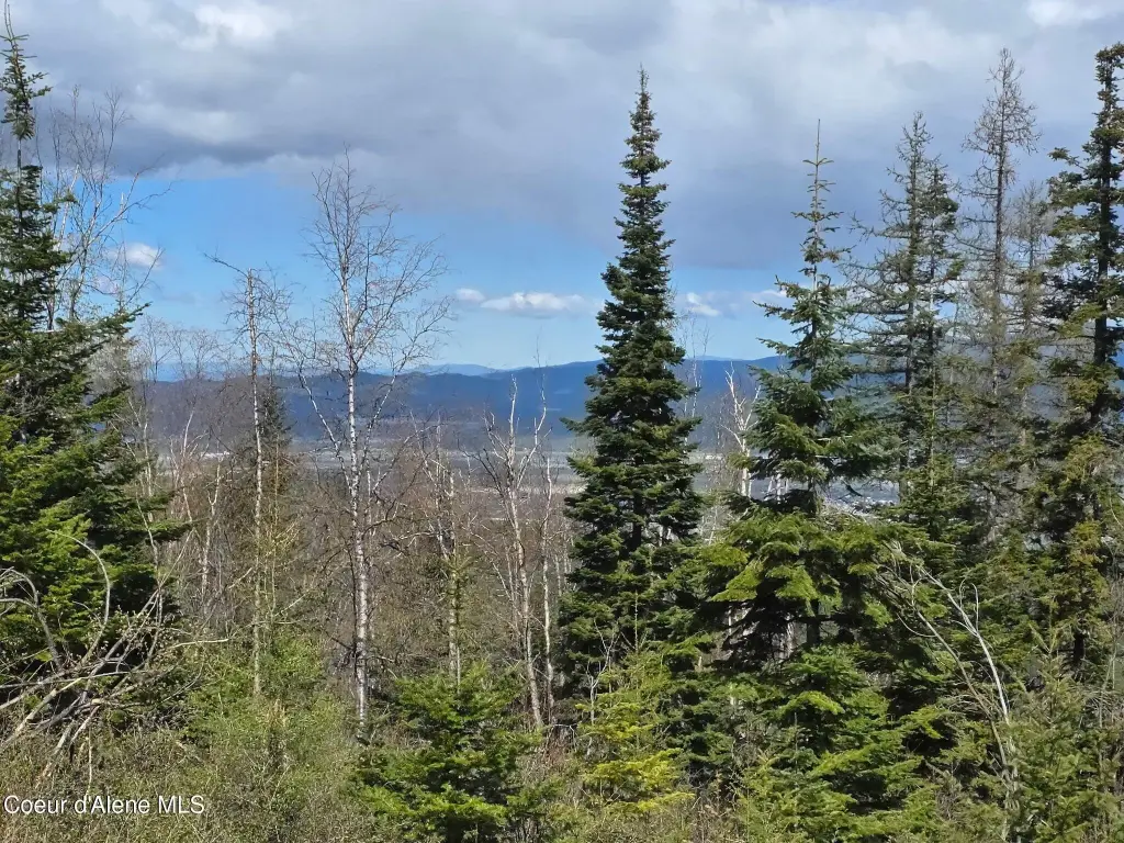
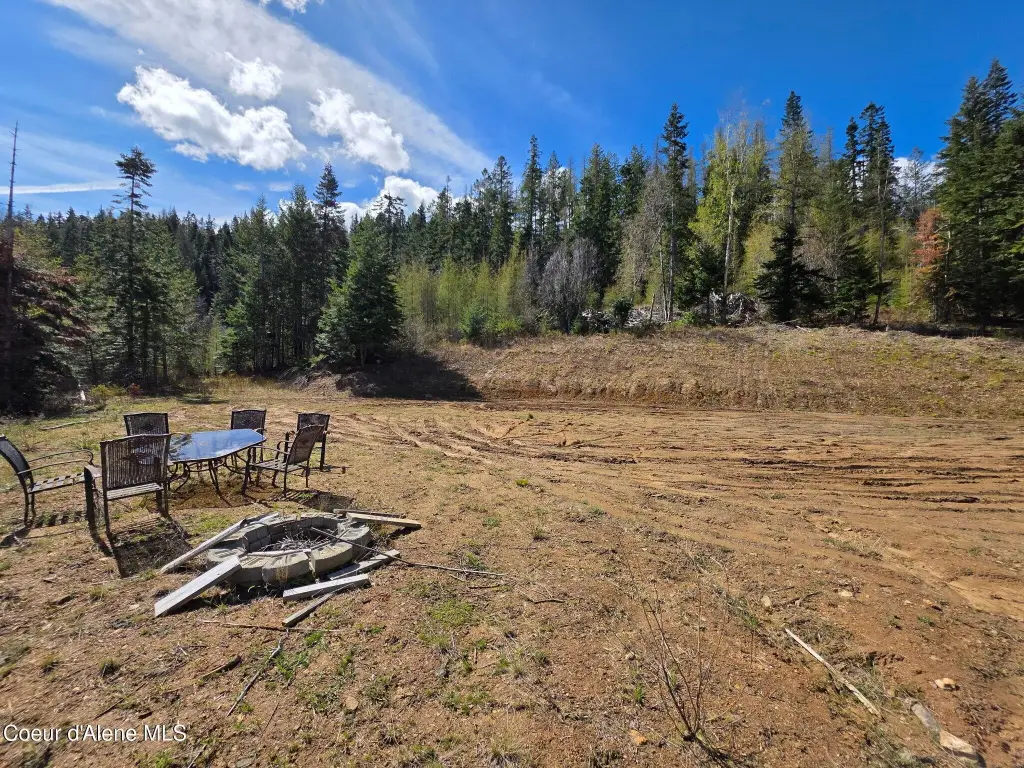
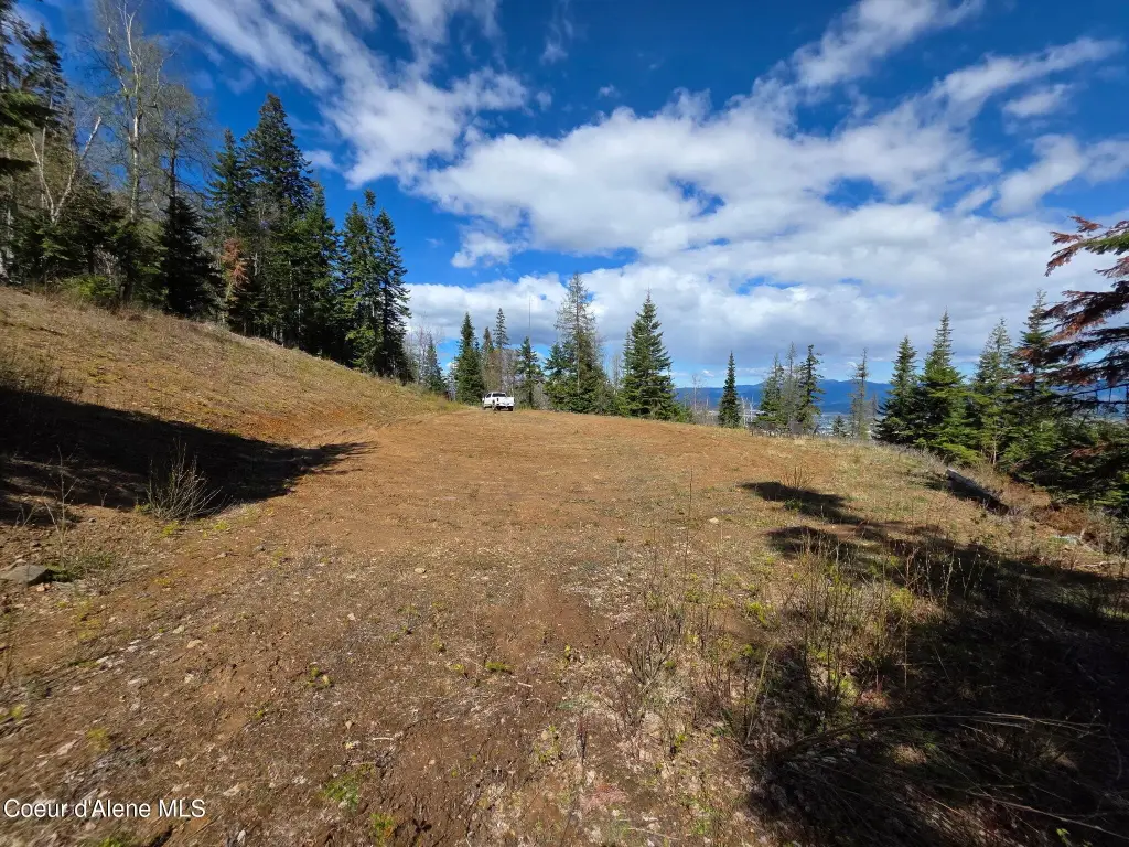
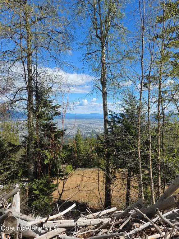
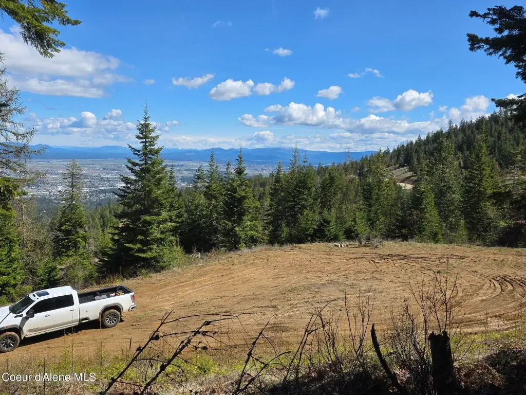
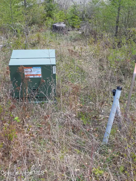
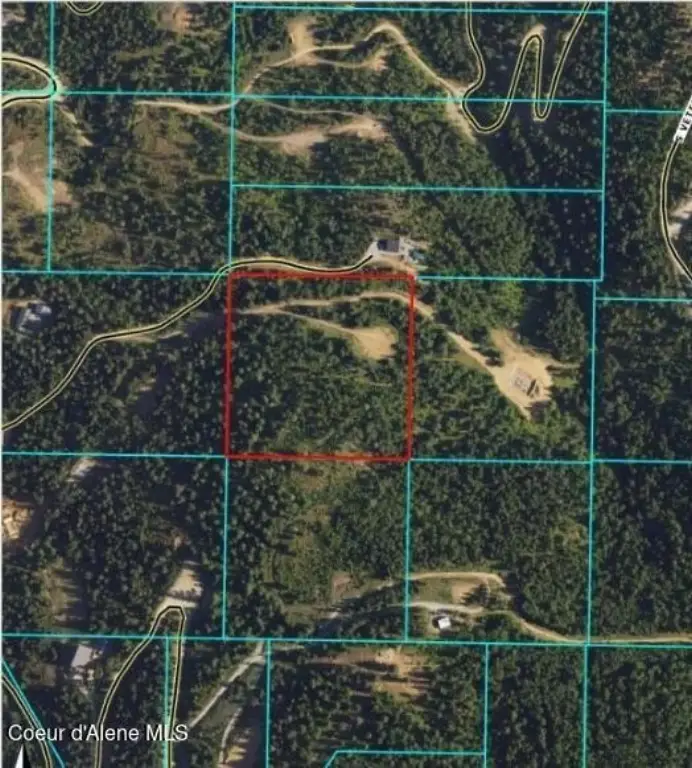
This is a 10-acre elevated homesite positioned for long sightlines and extended views. The property sits in a gated community setting and is described as private, forested, and quiet. Power is located at the property line with a junction box in place, supporting a build-ready starting point. The parcel is governed by rural residential zoning with mild CCRs, and it comes with a road maintenance agreement, including plans for a paved road.
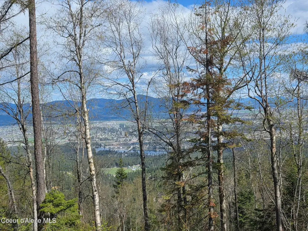
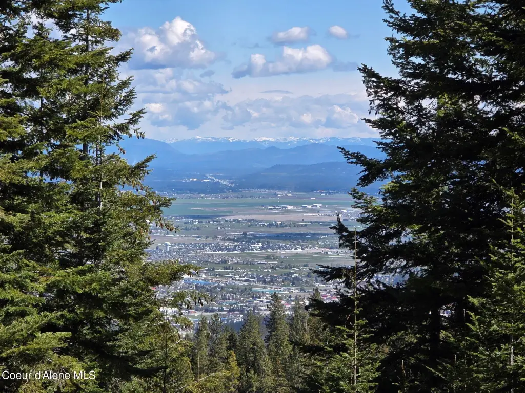
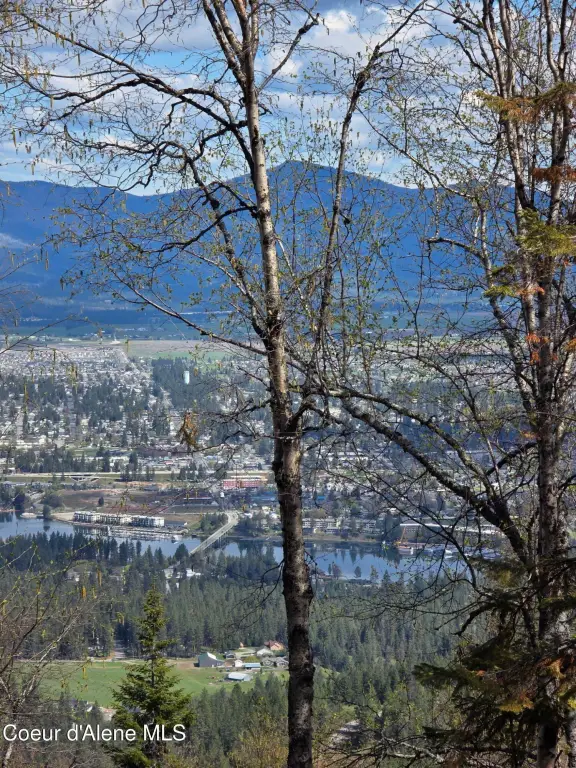
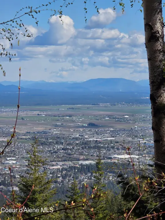
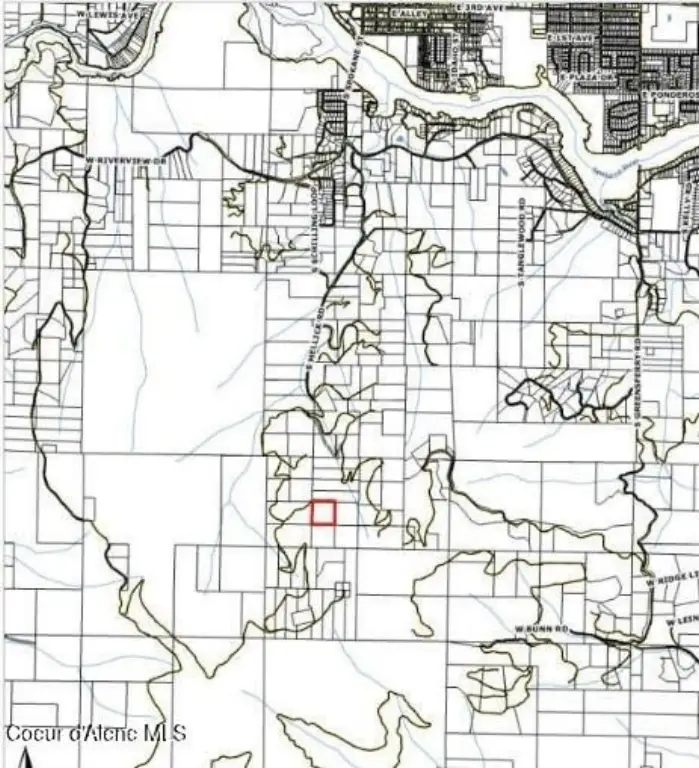
The listing notes views of Hauser Lake, Newman Lake, and the Spokane River, along with valley and mountain panoramas. The combination of high elevation and open sightlines is a key part of the property’s appeal, including sunset views referenced in the remarks. The address is listed as NKA Blessing Hill Rd, Post Falls, ID 83854, in Kootenai County.
For buyers looking to design a custom home, this parcel offers flexibility for placement and layout while keeping the core infrastructure step of bringing power to the site already handled at the property line. Rural residential zoning and mild CCRs provide a framework for home use while preserving the private, low-density character described in the listing.
Key Highlights
- 10‑acre elevated homesite with sweeping valley and mountain views, including Hauser Lake, Newman Lake, and the Spokane River.
- Build‑ready parcel with power at the property line and a junction box in place.
- Part of a gated community and described as private, forested, and quiet.
Property Analytics
Property Profile
Location Intelligence
Current Use by Public Records
Residential land & home ...


FAQs
What type of property is this?
Residential land & home lot - Build-ready elevated rural homesite with power at the line and sweeping valley, lake, and mountain views.
Where is this residential land & home lot located?
The property is located at NKA Blessing Hill Rd Post Falls, ID.
What is the asking price?
The asking price for this property is $550,000.
What are key features of this property?
This property features: 10‑acre elevated homesite with sweeping valley and mountain views, including Hauser Lake, Newman Lake, and the Spokane River.; Build‑ready parcel with power at the property line and a junction box in place.; Part of a gated community and described as private, forested, and quiet.


