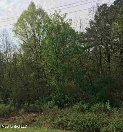
Highway-Front Land
Highway 80 Jackson, MS 39201
Highway 80, Jackson, MS, 39201
$292,560
For Sale
$292,560
LAND - Jackson, MS
Lot Size30.97 Acres
Days on Market245
Property Features for Highway 80
General Information
- Property type
- Land
- Property subtype
- Other
- Standard status
- Active
- APN
- 821-620-4
- Lot size
- 30.97 Acres
Taxes and HOA fees
- Tax Year
- 2024
- Tax Description
- Parcel 820-970: BEG INT S/L HWY 80 & E/L SEC 34 S 1149 FT TOSE COR SEC 34 W 1298.4 FT TO WIGGINS RD N ON E/S RD 373.5 FT E 714.7 FT N 1092.6 FT TO S/L HWY SE ON HWY 625.78 FT TO POB IN SE 1/4 SEC 34 T6N R1W Parcel 821-620-4: BEG APPROX 1367 FT NWLY NW COR LOT 8 NELSON PLACE PT 1 SWLY 815.9 FT NWLY 165.7 FT NELY 943.12 FT SELY 300 FT TO POB IN SW 1/4 SEC 35 T6 R1W Parcel:821-620: W HIGHWAY 80 THAT PT SW 1/4 S OF HWY 80 SEC 35 T6 R1W LESS TO INDIVIDUALS
- Tax Annual Amount
- 231
Listing agency
Ann Prewitt and Associates
(601) 898-0663
Listed by
Ann Prewitt · License #B14377
(601) 668-6534
Added: Nov 18, 2025 Updated: Jul 10 at 8:45AM Checked: Jul 21 at 8:06AM
MLS# 4131915
Copyright © 2026 MLS United. All rights reserved. All information provided by the listing agent/broker is deemed reliable but is not guaranteed and should be independently verified.
Investment Insights
Based on property information with market context.
This offering consists of three parcels totaling a 30.97-acre land tract. The property has Highway 80 frontage and is identified for use under zoning C-80-RE, supporting single-family residential or agricultural/farm opportunities.
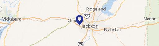
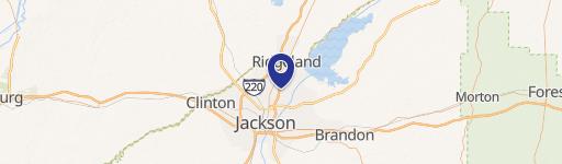
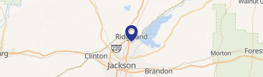
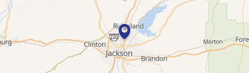
The land is located along Highway 80 in Jackson, Mississippi (Hinds County).
The land is located along Highway 80 in Jackson, Mississippi (Hinds County).
Key Highlights
- 30.97‑acre tract offers ample space and potential.
- Highway 80 frontage provides excellent accessibility and visibility.
- Zoned C‑80‑RE allows for Single‑Family Residential development.
Property Analytics
Property Profile
Location Intelligence
Current Use by Public Records
Residential land & home ...
Similar For Sale Nearby

FAQs
What type of property is this?
Residential land & home lot - Three-parcel tract with Highway 80 frontage, offering zoning for single-family residential or agricultural/farm uses.
Where is this residential land & home lot located?
The property is located at Highway 80 Jackson, MS.
What is the asking price?
The asking price for this property is $292,560.
What are key features of this property?
This property features: 30.97‑acre tract offers ample space and potential.; Highway 80 frontage provides excellent accessibility and visibility.; Zoned C‑80‑RE allows for Single‑Family Residential development.


