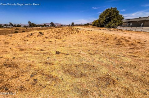
0 Highway 138 Highway, Hesperia, CA 92345
- Added:
- Jun 16, 2026
- Days on Market:
- 6
- Last Refresh:
- Jun 21 at 1:06 am
Property Features for 0 Highway 138 Highway
General Information
- Property type
- Land
- Property subtype
- Other
- Zoning
- RL
- Exterior features
- Community Features Included: Rural
- Standard status
- Active
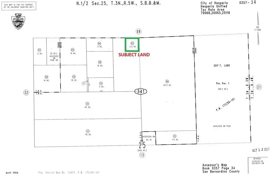
- APN
- 0357341050000
- Lot size
- 108,900.00 Acres
Building Details
- Architectural style
- Other

Listing agent Mohammad Alam License #01457818 (855) 225-2526
Listing office Alam Realty 12061 Jacaranda Ave #5, Apple Valley, CA (760) 247-6655
Listing date Jun 16, 2026
Copyright © 2026 California Regional Multiple Listing Service, Inc. All rights reserved. All information provided by the listing agent/broker is deemed reliable but is not guaranteed and should be independently verified.
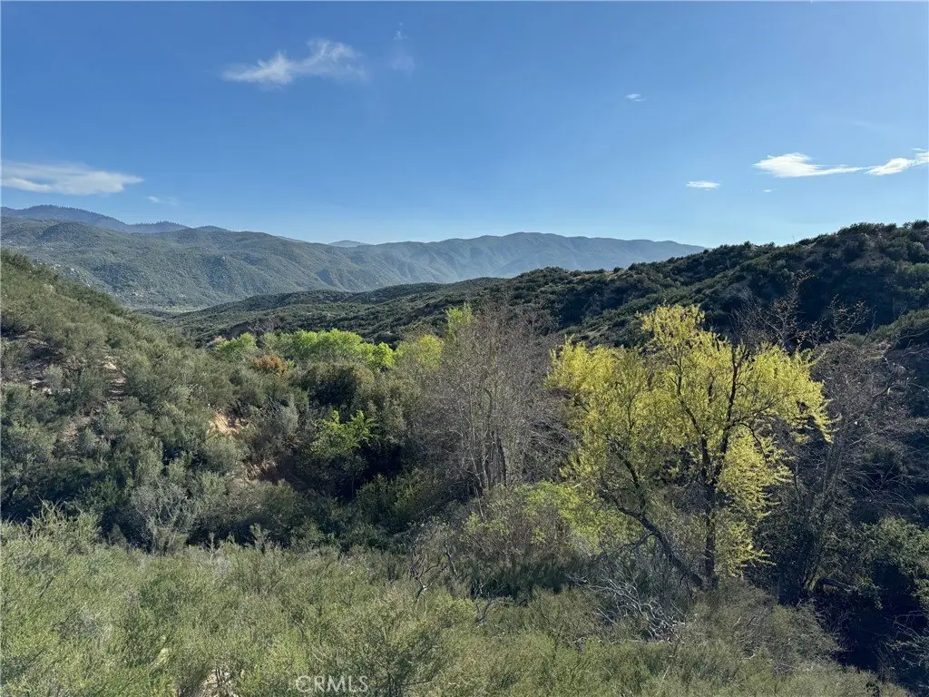
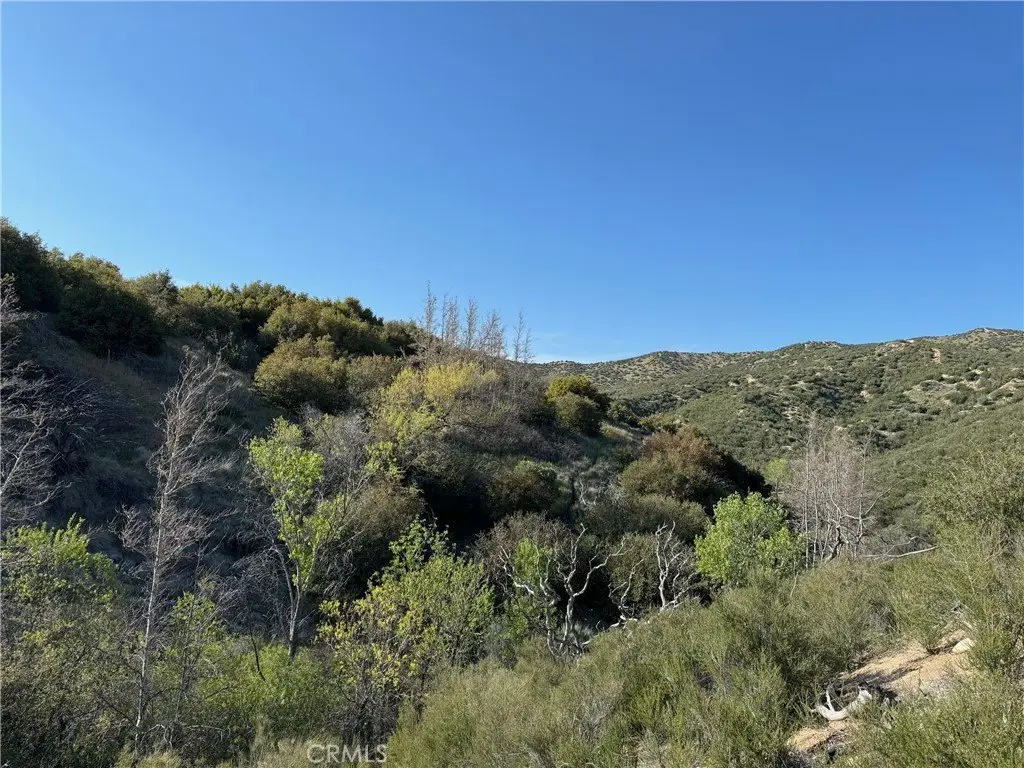
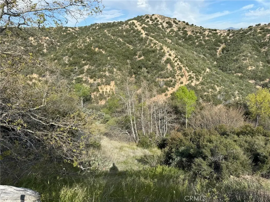
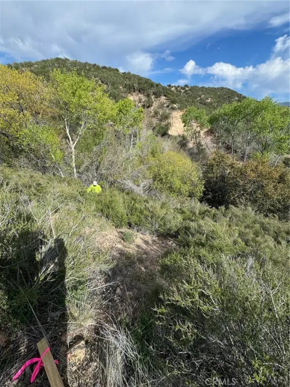
HighLights
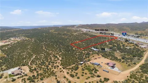
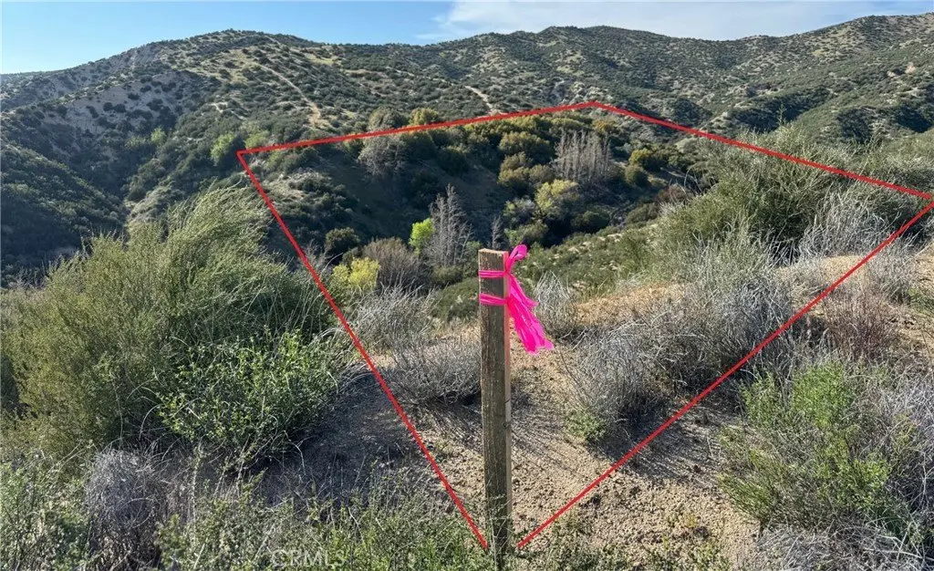
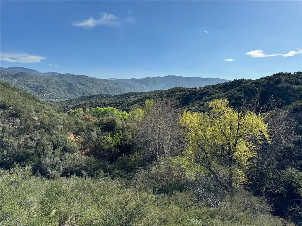
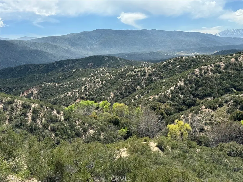
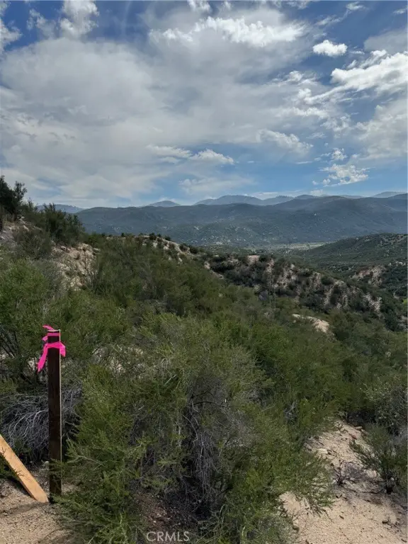
- 2.5‑acre rolling hills land in heavenly Oasis in the Summit Valley area of Hesperia
- About 1/2 mile west of Hwy‑138 (The Rim of World Scenic Hwy)
- Sits on the bottom of a canyon with level area
- Water creek runs through the land; includes larger native trees up to about 20 ft tall
- Off‑the‑grid property with no utility
- All 4 corners have been marked; originally part of a Rancho Las Flores project in 1990
Overview
The parcel is located in Hesperia, about a half mile west of Hwy 138, and is described as being in the “Oasis” area of the Summit Valley. The listing also references the property’s position along the southwesterly boundary of an ongoing Tapestry housing development.
With its canyon setting, creek feature, and off-grid status, this lot can fit buyers looking to build a mountain cabin or use the land for camping and personal recreation. The RL zoning designation supports residential lot planning, but prospective buyers should verify applicable development requirements and utility alternatives given the stated lack of utilities. The marked boundaries and mixture of terrain and level space can help inform feasibility for a site plan.
Current Use by Public Records
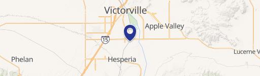
Map
- City
- Hesperia
- County
- San Bernardino
- State
- California
- Longitude
- -117.355316
- Latitude
- 34.324298