High-Visibility Mixed-Use Development
For Sale
$3,150,000
E Eads Parkway, Lawrenceburg, IN 47025
LAND - Lawrenceburg, IN
Lot Size9.26 Acres
Days on Market127
Property Features for E Eads Parkway
General Information
Property type
Land
Property subtype
Other
Property condition
Under Construction
Subdivision
Lawrenceburg
Standard status
Active
APN
15-07-11-200-017.000-016
Lot size
9.26 Acres
Building Details
Year built
2026
Listing Agency:
Premier Properties
(812) 537-9669
Listed By:
Kathy Patterson
(513) 967-8494
Added: Mar 27
Changed: Jun 3
Last Checked: Jul 31 at 1:06AM
MLS# 206991
Copyright © 2026 Southeastern Indiana Board of Realtors. All rights reserved. All information provided by the listing agent/broker is deemed reliable but is not guaranteed and should be independently verified.
Investment Insights
Based on property information with market context.
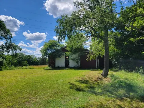
This 9.255-acre development site is positioned for mixed-use planning and is described as ready for development. The property includes access supported by all city utilities and is levy protected, giving developers flexibility for more than one type of improvement. A billboard owned by Rising Star Casino is also on the site, and the billboard is leased.
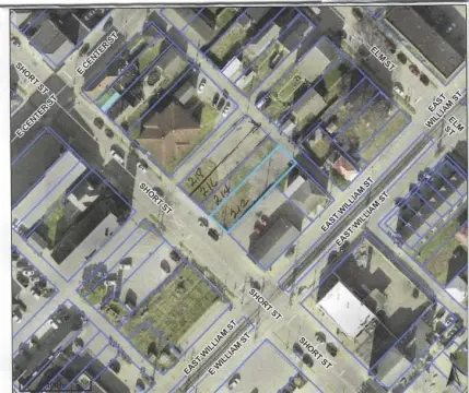
The location is highlighted for high visibility between the I275 interchange and Hollywood Casino in Greendale, Indiana. The property has road frontage on US 50, Urban Way, and Minger Drive, offering multiple points of ingress and exposure for a variety of uses.
Zoning is currently listed as unclear, and multiple zoning types may apply across different parts of the parcel. City documents indicate General Commercial, Highway Mixed Use, and Industrial Flex as potentially applicable categories, and more than one zoning type applies per the most recent county zoning map. Because of this, buyers are advised to take proposed development plans to the City of Greendale to determine whether they can comply with current zoning requirements. The site’s configuration and placement are well suited for developers evaluating restaurants, offices, and entertainment-oriented concepts.
Key Highlights
- 9.255‑acre mixed‑use development site with road frontage on US 50, Urban Way, and Minger Drive in Greendale, IN
- All city utilities available; levy protected
- High‑visibility location between the I‑275 interchange and Hollywood Casino in Greendale, IN
Property Analytics
Property Profile
Current Use
Lease Details
Yes
Highway access
Yes
Paved road access
Yes
Utilities to site
Location Intelligence
Trade Area within ½ mile
657
Businesses Nearby
Explore this area
Business Placement
Demographics for 47025, IN
23,118
Population
9,595
Households
2.4
Avg Household Size
42
Median Age
32%
College-Educated
93%
High-School Grad
52.3 sq mi
ZIP Area
442
Density / Sq Mi
$89,986
Median Household Income
$49,627
Median Earnings
$773
Median Rent
$231,000
Median Home Value
Market
Vacancy Rate% for Industrial in Midwest region

Questions? Ask Rey
Realmo’s AI knows this listing — price, zoning, demand, history. Ask anything.


Frequently Asked Questions
What type of property is this?
Commercial land - Prime tract with major frontage and city utilities, suited for mixed-use development pending zoning confirmation.
Where is this commercial land located?
The property is located at E Eads Parkway Lawrenceburg, IN.
What is the asking price?
The asking price for this property is $3,150,000.
What are key features of this property?
This property features: 9.255‑acre mixed‑use development site with road frontage on US 50, Urban Way, and Minger Drive in Greendale, IN; All city utilities available; levy protected; High‑visibility location between the I‑275 interchange and Hollywood Casino in Greendale, IN


