Wooded Commercial
For Sale
$2,490,000
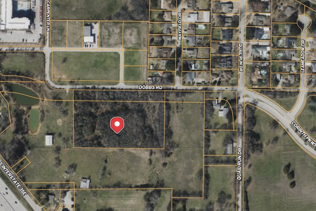
Dobbs Road, Corinth, TX 76208
Land, Corinth, TX
Property SizeContact for details
Lot Size4.18 Acres
Days on Market90
Property Features for Dobbs Road
General Information
Property type
Land
Property subtype
Other
Zoning description
MX-C / Mixed Use Commercial
Vegetation
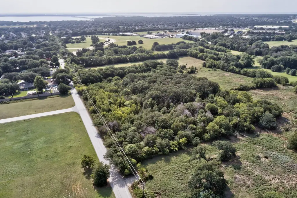
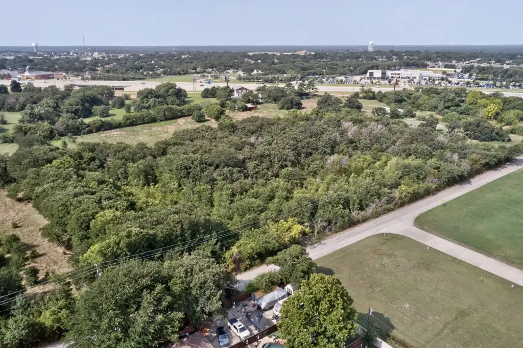
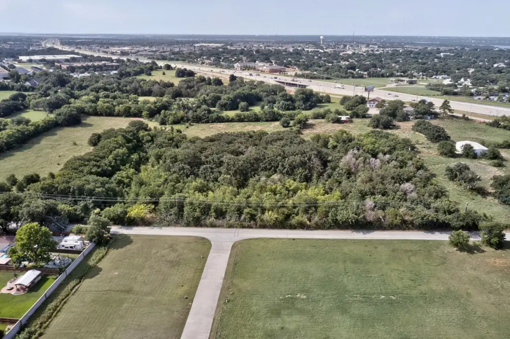
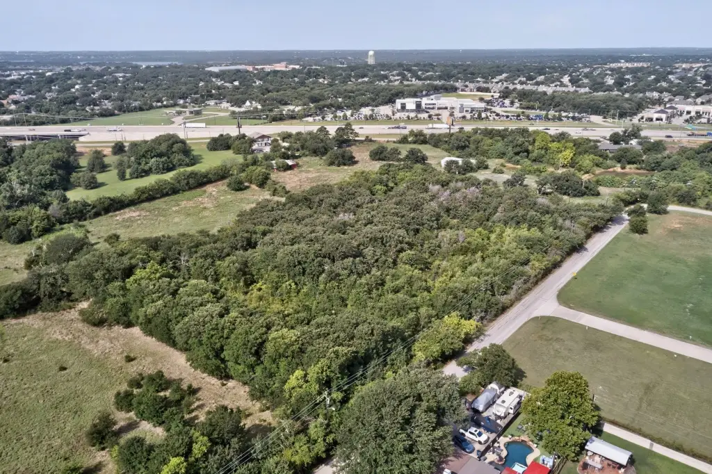
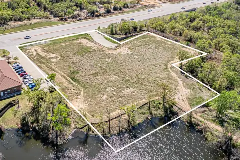
Wooded, Grassed
Subdivision
Ea Garrison
Lot features
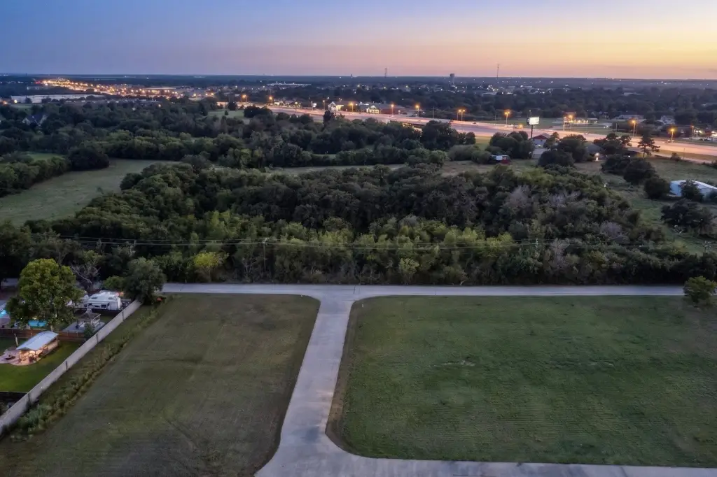
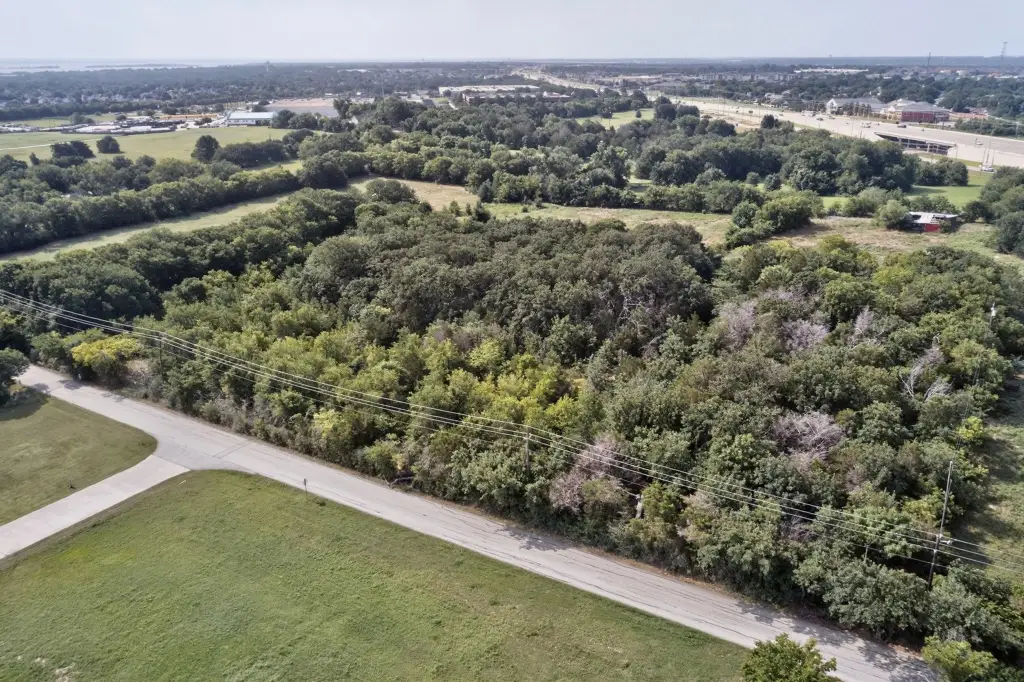
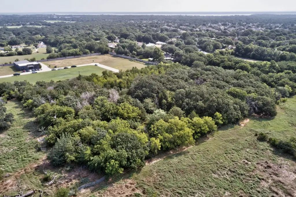
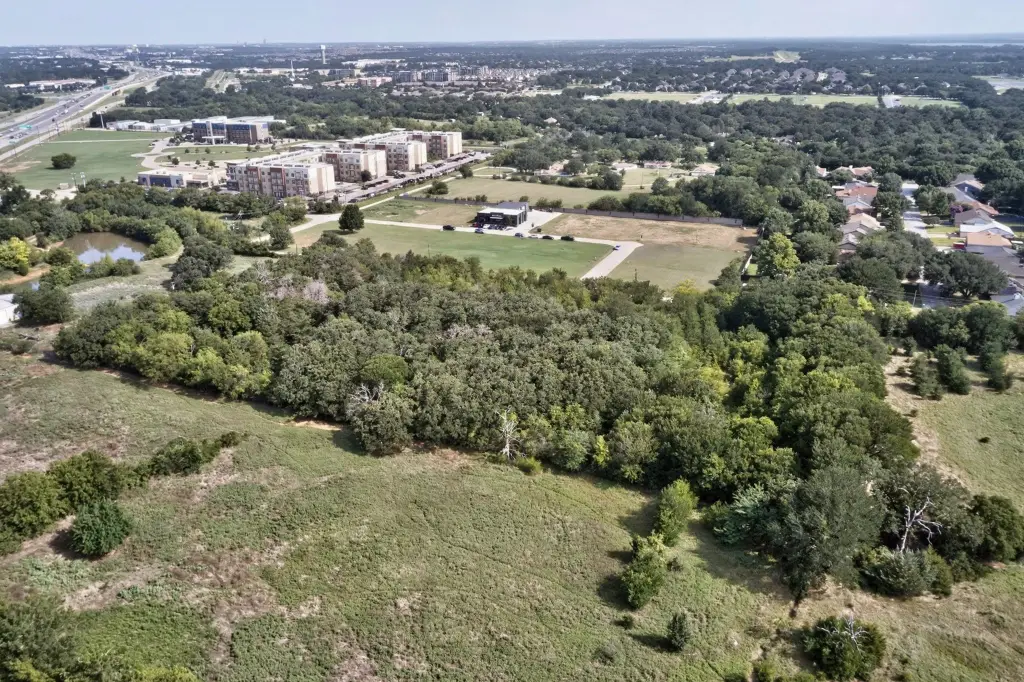
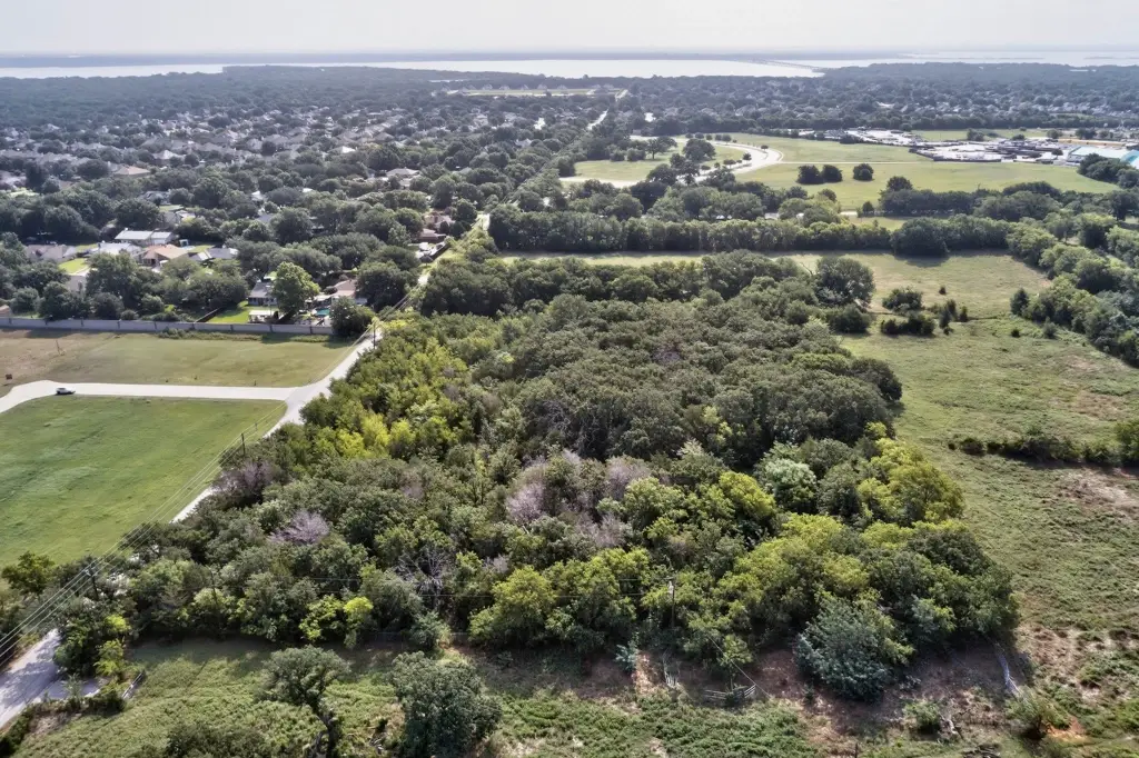
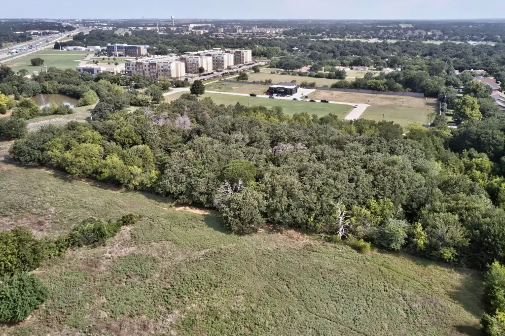
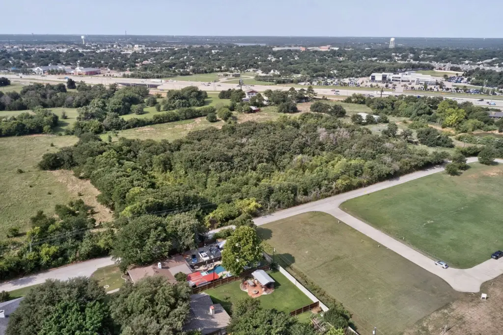
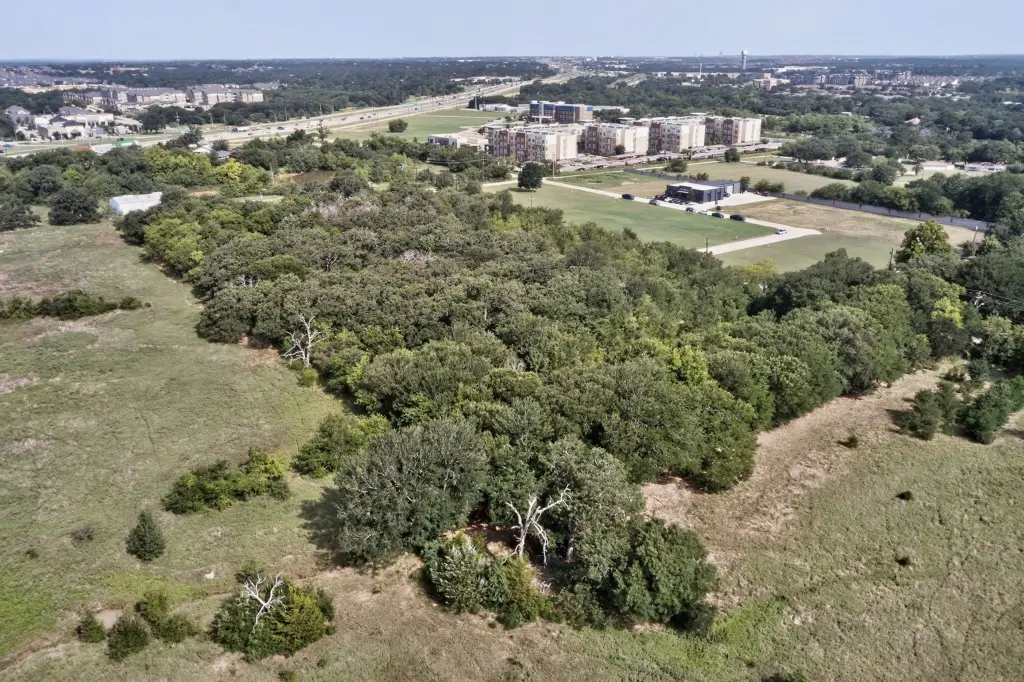
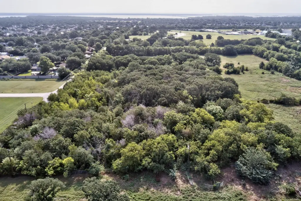
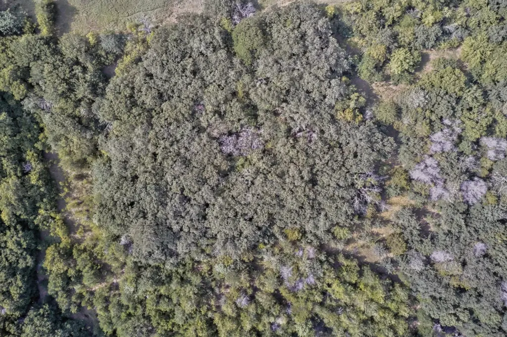
Acreage, Backs To Greenbelt Park, Interior Lot, Many Trees, City Lot
Elementary school
Shady Shores
Middle school
Lake Dallas
High school
Lake Dallas
Elementary school district
Lake Dallas ISD
Middle school district
Lake Dallas ISD
High school district
Lake Dallas ISD
Directions
Coming north on I-35E from Dallas- Lewisville Take I-35E North toward Denton. Take the Swisher Road - Lake Dallas -Corinth exit area. Stay on or get to the northbound frontage road. Turn right-east toward Dobbs Road -Lake Sharon Drive area. 102 Dobbs Rd, Corinth, TX 76208
Standard status
Active
APN
R62088
Lot size
4.18 Acres
Taxes and HOA fees
Tax Description
A0511A E.A. GARRISON, TR 3(PT), 4.1790 ACRES,
Tax Annual Amount
9931
Legal Description
A0511A E.A. GARRISON, TR 3(PT), 4.1790 ACRES,
Utilities
Sewer type
Public Sewer
Water source
Public
Listing Agency:
Keller Williams Urban Dallas · Keller Williams Realty
(214) 234-8000
Listed By:
Matt Templeton · License #0680490
(469) 900-7409
Added: Jul 18
Changed: Oct 6
Last Checked: Oct 15 at 2:06AM
MLS# 21309374
Copyright © 2026 North Texas Real Estate Information Systems, Inc. All rights reserved. All information provided by the listing agent/broker is deemed reliable but is not guaranteed and should be independently verified.
Investment Insights
Based on property information with market context.
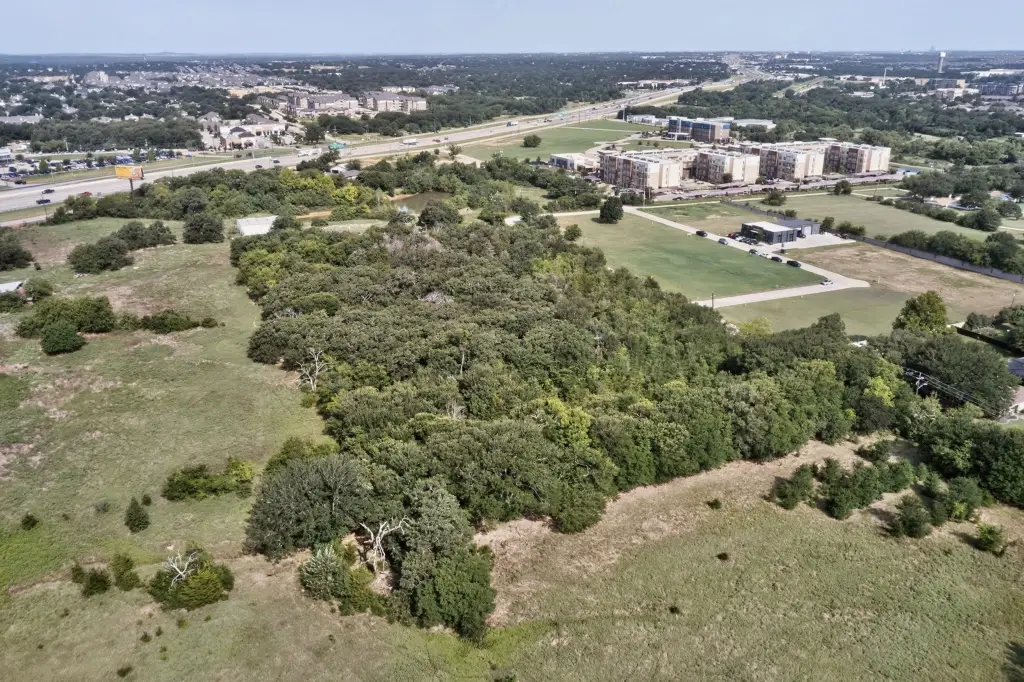
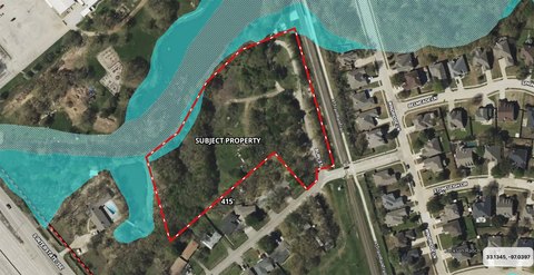
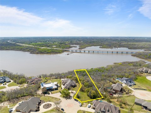
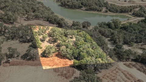
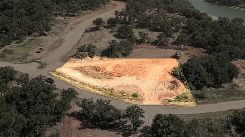
This 4.179-acre unimproved commercial land tract combines wooded areas, open ground, and adjacency to a greenbelt. The property is zoned MX-C and lies within Corinth city limits, with public water and public sewer available for future development planning.
Located on Dobbs Road in Corinth, the parcel is near I-35E, Lake Dallas, Shady Shores, and surrounding residential growth. Planned Lake Sharon and Dobbs Road realignment is intended to improve connections to Lake Sharon Drive and a proposed I-35E underpass. The site is positioned within the Lake Sharon and Dobbs Road corridor and offers a mix of commercial land characteristics and natural site features.
Located on Dobbs Road in Corinth, the parcel is near I-35E, Lake Dallas, Shady Shores, and surrounding residential growth. Planned Lake Sharon and Dobbs Road realignment is intended to improve connections to Lake Sharon Drive and a proposed I-35E underpass. The site is positioned within the Lake Sharon and Dobbs Road corridor and offers a mix of commercial land characteristics and natural site features.
Key Highlights
- 4.179‑acre unimproved commercial land tract
- MX‑C zoning within Corinth city limits
- Public water and public sewer available
Property Analytics
Unlock full access to Insights
Subscribe to Realmo Intelligence
Open Analytics
Current Use
Lease Details
Yes
Highway access
Yes
Utilities to site
Location Intelligence
Trade Area within ½ mile
98
Businesses Nearby
Explore this area
Business Placement
Demographics for 76208, TX
27,084
Population
9,440
Households
2.9
Avg Household Size
35
Median Age
35%
College-Educated
90%
High-School Grad
27.4 sq mi
ZIP Area
988
Density / Sq Mi
$90,833
Median Household Income
$46,843
Median Earnings
$1,591
Median Rent
$358,000
Median Home Value
Check the figures for this property
Cap Rate, Value Estimation, Potential NOI and more
View Realmo Analytics

Questions? Ask Rey
Realmo’s AI knows this listing — price, zoning, demand, history. Ask anything.




Frequently Asked Questions
What type of property is this?
Commercial land - Unimproved MX-C parcel with public water and sewer available within Corinth city limits.
Where is this commercial land located?
The property is located at Dobbs Road Corinth, TX.
What is the asking price?
The asking price for this property is $2,490,000.
What are key features of this property?
This property features: 4.179‑acre unimproved commercial land tract; MX‑C zoning within Corinth city limits; Public water and public sewer available