Irrigated Agricultural Land
County Road 119 lot 3 Westcliffe, CO 81252


For Sale
$650,000
LAND - Westcliffe, CO
Lot Size80.00 Acres
Days on Market141
Property Features for County Road 119 lot 3
General Information
Property type
Land
Property subtype
Other
Standard status
Active
Lot size
80.00 Acres
Taxes and HOA fees
Tax Year
2025
Tax Annual Amount
280
Listing Agency:
Exp Realty LLC
(888) 440-2724
Listed By:
Machelle Williams · License #FA.100095076
(303) 882-1191
Added: Mar 8
Changed: Jun 8
Last Checked: Jul 27 at 11:06AM
MLS# 2953430
Copyright © 2026 elevateMLS. All rights reserved. All information provided by the listing agent/broker is deemed reliable but is not guaranteed and should be independently verified.
Investment Insights
Based on property information with market context.
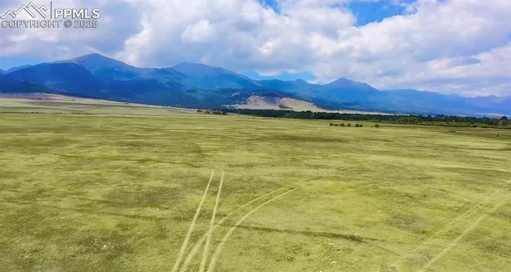
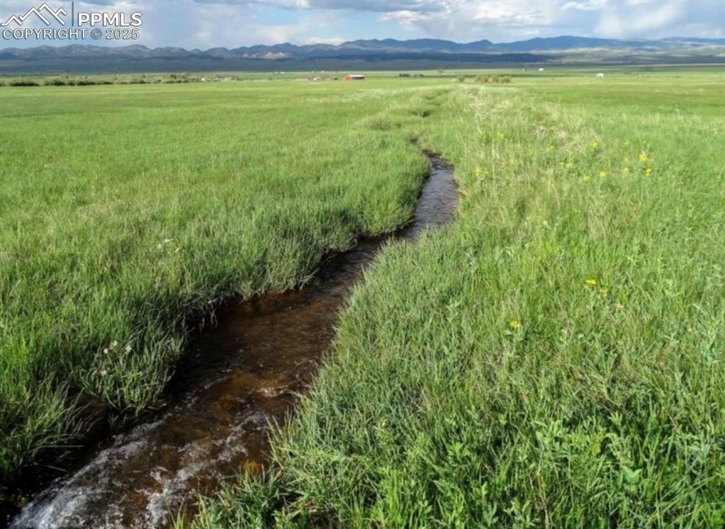
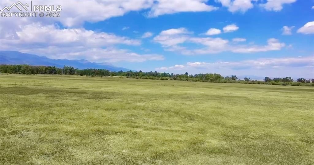
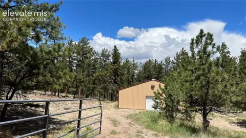
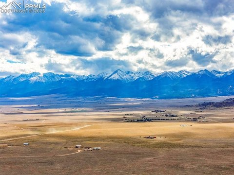
This 80-acre agricultural property is positioned on Westcliffe valley floor and is described as level and well-suited for productive use. The land includes valuable Miller Ditch water rights intended to support irrigation for hay production, grazing, or other agricultural pursuits. The property is already divided into two legal parcels, offering flexibility to use and potentially sell separately while maintaining the stated 80-acre minimum lot size protection associated with the valley. Agricultural status is noted in the remarks, and electricity is described as close by for future improvements.
The parcel is located in Custer County, Colorado, with access via County Road 119 lot 3, Westcliffe, CO 81252. The seller describes the property’s proximity to the base of the Sangre de Cristo Mountains and highlights the wide-open landscape and mountain views.
For tenants, buyers, or operators seeking rural acreage, this configuration supports a working ranch or hobby farm use where irrigation and arable ground matter. The two legal parcels may be helpful for planning a build site and farming operations, with the option to keep the layout flexible over time. Prospective users should verify all conditions of the water rights, parcel boundaries, and any development or agricultural requirements during due diligence.
Key Highlights
- 80‑acre parcel on the Westcliffe valley floor, just a short drive from the base of the Sangre de Cristo Mountains
- Includes valuable Miller Ditch water rights for irrigation to support hay production, grazing, or other agricultural uses
- Fertile soils and level terrain suitable for a working ranch, hobby farm, or other rural use
Property Analytics
Property Profile
Location Intelligence
Current Use


Frequently Asked Questions
What type of property is this?
Farm - 80-acre agricultural parcel with Miller Ditch water rights and level terrain suitable for hay, grazing, or a working farm setup.
Where is this farm located?
The property is located at County Road 119 lot 3 Westcliffe, CO.
What is the asking price?
The asking price for this property is $650,000.
What are key features of this property?
This property features: 80‑acre parcel on the Westcliffe valley floor, just a short drive from the base of the Sangre de Cristo Mountains; Includes valuable Miller Ditch water rights for irrigation to support hay production, grazing, or other agricultural uses; Fertile soils and level terrain suitable for a working ranch, hobby farm, or other rural use


