61545 Highway 205 Burns, OR 97720
- Commercial real estate
- 320.00 lot acres
Current Use by Public Records
- Commercial real estate
Property Details for 61545 Highway 205
- Lot size
- 320.00 lot acres
- Property type
- Commercial real estate
Description
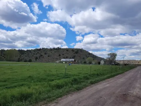
This exceptional 320-acre commercial property in Harney County, Oregon, presents a unique investment opportunity. Located near Burns at 61545 Hwy 205, zip code 97720 (latitude 43.4336896, longitude -119.0375199), this expansive land parcel offers significant potential. The property boasts a 6' well and a septic system installed in 1998, with existing power lines extending to a designated homesite. Adding to its value, the sale includes 160 acres of adjacent State of Oregon land, ideal for grazing, significantly increasing the overall acreage available. The property is fully fenced, providing security and control. This versatile land is suitable for a variety of commercial uses, including but not limited to agricultural ventures, or as a base for various business operations. The existing infrastructure, including the well, septic, and power, reduces initial development costs. With its size, location, and existing utilities, this property represents a compelling investment opportunity in Eastern Oregon. The asking price for this remarkable property is $265,000.
Value Estimations
-
AI approach
-
CAP approach
-
Comparable approach
-
Alternative Use
Get a detailed, property-specific valuation — fast and free
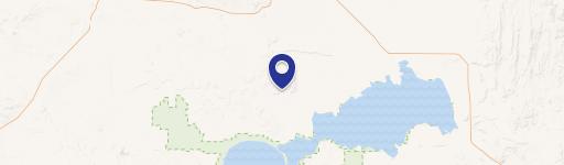
Location Insight
- Map
- Local Demand
- City
- Burns
- County
- Harney
- State
- Oregon
- Longitude
- -119.0375199
- Latitude
- 43.4336896