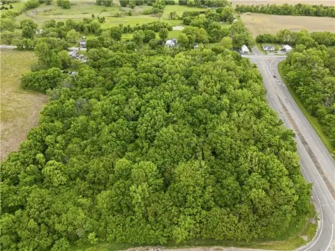
N Woodland Ave, Kansas City, MO 64155
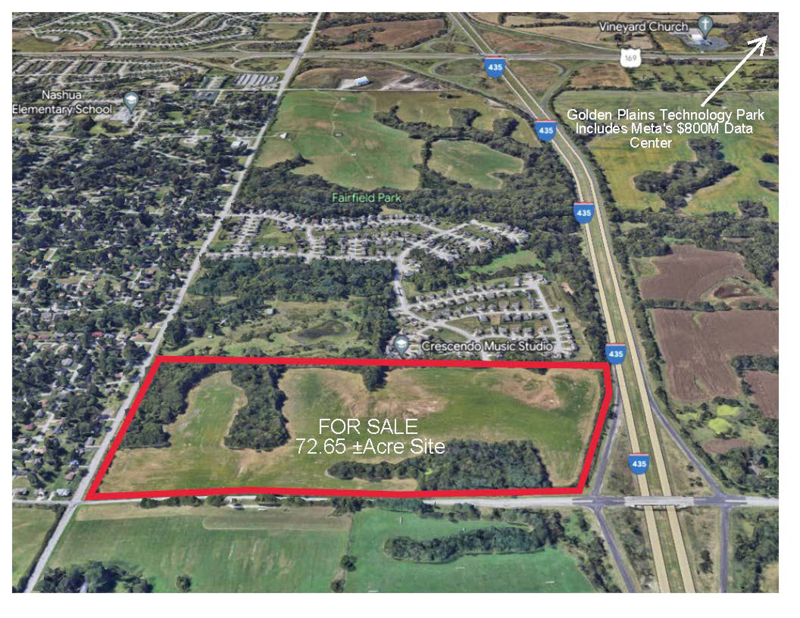
Mixed-use development site near I-435 and new airport.
- Added:
- Feb 22, 2024
- Days on Market:
- 856
- Last Refresh:
- May 12 at 8:22 pm
Property Features for N Woodland Ave
General Information
- Standard status
- Active
- Lot size
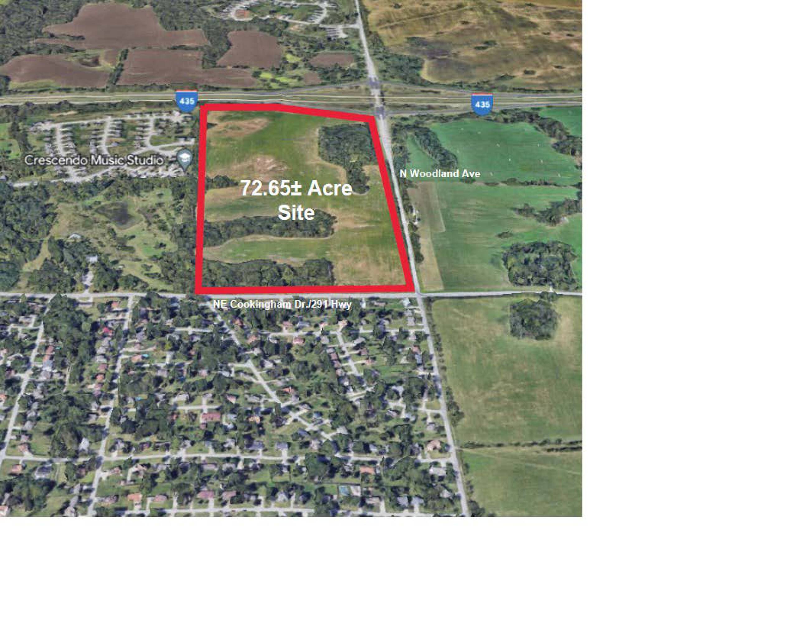
- 72.65 Acres
- Property subtype
- Land

Listing office Midwest Capital Realty Advisors, LLC (816) 769-5507
Listing date Feb 22, 2024
Source Crexi
Displayed information is deemed reliable but is not guaranteed and should be independently verified.
All listing content including descriptions, pricing, images are the copyrighted material of Midwest Capital Realty Advisors, LLC
HighLights
- 72.65 ± Acre Mixed Use Development Site at I‑435 & North Woodland Ave Interchange
- Zoning B2‑2, R‑0.5, R‑7.5 allows for diverse development options
- Located near Golden Plains Technology Park (Meta’s $800M Data Center)
- All utilities available near site
- Minutes from new Kansas City International Airport (1M sq ft, 40 gates)
- Proximity to Staley High School and Staley Farms Golf Course
Overview
Current Use by Public Records
Map
- City
- Kansas City
- County
- Platte
- State
- Missouri
- Longitude
- -94.559701
- Latitude
- 39.110724