8704 Parkland St Broomfield, CO 80020
Call to check price and availability
Prime Broomfield commercial land, mixed-use zoning.
Property Features for 8704 Parkland St
General Information
- Property type
- Land
- Lot Size
- 205,603 SF

Listing Agency: Fuller Real Estate Listing Agent: John Becker
Displayed information is deemed reliable but is not guaranteed and should be independently verified.
Overview
This exceptional 4.72-acre commercial land parcel is situated in the thriving Arista Development at the intersection of 116th and Wadsworth Pkwy in Broomfield, Colorado (APN 171703426002). Currently unsubdivided, this offering comprises two potential parcels: a 2-acre convenience store pad site and a 4.72-acre site ideal for a multi-tenant commercial development. The seller will level both sites, and subdivision will be the responsibility of the buyer. The property boasts three-quarter access, with water available partway down Parkland Street and sanitary sewer located at the southeast corner. Zoning is designated as Broomfield Mixed-Use Commercial, allowing for a variety of commercial uses, but excluding residential development. This location benefits from the significant recent growth in the Arista area, featuring numerous new apartments, condominiums, and commercial buildings. The asking price is $2,475,000, translating to $12 per square foot. This presents a unique opportunity to capitalize on the burgeoning Broomfield market. The property's address is 8704 Parkland St, Broomfield, CO 80020.
Property Profile
Insight Report
Location Intelligence
Current Use by Public Records
Commercial real estate
Location Insight
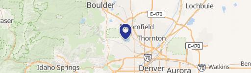
- Map
- Local Demand
- City
- Broomfield
- County
- Broomfield
- State
- Colorado
- Longitude
- -105.0674317
- Latitude
- 39.9389199
Nearby Similar for Sale






FAQs
What type of property is this?
Land - Prime Broomfield commercial land, mixed-use zoning.
Where is this land located?
The property is located at 8704 Parkland St Broomfield, CO.
What is the asking price?
The asking price for this property is $2,475,000.
What are key features of this property?
This property features: 4.72-acre commercial land parcel in Broomfield, CO's Arista Development at 116th & Wadsworth Pkwy (APN 171703426002).; Two potential parcels: a 2-acre convenience store pad site and a larger 4.72-acre multi-tenant site. Seller will level both sites; buyer responsible for subdivision.; Three-quarter access; water partially available on Parkland St; sewer at southeast corner.
