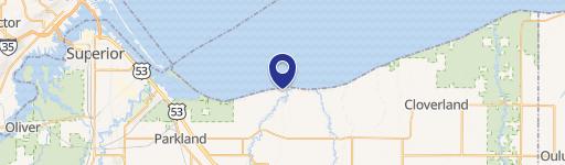
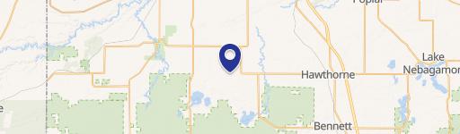
8303 Camp Amnicon Rd, South Range, WI 54874
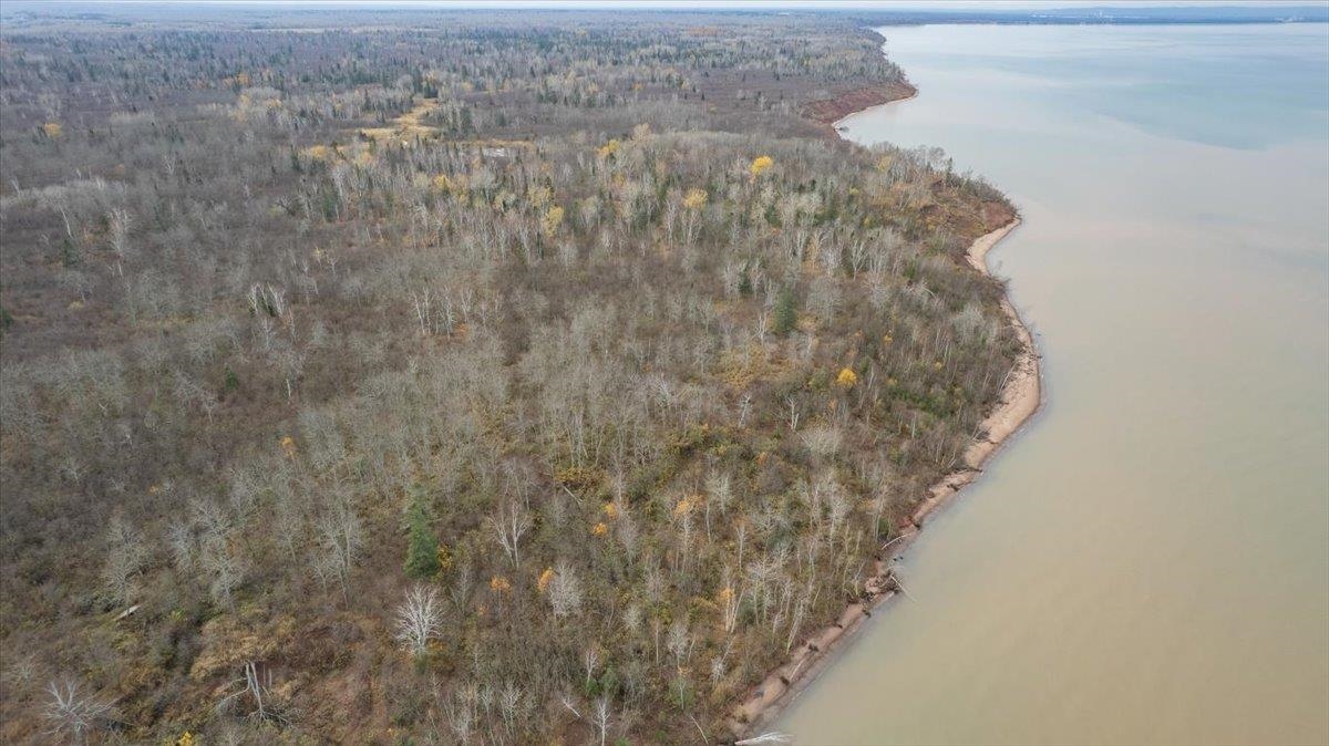
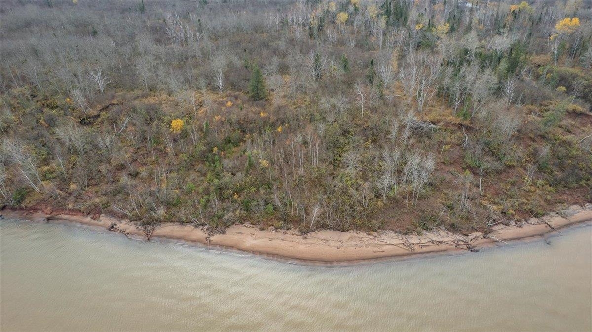
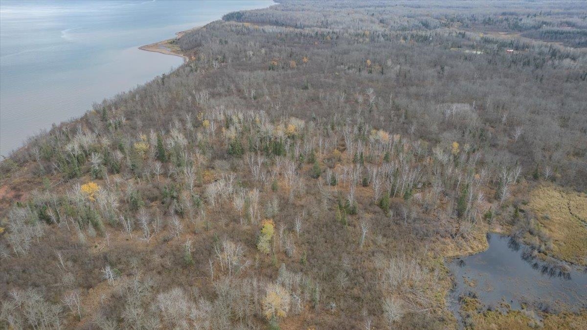
Forestry-zoned Lake Superior shoreline land with estimated frontage, sold as two parcels requiring a survey for division.
- Added:
- Nov 20, 2025
- Days on Market:
- 219
- Last Refresh:
- Jun 27 at 2:27 am
Property Features for 8303 Camp Amnicon Rd
General Information
- Standard status
- Active
- Lot size
- 11.00 Acres
- Property subtype
- Land
Listing office RE/MAX Results
Listing date Nov 20, 2025
Source Visionsfirstrealty
Displayed information is deemed reliable but is not guaranteed and should be independently verified.
All listing content including descriptions, pricing, images are the copyrighted material of RE/MAX Results
HighLights
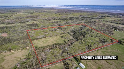
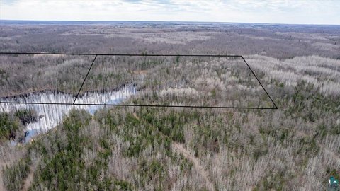
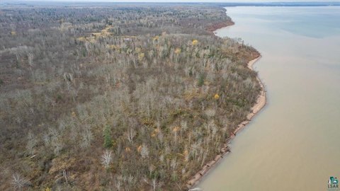
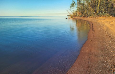
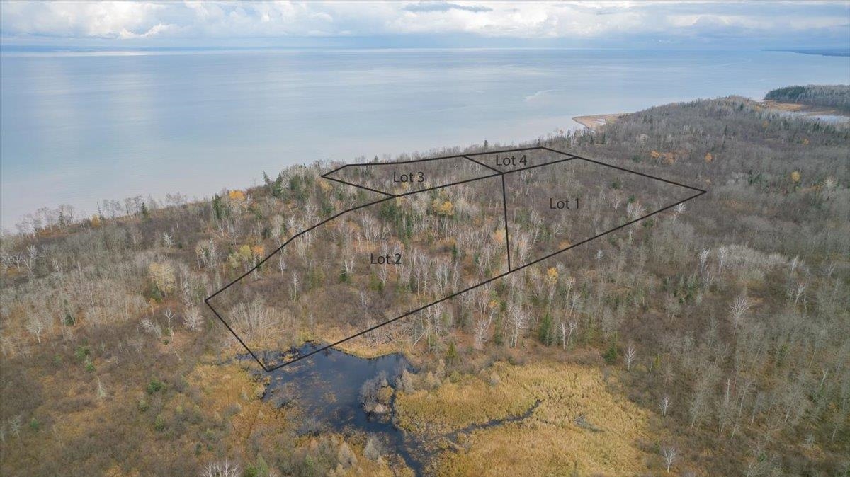
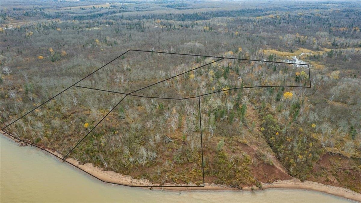
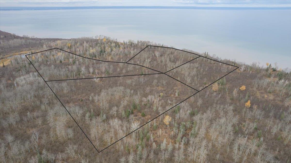
- 11‑acre Lake Superior waterfront parcel on the south shore in Douglas County (Lot 1 sold with Lot 2 together).
- Lot 1 includes two parcels: PID LA‑018‑00949‑00 (~2.5 acres with ~350' Lake Superior frontage) and PID LA‑018‑00932‑00 (to be divided at closing).
- No current vehicular access; buyer must obtain an easement or negotiate access in the contract.
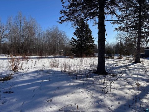
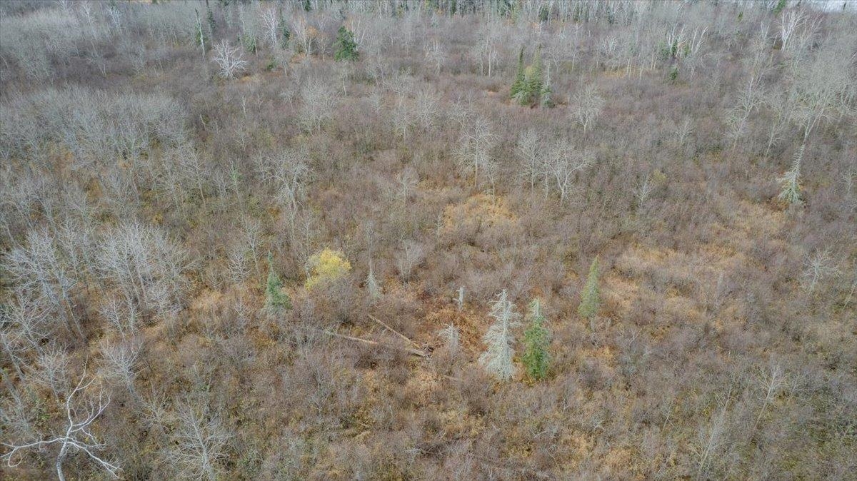
- Zoned Forestry F1; lot should allow acceptable setbacks to meet building code (acreage/frontage estimated).
- A survey is required to divide the property; hand‑drawn map is for illustrative purposes only.
- Both parcels are listed for sale together for $250,000; buyer may buy Lot 1 and Lot 2 together to avoid extra division expense.
Overview
There is currently no vehicular access to the land. The buyer will be responsible for obtaining an easement or negotiating access terms as part of the transaction. The property is described as Forestry F1 zoning, and it is expected to allow acceptable building code setbacks, subject to confirmation during the permitting process.
For buyers considering recreational uses, this is a waterfront parcel where access planning and a property survey will be key early steps. Because vehicular access is not currently established and the acreage/frontage are estimates pending survey, the best next move is to review the associated documents and contract terms regarding division and access. Information for Lot 2 is referenced in MLS# 6122984.
Current Use by Public Records
Location Insight
- Map
- Local Demand
- City
- South Range
- County
- Douglas
- State
- Wisconsin
- Longitude
- -91.87137
- Latitude
- 46.68614