Lake Superior Waterfront Land
8303 Camp Amnicon Rd lot 1 South Range, WI 54874

For Sale
$145,000
LAND - South Range, WI
Lot Size10.67 Acres
Days on Market160
Property Features for 8303 Camp Amnicon Rd lot 1
General Information
Property type
Land
Property subtype
Other
Standard status
Active
Lot size
10.67 Acres
Taxes and HOA fees
Tax Year
2025
Tax Annual Amount
250
Utilities
Water front features
Lake
Water front
1
Listing Agency:
RE/MAX Results
(952) 829-2900
Listed By:
Tom Acton · License #40200615|WI67860-94
(952) 829-2900
Added: Feb 17
Changed: Jun 10
Last Checked: Jul 27 at 2:06PM
MLS# 6122991
Copyright © 2026 Lake Superior Association of REALTORS®. All rights reserved. All information provided by the listing agent/broker is deemed reliable but is not guaranteed and should be independently verified.
Investment Insights
Based on property information with market context.
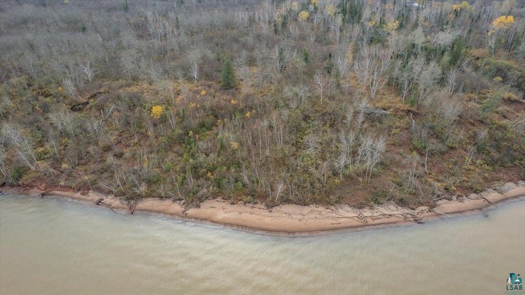
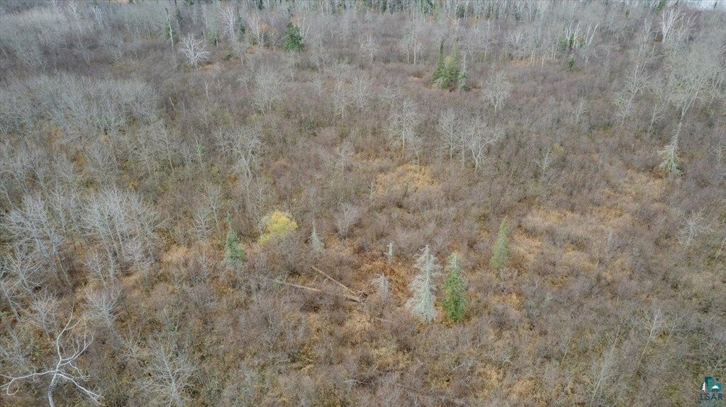
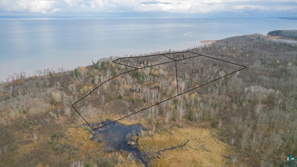
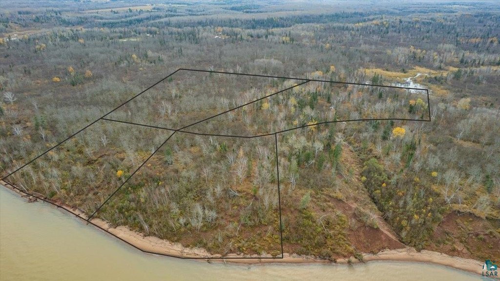
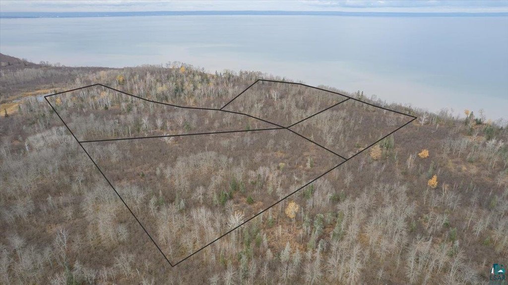
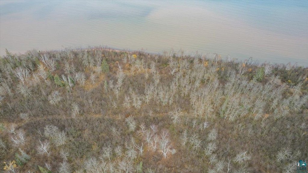
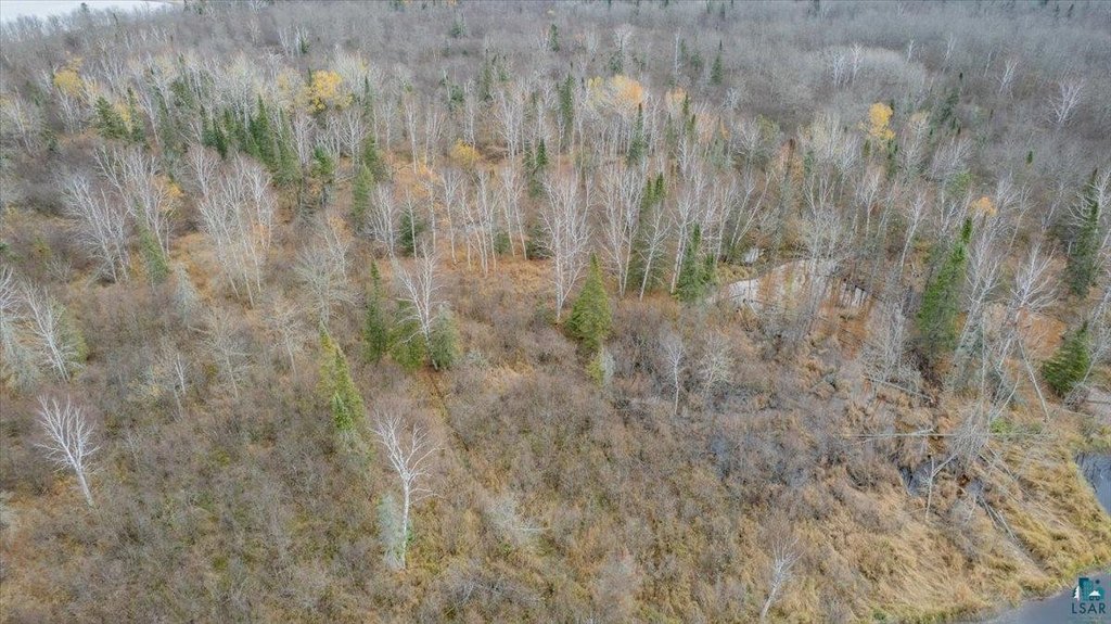
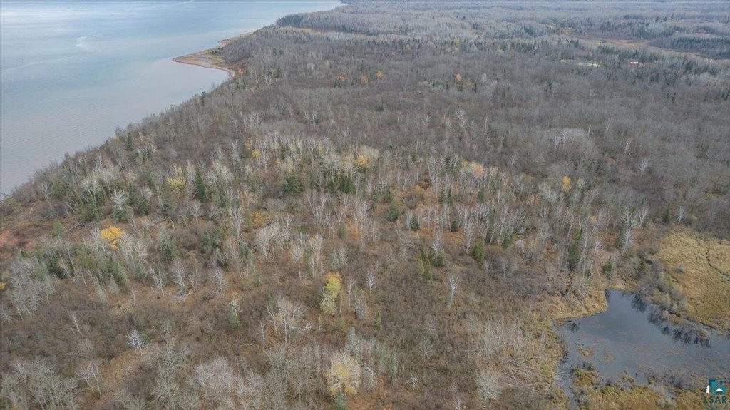
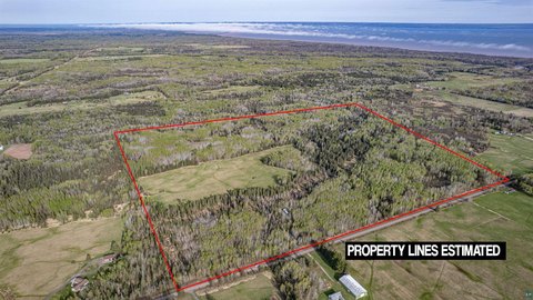
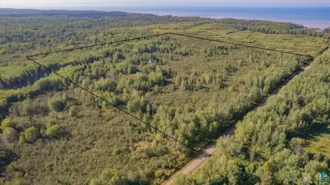
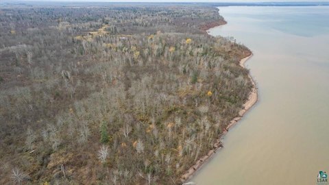
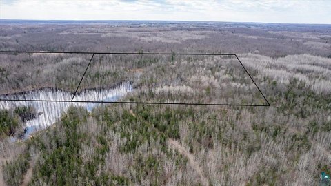
This offering is a Lake Superior waterfront land parcel in Douglas County, WI, presented as two parcels that are offered together. The primary parcel, PID LA-018-00949-00, is described as having approximately 350 feet of frontage on Lake Superior and about 2.5 acres. The second parcel, PID LA-018-00932-00, will be divided at closing and is described as containing approximately a total of 11 acres between the two lots, subject to final division and survey. Acreage and frontage figures are estimated using GIS measurements, and lot lines have not been determined at this time, with a survey required to divide the property.
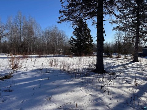
The parcel is located on the south shore in South Range. The listing notes that there is currently no vehicular access to the property, and the buyer will be responsible for obtaining an easement or negotiating it in a contract. The land is described as zoned Forestry F1.
For buyers seeking recreation-oriented waterfront property, this site provides Lake Superior shoreline as a core attribute. Because current vehicle access does not exist, prospective owners should be prepared to address the easement/access arrangement as part of their due diligence and transaction planning. The property should also allow for acceptable setbacks to meet building code, though final development options would depend on the completed survey and parcel division.
Key Highlights
- 11‑acre Lake Superior waterfront parcel on the south shore in Douglas County
- Lot 1 includes 2 parcels: PID LA‑018‑00949‑00 with ~350' of Lake Superior frontage and ~2.5 acres
- Second parcel, PID LA‑018‑00932‑00, will be divided at closing and will total approximately 11 acres between the 2 lots
Property Analytics
Property Profile
Location Intelligence
Current Use


Frequently Asked Questions
What type of property is this?
Waterfront Land - Forestry-zoned lakefront land with substantial Lake Superior frontage, offered as two parcels requiring easement-based access.
Where is this waterfront land located?
The property is located at 8303 Camp Amnicon Rd lot 1 South Range, WI.
What is the asking price?
The asking price for this property is $145,000.
What are key features of this property?
This property features: 11‑acre Lake Superior waterfront parcel on the south shore in Douglas County; Lot 1 includes 2 parcels: PID LA‑018‑00949‑00 with ~350' of Lake Superior frontage and ~2.5 acres; Second parcel, PID LA‑018‑00932‑00, will be divided at closing and will total approximately 11 acres between the 2 lots


