Waterfront Land with Aroostook River
773 Wrightville Road Ashland, ME 04732
For Sale
$244,900
Wooded waterfront parcel with extended river frontage and utilities access along Wrightville Road for a range of off-grid or commercial uses.
Lot Size86.00 Acres
Days on Market184
Property Features for 773 Wrightville Road
General Information
- Standard status
- Active
- Lot size
- 86.00 Acres
- Property subtype
- Land
Listing Agency:
Maine (207-794-6164)
(207) 290-0372
Listed By:
Phil McPhail
(207) 290-0372
Source:
Lifestylepropertiesofmaine
Added: Jan 22
Changed: Jul 10
Last Checked: Jul 23 at 7:23AM
Displayed information is deemed reliable but is not guaranteed and should be independently verified. All listing content including descriptions, pricing, images are the copyrighted material of Maine (207-794-6164)
Investment Insights
Based on property information with market context.
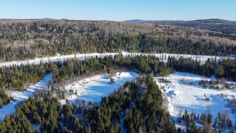
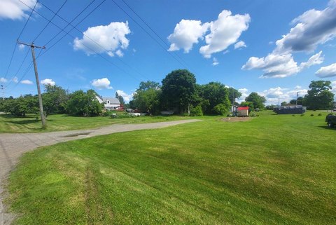
This wooded waterfront parcel totals 86± acres and includes approximately 1,400 feet of frontage on the Aroostook River. The property features gently rolling and sloping terrain with elevations reported at roughly 500 to 600 feet above sea level. NRCS soil mapping indicates a mix of Stetson gravelly loams along the river and Manarda-Burnham soils through the forested areas. The riverbank is described as high, offering protection from flood waters. Electric power is available along Wrightville Road, and cell phone service is available on-site. A sand and gravel quarry of about 1½ acres is also located on the land.
The parcel is in the Town of Ashland, situated just south of the point where the Aroostook River emerges from undeveloped forestland. While the setting is remote in character, the remarks note reasonable access to regional services and amenities. Presque Isle is approximately 28 miles away, Fort Kent is about 50 miles away, and Bangor is roughly 143 miles from the property.
The site supports multiple concepts where land, privacy, and water access are key, including a remote cabin retreat, homestead, lodge or guide service, commercial campground, or year-round residence. The combination of extended river frontage, a high riverbank, and existing utility availability along the road can help accommodate development plans that require both access and a natural setting.
Key Highlights
- 86± acre wooded parcel with approx. 1,400 ft of frontage on the Aroostook River in Ashland, Maine
- Gently rolling to sloping terrain with elevations around 500 to 600 ft above sea level
- NRCS reports Stetson gravelly loams along the river and Manarda‑Burnham soils in forested areas
Property Analytics
Property Profile
Location Intelligence
Current Use by Public Records
Waterfront Land


FAQs
What type of property is this?
Waterfront Land - Wooded waterfront parcel with extended river frontage and utilities access along Wrightville Road for a range of off-grid or commercial uses.
Where is this waterfront land located?
The property is located at 773 Wrightville Road Ashland, ME.
What is the asking price?
The asking price for this property is $244,900.
What are key features of this property?
This property features: 86± acre wooded parcel with approx. 1,400 ft of frontage on the Aroostook River in Ashland, Maine; Gently rolling to sloping terrain with elevations around 500 to 600 ft above sea level; NRCS reports Stetson gravelly loams along the river and Manarda‑Burnham soils in forested areas