Industrial Land with Extensive Road
4330 Mars Hill Road Bogart, GA 30622
For Sale
$1,300,000
LAND - Bogart, GA
Lot Size8.19 Acres
Days on Market68
Property Features for 4330 Mars Hill Road
General Information
Property type
Land
Property subtype
Other
Standard status
Active
APN
B 02 030
Lot size
8.19 Acres
Taxes and HOA fees
Tax Description
1784 606
Tax Annual Amount
3397
Utilities
Sewer type
Septic Tank
Water source
Public
Building Details
Building materials
Brick
Listing Agency:
NAI Elrod Group
(706) 553-1000
Listed By:
Brian Elrod · License #251606
(678) 859-6110
Added: May 22
Changed: Jul 6
Last Checked: Jul 28 at 2:06PM
MLS# CL357268
Copyright © 2026 Hive MLS. All rights reserved. All information provided by the listing agent/broker is deemed reliable but is not guaranteed and should be independently verified.
Investment Insights
Based on property information with market context.
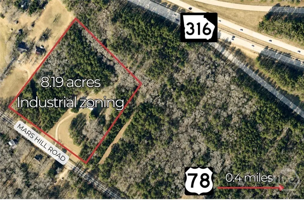
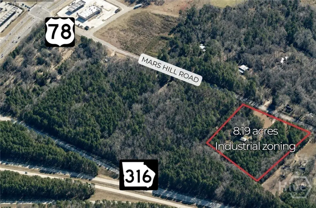
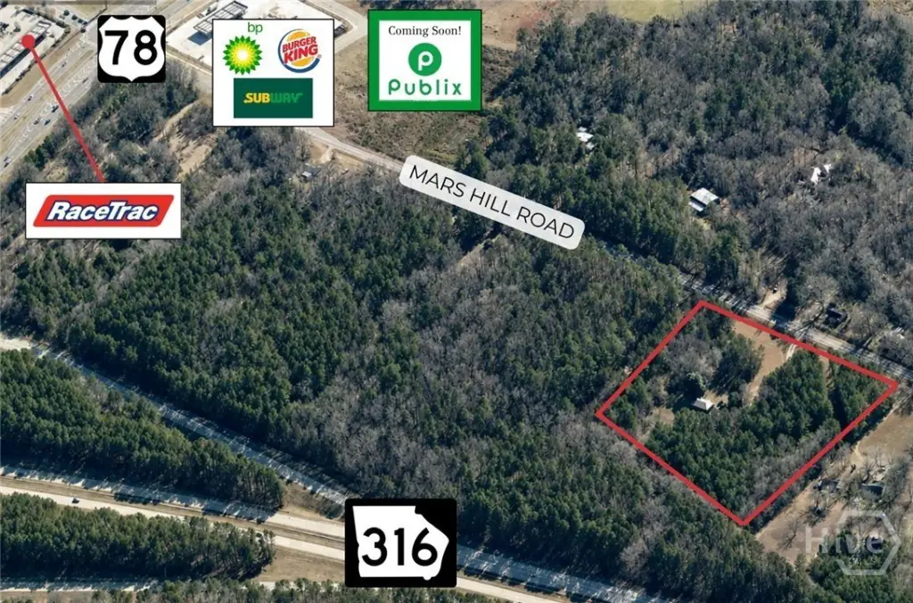
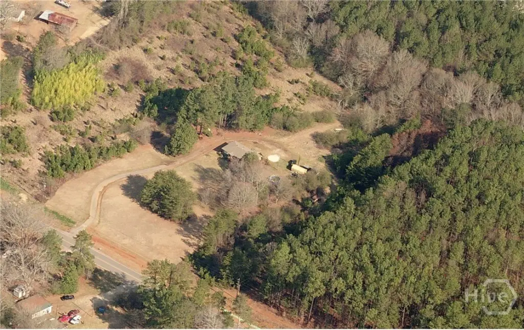
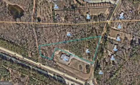
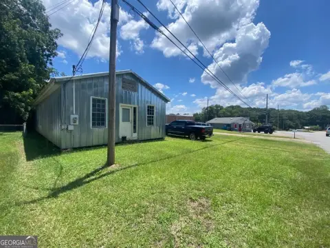
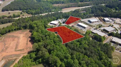
Industrially zoned land in Oconee County offers a largely level, open setting with more than 570 feet of road frontage. The property includes a 1,299 SF residential structure and has water available on site, with no recorded easements noted.
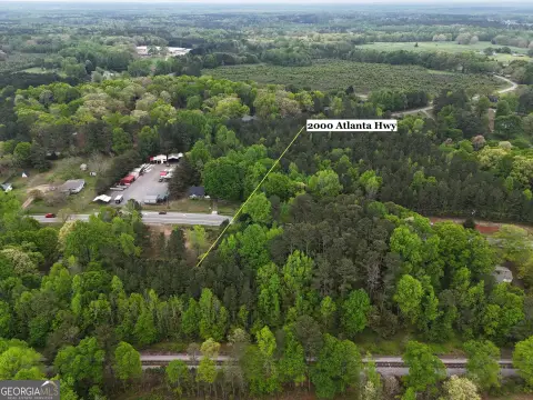
The parcel is located at 4330 Mars Hill Road, less than a mile from the GA 316/Hwy 78 interchange. Access to the interchange provides direct regional connectivity toward Athens, I-85, and metro Atlanta. Downtown Athens and UGA are approximately 12 miles north, and Atlanta is about 60 miles west.
With its acreage, highway proximity, and substantial frontage, the site is positioned for industrial, warehousing, or owner-user development.
Key Highlights
- 8.19‑acre industrially zoned parcel on Mars Hill Road in Oconee County
- Largely level and open land with over 570 feet of road frontage
- Less than 1 mile to the GA 316/Hwy 78 interchange
Property Analytics
Property Profile
Location Intelligence
Current Use


Frequently Asked Questions
What type of property is this?
Industrial land - Industrially zoned, largely level parcel with over 570 feet of road frontage and water available on site.
Where is this industrial land located?
The property is located at 4330 Mars Hill Road Bogart, GA.
What is the asking price?
The asking price for this property is $1,300,000.
What are key features of this property?
This property features: 8.19‑acre industrially zoned parcel on Mars Hill Road in Oconee County; Largely level and open land with over 570 feet of road frontage; Less than 1 mile to the GA 316/Hwy 78 interchange


