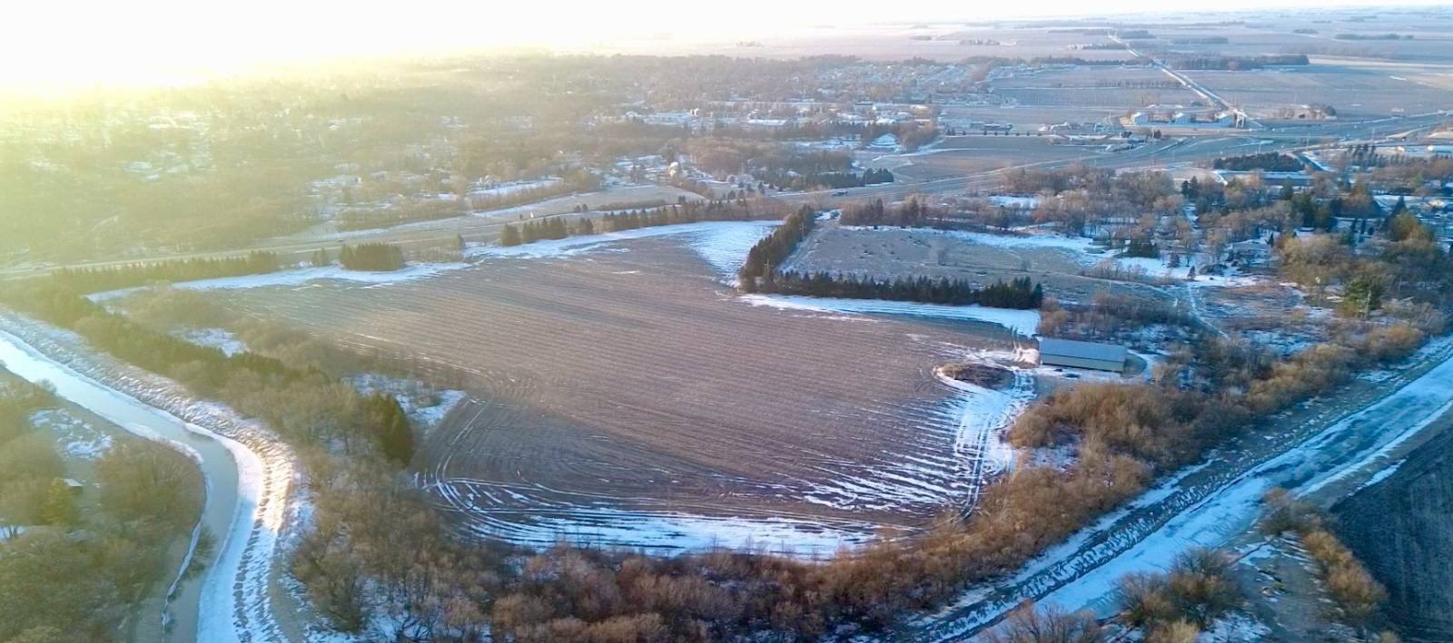
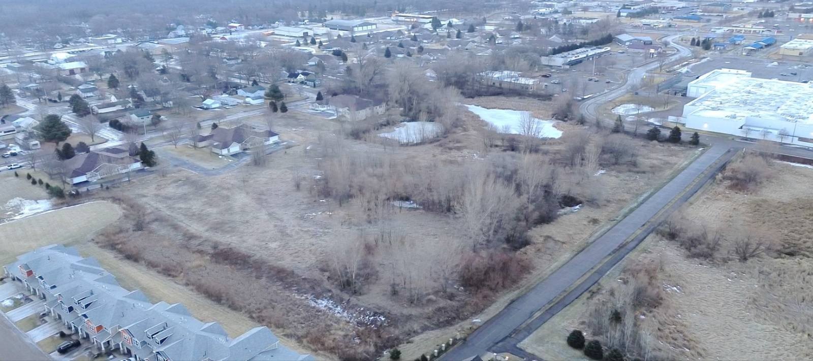
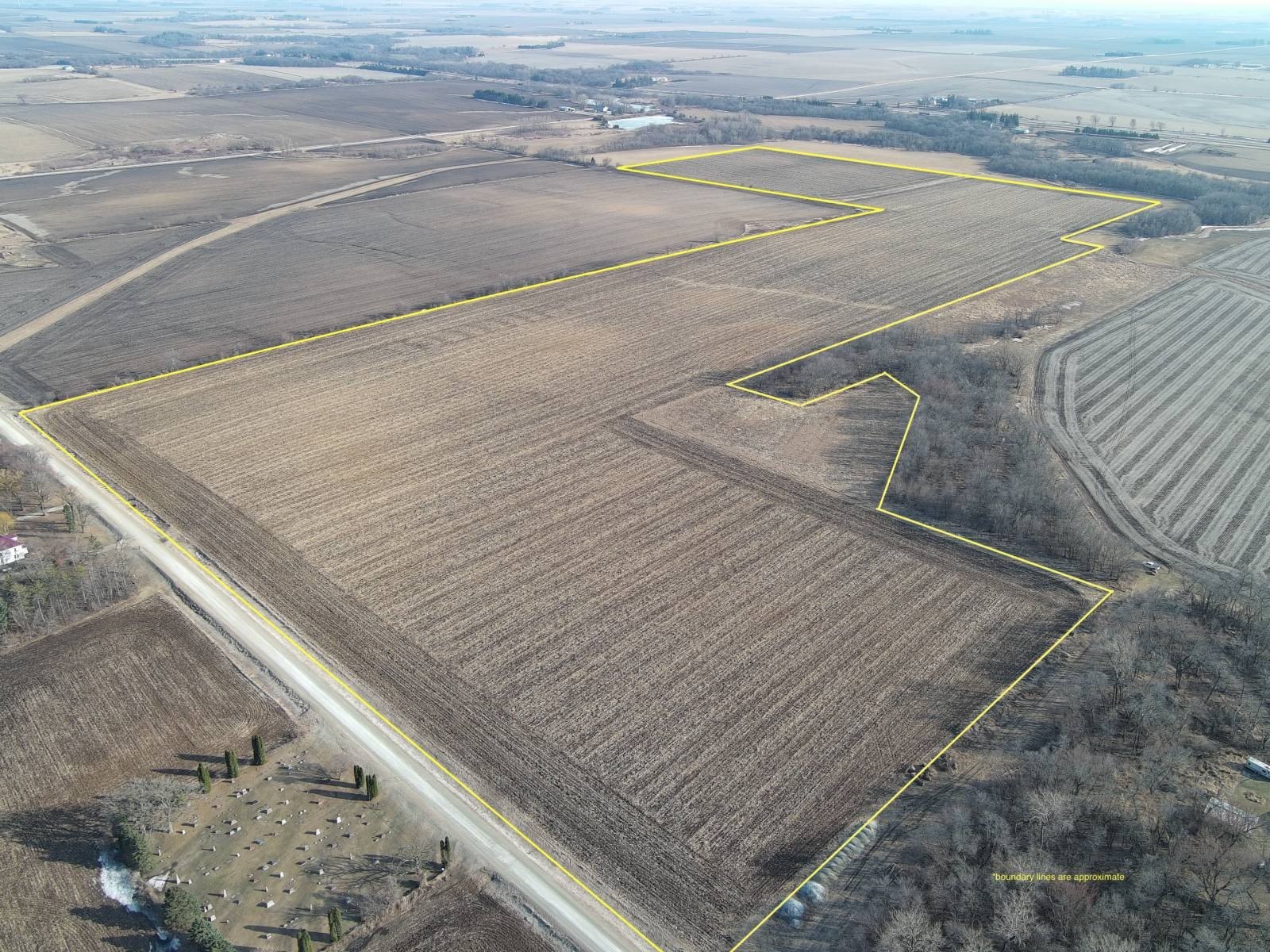
TBD 29th Ave SE, Austin, MN 55912
- Added:
- Jul 15, 2024
- Days on Market:
- 694
- Last Refresh:
- Jun 8 at 11:06 pm
Property Features for TBD 29th Ave SE
General Information
- Property type
- Land
- Property subtype
- Other
- Parking features
- Garage
- Standard status
- Active
- Lot size
- 16.16 Acres
Taxes and HOA fees
- Tax Annual Amount
- 0
Building Details
- Architectural style
- Other
Listing agent Troy Stafford (507) 218-1243
Listing office High Point Land Company, LLC 520 Main Street South, Stewartville, MN (319) 559-2345
Listing date Jul 15, 2024
Copyright © 2026 My State MLS. All rights reserved. All information provided by the listing agent/broker is deemed reliable but is not guaranteed and should be independently verified.
HighLights
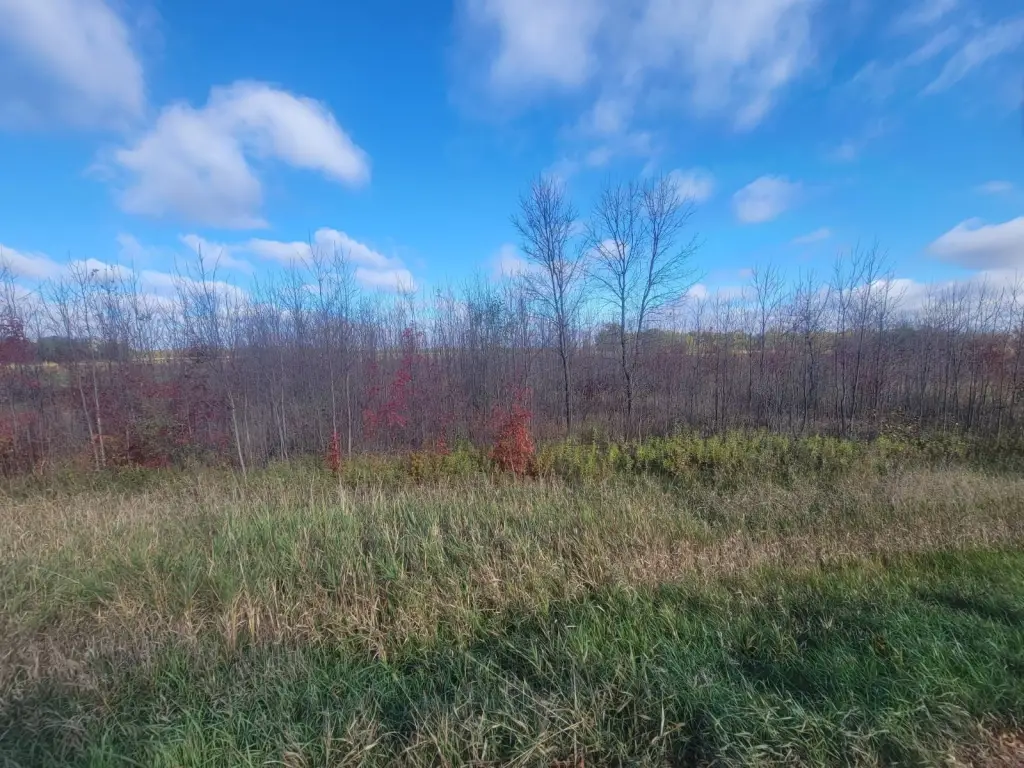
- 16.16+\/- acres of Agricultural Non‑homestead land near Austin, MN.
- Prime location just 1/3 mile off Highway #218.
- Great access off of a paved road (County Road #28).
- Virtually endless development opportunities for permitted uses.
- Conditional uses permitted include auction facilities, commercial outdoor recreational, churches, kennels, stables, greenhouse/nursery, campgrounds, alcohol stills, storage units, or wineries.
- Very fertile soil.
Overview
The land is located just south of Austin, Minnesota, about 1/3 mile off Highway #218. Access is provided off County Road #28, which is paved, supporting convenient ingress and egress for equipment, visitors, or customers depending on the intended use. The offering is described as being on a heavy traffic corridor.
According to the listing remarks, permitted uses include virtually all agricultural uses, along with parks and recreational or conservational areas. Conditional uses mentioned include auction facilities, commercial outdoor recreational, churches, kennels, stables, greenhouse/nursery, campgrounds, alcohol stills, storage units, and wineries. For buyers and operators seeking land that can support agriculture and a variety of outdoor and community-based projects, this tract provides a starting point for planning, permitting, and next steps with the appropriate authorities.
Current Use by Public Records
Map
- City
- Austin
- County
- Mower
- State
- Minnesota
- Longitude
- -92.956135
- Latitude
- 43.637945