Residential Land with Outbuilding
For Sale
$125,000
23708 Mary Jo Lane, Waterloo, NE 68069
LAND, Waterloo, NE
Property SizeContact for details
Lot Size0.73 Acres
Days on Market204
Property Features for 23708 Mary Jo Lane
General Information
Property type
Land
Property subtype
Other
Subdivision
Harvest Heights on the Creek
Elementary school
Douglas County West
Middle school
Douglas County West
High school
Douglas County West
Elementary school district
Douglas County West
Middle school district
Douglas County West
High school district
Douglas County West
Directions
North on HWY 275/240th and Dodge St, exit on Blondo st turn left on Mary Jo Lane. Property on your right
Standard status
Active
APN
1264130062
Lot size
0.73 Acres
Taxes and HOA fees
Tax Year
2024
Tax Description
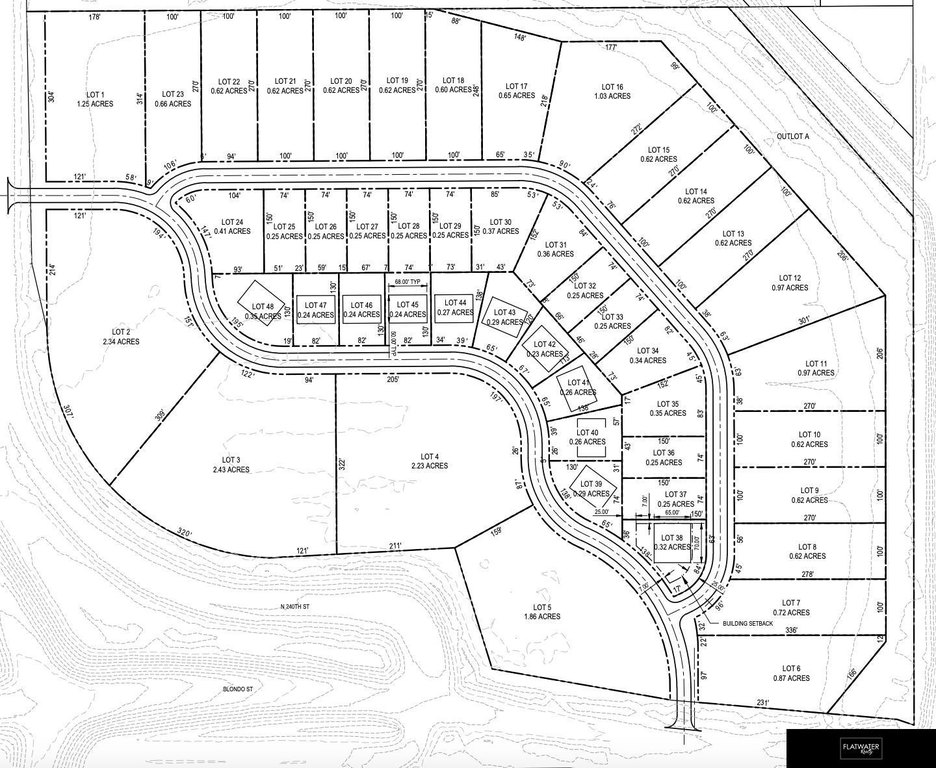
HARVEST HEIGHTS ON THE CREEK LOT 7
Tax Annual Amount
51
Legal Description
HARVEST HEIGHTS ON THE CREEK LOT 7
Listing Agency:
Flatwater Realty
(402) 875-5000
Listed By:
Tristan Nelson · License #20190068
(402) 889-1229
Added: Mar 19
Changed: Sep 5
Last Checked: Oct 8 at 3:06PM
MLS# 22607241
Copyright © 2026 Great Plains Regional MLS. All rights reserved. All information provided by the listing agent/broker is deemed reliable but is not guaranteed and should be independently verified.
Investment Insights
Based on property information with market context.
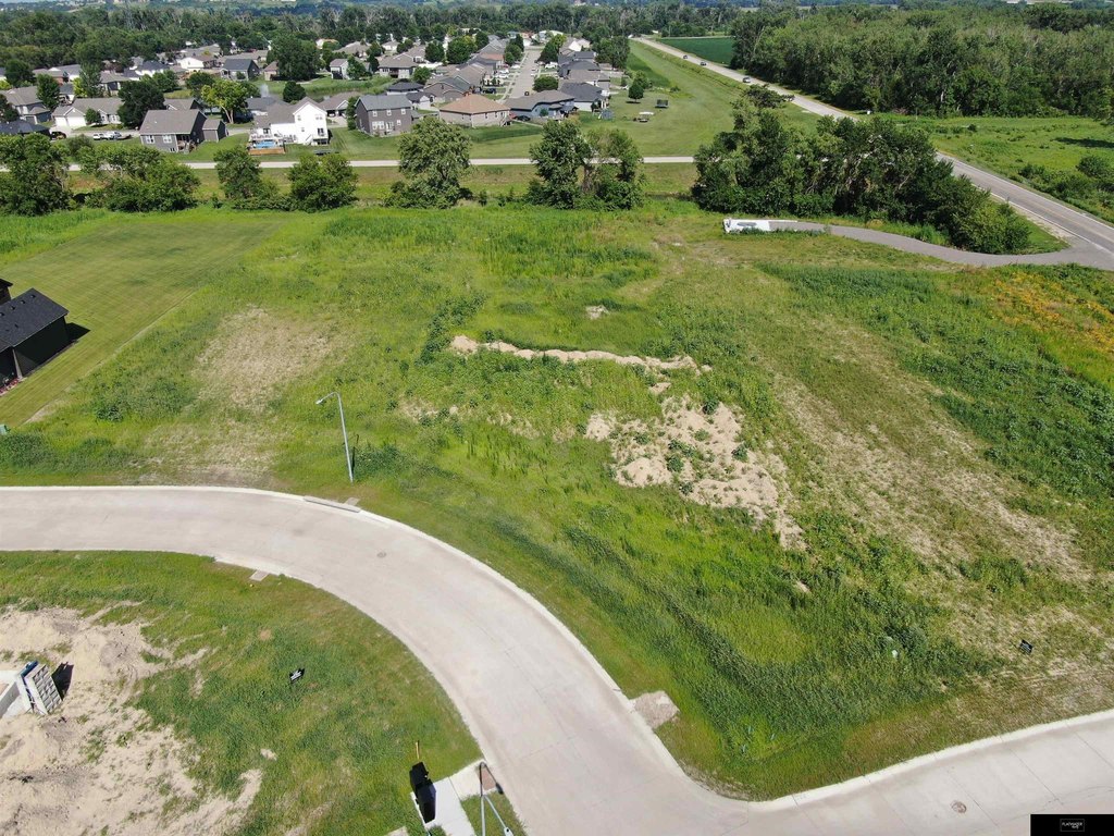
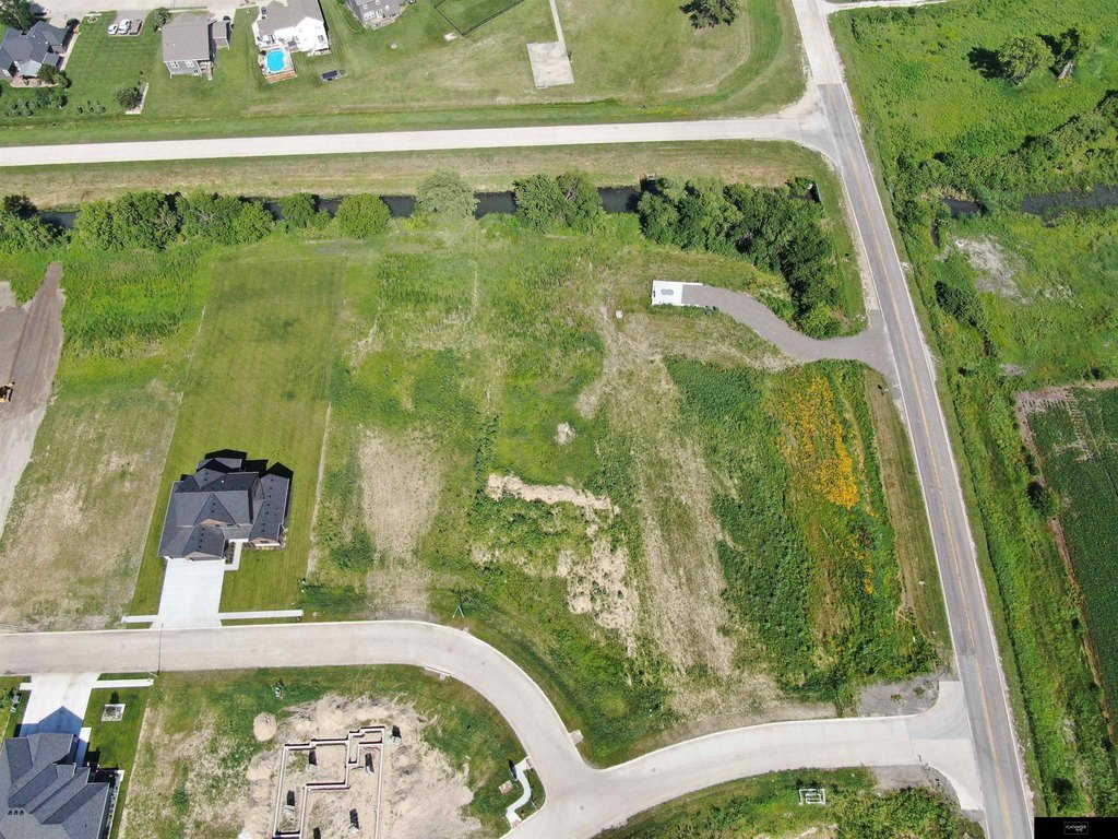
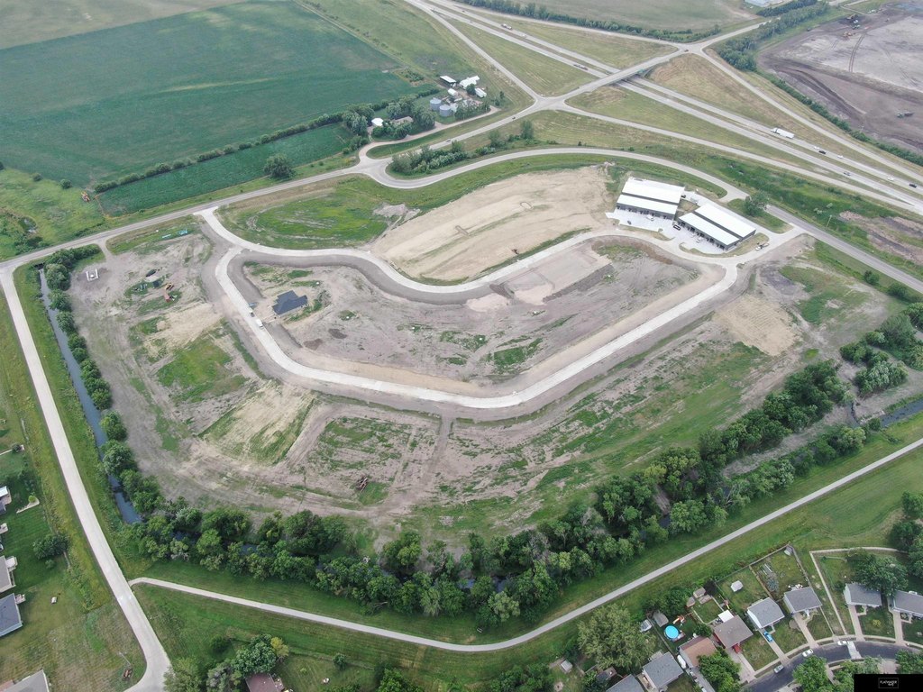
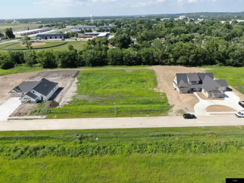
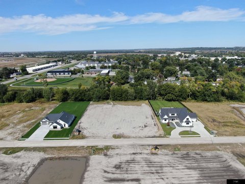
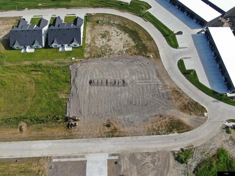
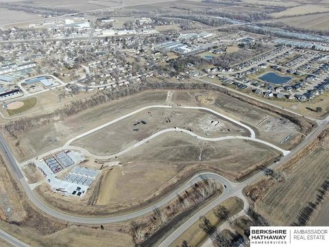
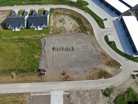
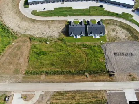
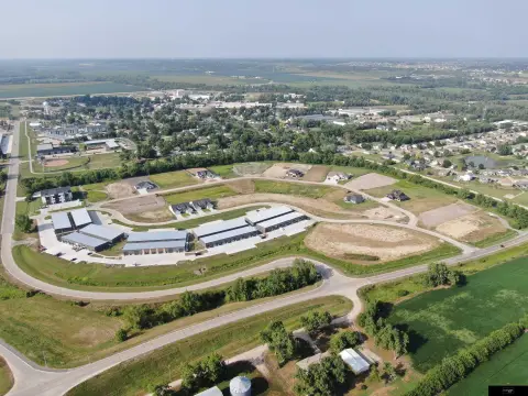
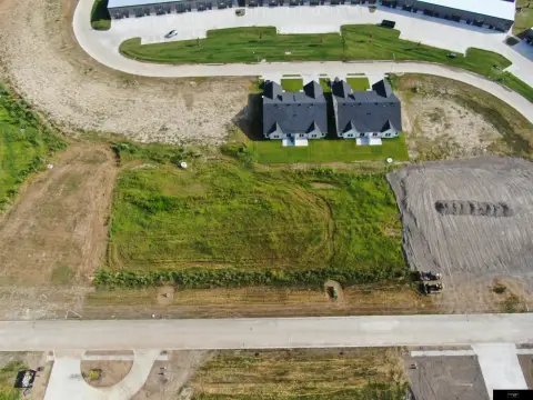
This for-sale residential lot is part of Harvest Heights On The Creek, a mixed-use development setting described as country-style living along a tree-lined creek. The listing notes that residential lots can have developer-approved outbuildings, providing flexibility for storage and additional structures within the development’s rules. Construction is required to be slab on grade for all houses or buildings, and fill dirt has been added to establish a building pad above the base flood elevation (BFE). The remarks state this improvement makes flood insurance not required for the property.
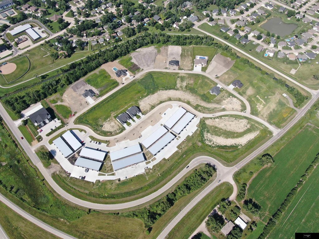
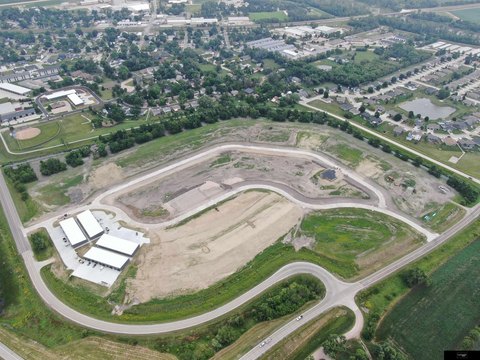
The development is located in the village of Waterloo, just off of Hwy. 275 Freeway at 240th and Blondo, with Elkhorn described as only a couple of minutes away. The property is also described as within a golf cart ride of local conveniences and dining, including a post office, Kelcey’s Convenience Store, Farmer Brown’s steakhouse, El Bee’s, DogHouse Saloon, and R Bar.
For buyers seeking a residential home site in a controlled development environment, these documented building guidelines, outbuilding allowance, and flood-elevation site preparation are practical considerations. The location description also supports convenient access to nearby village amenities and restaurants referenced in the remarks.
The development is located in the village of Waterloo, just off of Hwy. 275 Freeway at 240th and Blondo, with Elkhorn described as only a couple of minutes away. The property is also described as within a golf cart ride of local conveniences and dining, including a post office, Kelcey’s Convenience Store, Farmer Brown’s steakhouse, El Bee’s, DogHouse Saloon, and R Bar.
For buyers seeking a residential home site in a controlled development environment, these documented building guidelines, outbuilding allowance, and flood-elevation site preparation are practical considerations. The location description also supports convenient access to nearby village amenities and restaurants referenced in the remarks.
Key Highlights
- Harvest Heights On The Creek is a mixed‑use development in the village of Waterloo, just off Hwy. 275 at 240th and Blondo.
- Residential lots may include developer‑approved outbuildings.
- All houses/buildings must be slab‑on‑grade construction.
Property Analytics
Unlock full access to Insights
Subscribe to Realmo Intelligence
Open Analytics
Current Use
Lease Details
Yes
Highway access
Location Intelligence
Trade Area within ½ mile
84
Businesses Nearby
Explore this area
Business Placement
Demographics for 68069, NE
2,854
Population
1,476
Households
1.9
Avg Household Size
50
Median Age
43%
College-Educated
98%
High-School Grad
29.8 sq mi
ZIP Area
96
Density / Sq Mi
$113,442
Median Household Income
$48,750
Median Earnings
$1,142
Median Rent
$351,700
Median Home Value
Check the figures for this property
Cap Rate, Value Estimation, Potential NOI and more
View Realmo Analytics

Questions? Ask Rey
Realmo’s AI knows this listing — price, zoning, demand, history. Ask anything.


Frequently Asked Questions
What type of property is this?
Residential land & home lot - Build-ready residential lot in a mixed-use development with developer-approved outbuilding allowance and slab-on-grade requirements.
Where is this residential land & home lot located?
The property is located at 23708 Mary Jo Lane Waterloo, NE.
What is the asking price?
The asking price for this property is $125,000.
What are key features of this property?
This property features: Harvest Heights On The Creek is a mixed‑use development in the village of Waterloo, just off Hwy. 275 at 240th and Blondo.; Residential lots may include developer‑approved outbuildings.; All houses/buildings must be slab‑on‑grade construction.