20 St SW, Bandon, OR 97411
- Added:
- Oct 22, 2023
- Days on Market:
- 979
- Last Refresh:
- Jun 26 at 8:06 pm
Property Features for 20 St SW
General Information
- Property type
- Land
- Property subtype
- Single Family Residence
- Zoning
- UR-2
- Standard status
- Active
- APN
- 99921255
- Lot size
- 0.63 Acres
Taxes and HOA fees
- Tax Description
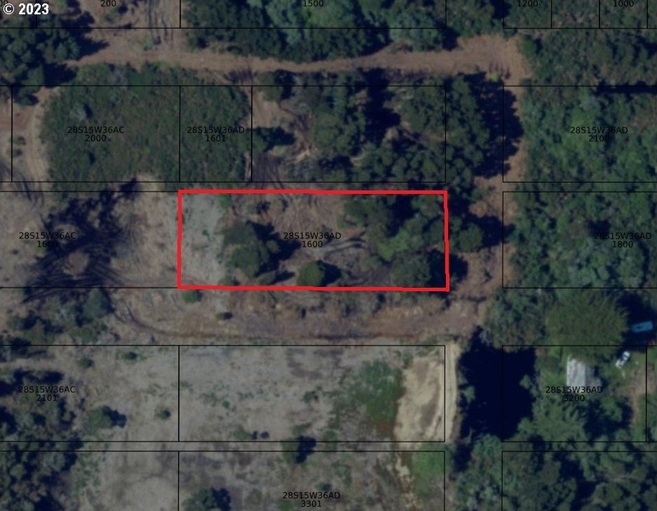
- TRS 28S-15W-36AD TL 1602, Block 4, Lots 12-22
- Tax Annual Amount
- 247

Listing agent Mel Garrett License #200308129 (541) 404-3364
Listing office Chas. Waldrop Real Estate LLC 880 Franklin Avenue SW, BANDON, OR (541) 290-9455
Listing date Oct 22, 2023
Copyright © 2026 Regional Multiple Listing Services. All rights reserved. All information provided by the listing agent/broker is deemed reliable but is not guaranteed and should be independently verified.
HighLights
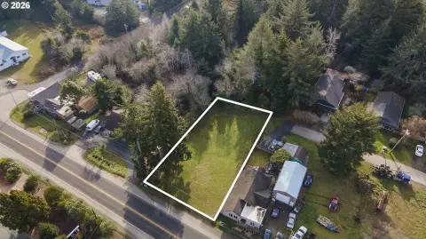
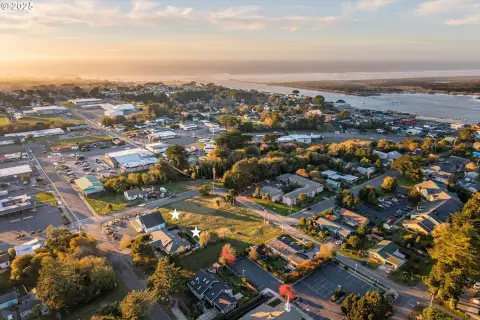
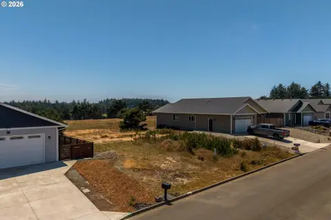
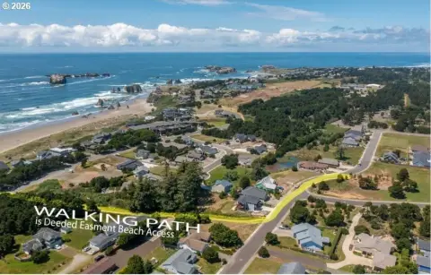
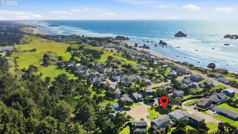
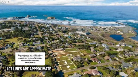
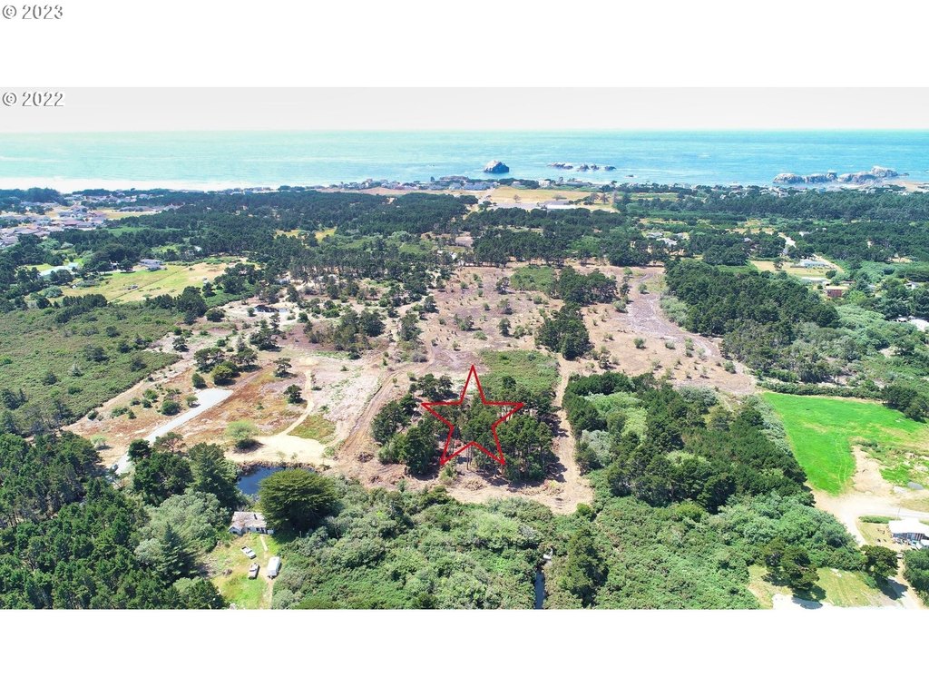
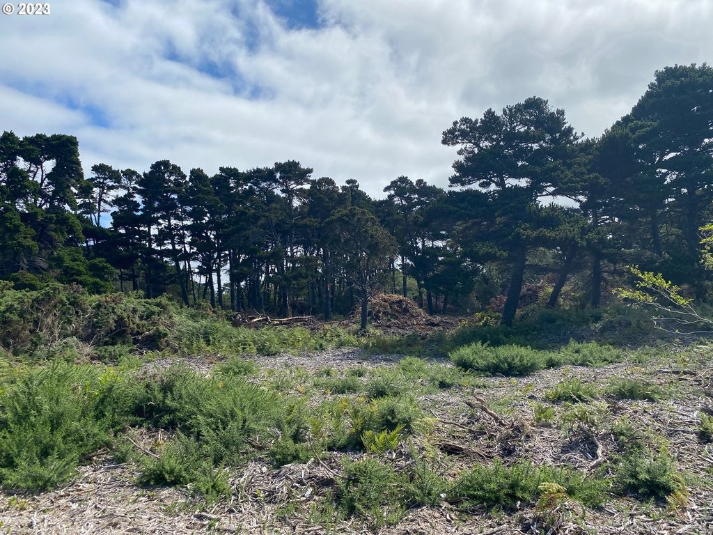
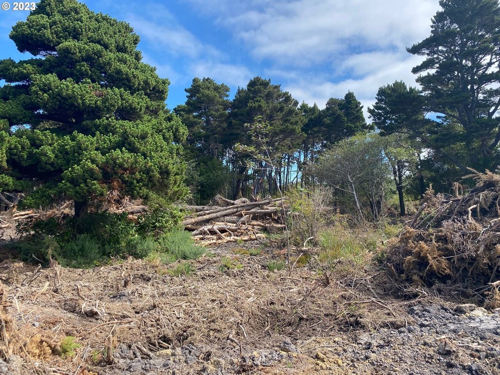
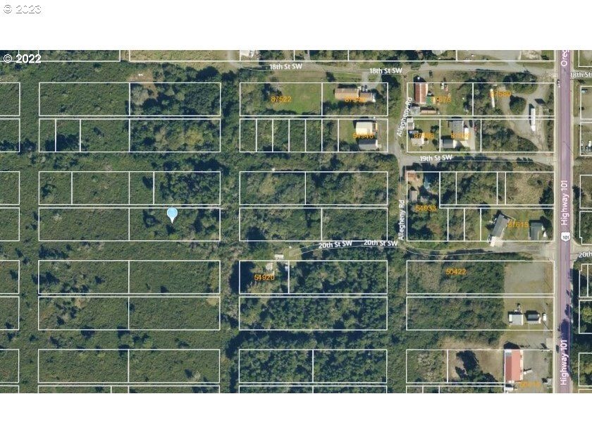
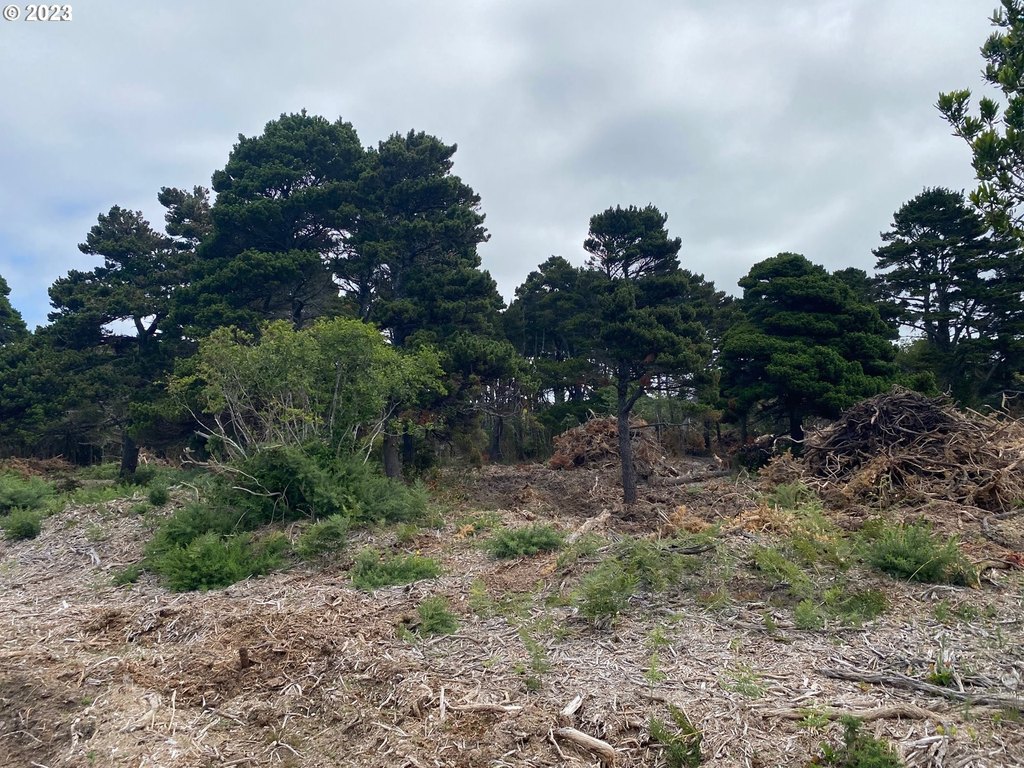
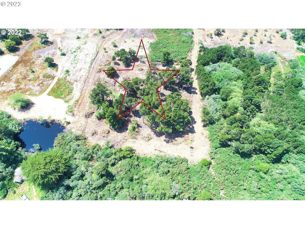
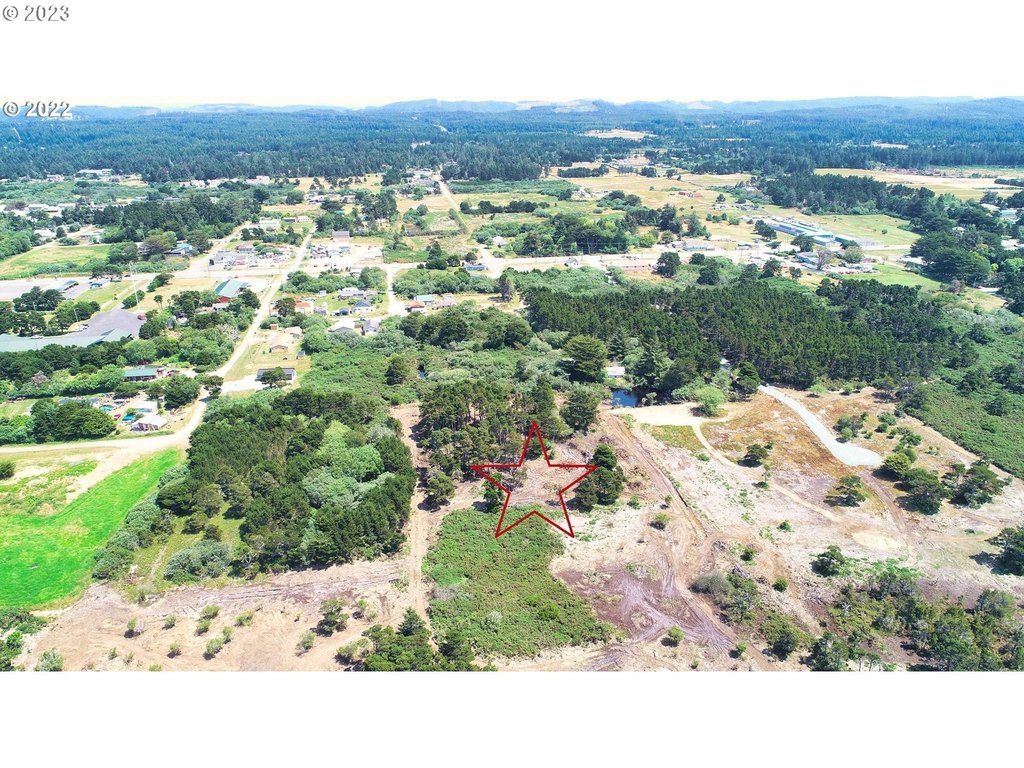
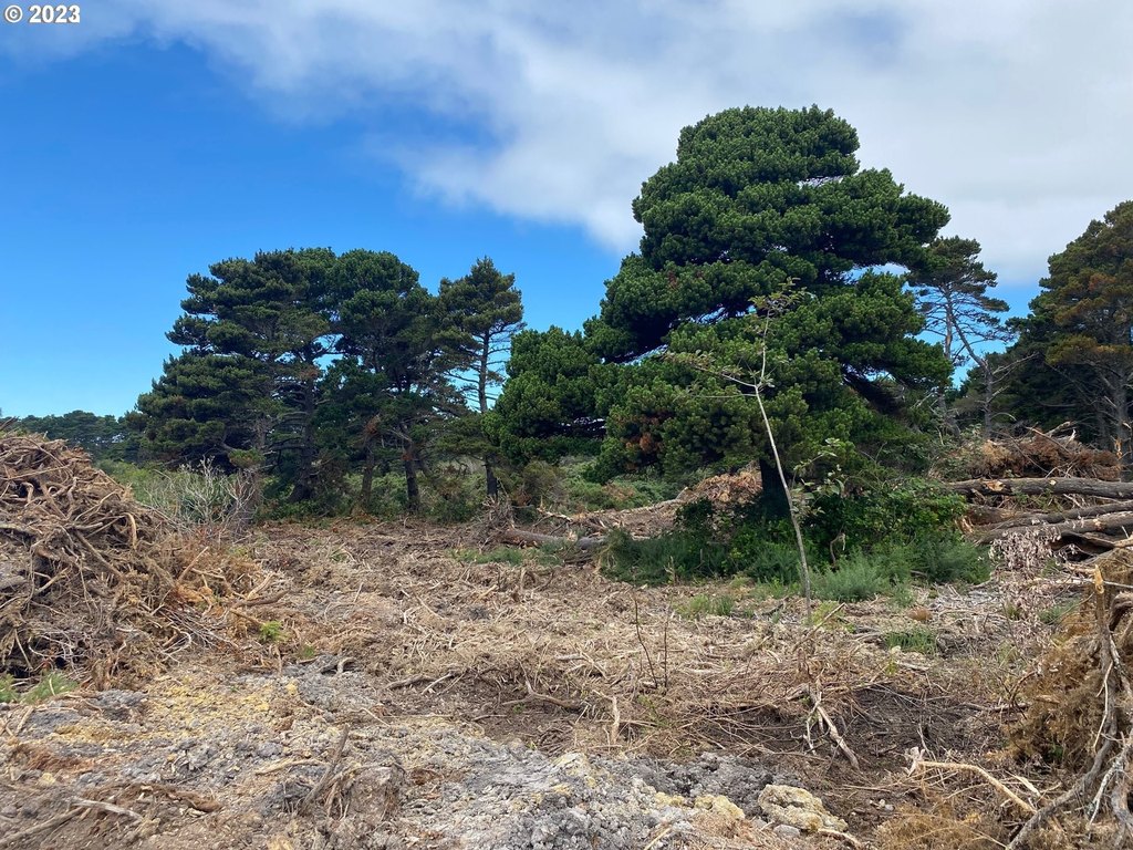
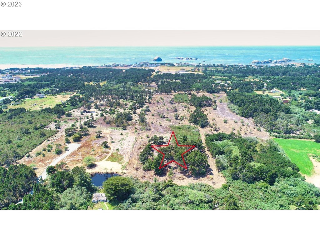
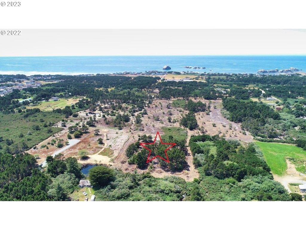
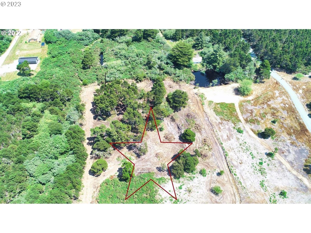
- .63‑acre residential lot (100' x 275') on Bandon's west side in Face Rock Heights
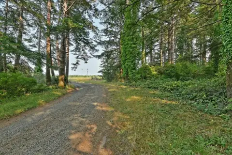
- Mostly cleared with pine trees left on site
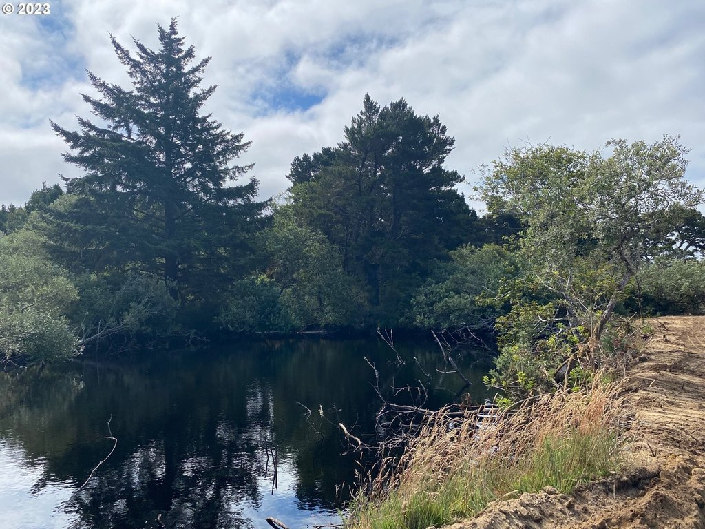
- View of a nearby pond
- 10‑minute walk to the beach (per remarks)
- Needs well and septic; City of Bandon electric and road work required (last part of the road to be improved)
- Owner may carry (per remarks)
Overview
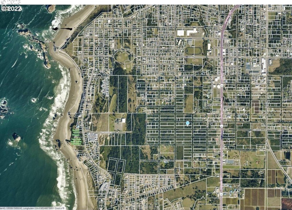
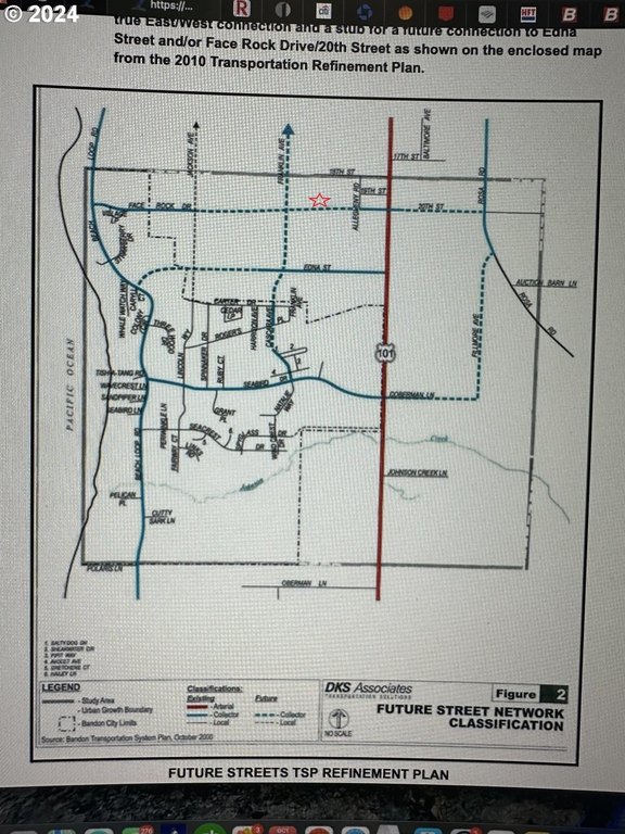
The lot is located on Bandon’s west side in Face Rock Heights, with the seller stating it is roughly a 10-minute walk to the beach. The area is described as being actively developed, and the remarks reference nearby coastal amenities and planned road connectivity associated with a proposed resort concept.
For the right buyer or builder, the property fits those looking for a larger homesite that is already partially cleared and preserves some trees for character. Because well, septic, electric extension, and final road work are specifically called out, it is best suited for an end user or developer comfortable underwriting site infrastructure and construction readiness before building.
Current Use by Public Records
Location Insight
- Map
- Local Demand
- City
- Bandon
- County
- Coos
- State
- Oregon
- Longitude
- -124.41946
- Latitude
- 43.106584