Waterfront Agricultural and Recreation
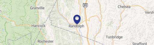
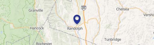
1850 Stock Farm Rd Randolph, VT 05060
1850 Stock Farm Rd, Randolph, VT, 05060
$75,000
For Sale
$75,000
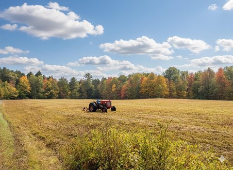
Waterfront land with corn fields, wooded slopes, and tested septic approval for agricultural or recreational use.
Lot Size11.64 Acres
Days on Market52
Property Features for 1850 Stock Farm Rd
General Information
- Standard status
- Active
- Lot size
- 11.64 Acres
- Property subtype
- Land
Listing agency
KW Vermont
(802) 503-1103
Listed by
Jess Kerns
(802) 503-1103
Source
Elliman
Added: Jun 1 Updated: Jul 10 at 3:59PM Checked: Jul 21 at 6:59AM
Displayed information is deemed reliable but is not guaranteed and should be independently verified. All listing content including descriptions, pricing, images are the copyrighted material of KW Vermont
Investment Insights
Based on property information with market context.
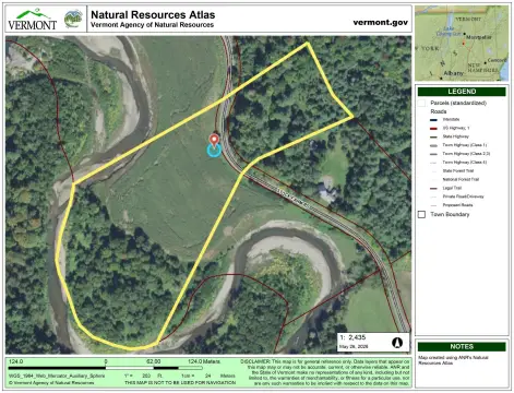
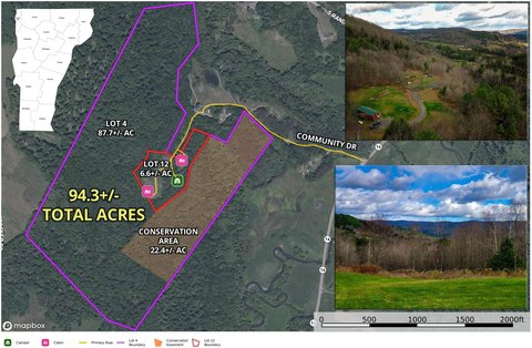
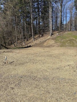
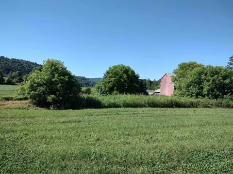
This offering is a private waterfront parcel with sandy shoreline along the Third Branch of the White River, totaling approximately 11.64 acres. The land is a mix of open agricultural fields and wooded, steeply sloped terrain, with the western side featuring about 5 acres of corn currently planted. That side fronts the river with approximately 580+ feet of frontage and is described as slightly rolling to flat. The eastern side is wooded and slopes up to an elevated plateau of approximately 3 acres, which may be suited to a future homesite overlooking the river valley. Soil has been tested and approved for a septic system, though the lot has not yet been permitted and additional investigation is needed.
The parcel is located within the Green Mountain Stock Farm community in Randolph, VT and spans both sides of Stock Farm Road. The road is stated to be plowed and maintained by the town. The western portion is within the town’s Flood Plain Overlay district and is described as allowing agricultural and recreational use. Utilities are available along the road frontage, with ECFiber and Consolidated servicing nearby homes.
Covenants apply through the Green Mountain Stock Farm community, along with annual association dues of $400, which support the community trail system. The combination of active agricultural fields, substantial river frontage, and varied terrain makes the property a practical fit for an agricultural operation, a low-impact recreation retreat, or a prospective development plan pending further permitting and site work.
Key Highlights
- ±11.64‑acre waterfront parcel along the Third Branch of the White River in Green Mountain Stock Farm (Randolph, VT).
- Approximately 5 acres of agricultural fields planted with corn and 580+ ft of river frontage.
- Property stretches on both sides of Stock Farm Road; road is plowed and maintained by the town.
Property Analytics
Property Profile
Location Intelligence
Current Use by Public Records
Waterfront Land
Similar For Sale Nearby
FAQs
What type of property is this?
Waterfront Land - Waterfront land with corn fields, wooded slopes, and tested septic approval for agricultural or recreational use.
Where is this waterfront land located?
The property is located at 1850 Stock Farm Rd Randolph, VT.
What is the asking price?
The asking price for this property is $75,000.
What are key features of this property?
This property features: ±11.64‑acre waterfront parcel along the Third Branch of the White River in Green Mountain Stock Farm (Randolph, VT).; Approximately 5 acres of agricultural fields planted with corn and 580+ ft of river frontage.; Property stretches on both sides of Stock Farm Road; road is plowed and maintained by the town.


