Wooded Hunting Land with
For Sale
$575,000
000 McGuill Rd., Goliad, TX 77963
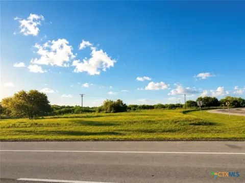
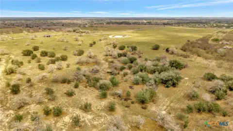
Heavily wooded ranch land bordered by creeks, with much of the property in the 100-year floodplain.
Property SizeContact for details
Days on Market10
Property Features for 000 McGuill Rd.
General Information
Standard status
Active
Property subtype
Land
Listing Agency:
D Ann Harper Realty, Inc
(361) 655-0484
Listed By:
Billy Maston Murphy · License #0510349
(361) 655-0484
Source:
Elliman
Added: Jul 26
Changed: Jul 27
Last Checked: Aug 3 at 9:53AM
Displayed information is deemed reliable but is not guaranteed and should be independently verified. All listing content including descriptions, pricing, images are the copyrighted material of D Ann Harper Realty, Inc
Investment Insights
Based on property information with market context.
Sarco Creek Ranch is heavily wooded with oak trees and South Texas brush, with multiple cleared senderos and trails for access. The ranch is bordered by Sarco creek along the western side and Blanco creek along the southern border, and it features approximately 32’ of elevation change near the entrance toward the northwest side of the property.
According to the current FEMA map, the majority of the property lies within the 100-year floodplain, with the exception of a small area along the northeast borderline. The main building site is described near the entrance, close to an electrical line that runs along McGuill Rd.
Seller will convey all owned mineral interest. The property is described as having historically held water even in worst droughts, and the seller reports minimal hunting pressure, with 1–2 does harvested per year historically.
According to the current FEMA map, the majority of the property lies within the 100-year floodplain, with the exception of a small area along the northeast borderline. The main building site is described near the entrance, close to an electrical line that runs along McGuill Rd.
Seller will convey all owned mineral interest. The property is described as having historically held water even in worst droughts, and the seller reports minimal hunting pressure, with 1–2 does harvested per year historically.
Key Highlights
- Sarco Creek Ranch on the southern Goliad/Refugio county line, with Blanco Creek as the southern border and Sarco Creek as the western border.
- Much of the property lies within the 100‑year floodplain per current FEMA map, with a small area along the northeast border outside the floodplain.
- About 32’ elevation change from Sarco Creek to the northwest side near the entrance.
Property Analytics
Current Use
Location Intelligence
Trade Area within ½ mile
1
Businesses Nearby
Explore this area
Business Placement
Demographics for 77963, TX
5,184
Population
2,644
Households
2
Avg Household Size
47
Median Age
19%
College-Educated
84%
High-School Grad
579.0 sq mi
ZIP Area
9
Density / Sq Mi
$56,466
Median Household Income
$39,639
Median Earnings
$730
Median Rent
$177,600
Median Home Value

Questions? Ask Rey
Realmo’s AI knows this listing — price, zoning, demand, history. Ask anything.





Frequently Asked Questions
What type of property is this?
Hunting land - Heavily wooded ranch land bordered by creeks, with much of the property in the 100-year floodplain.
Where is this hunting land located?
The property is located at 000 McGuill Rd. Goliad, TX.
What is the asking price?
The asking price for this property is $575,000.
What are key features of this property?
This property features: Sarco Creek Ranch on the southern Goliad/Refugio county line, with Blanco Creek as the southern border and Sarco Creek as the western border.; Much of the property lies within the 100‑year floodplain per current FEMA map, with a small area along the northeast border outside the floodplain.; About 32’ elevation change from Sarco Creek to the northwest side near the entrance.


